
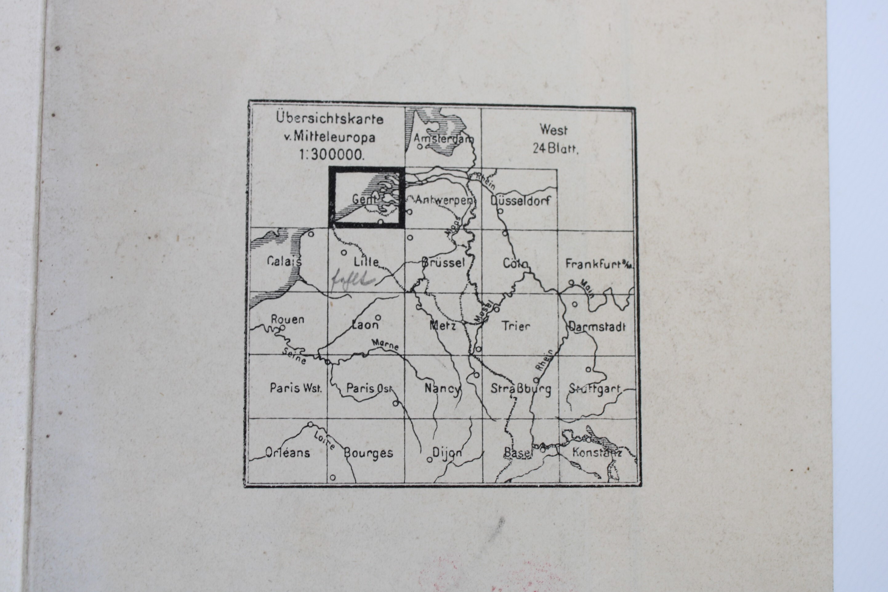
'Ubersichtskarte von MittelEuropa', 1909
Sold
Sorry, this product is not available anymore. Follow us on Facebook or subscribe to our newletter to discover our new arrivals.
- Description
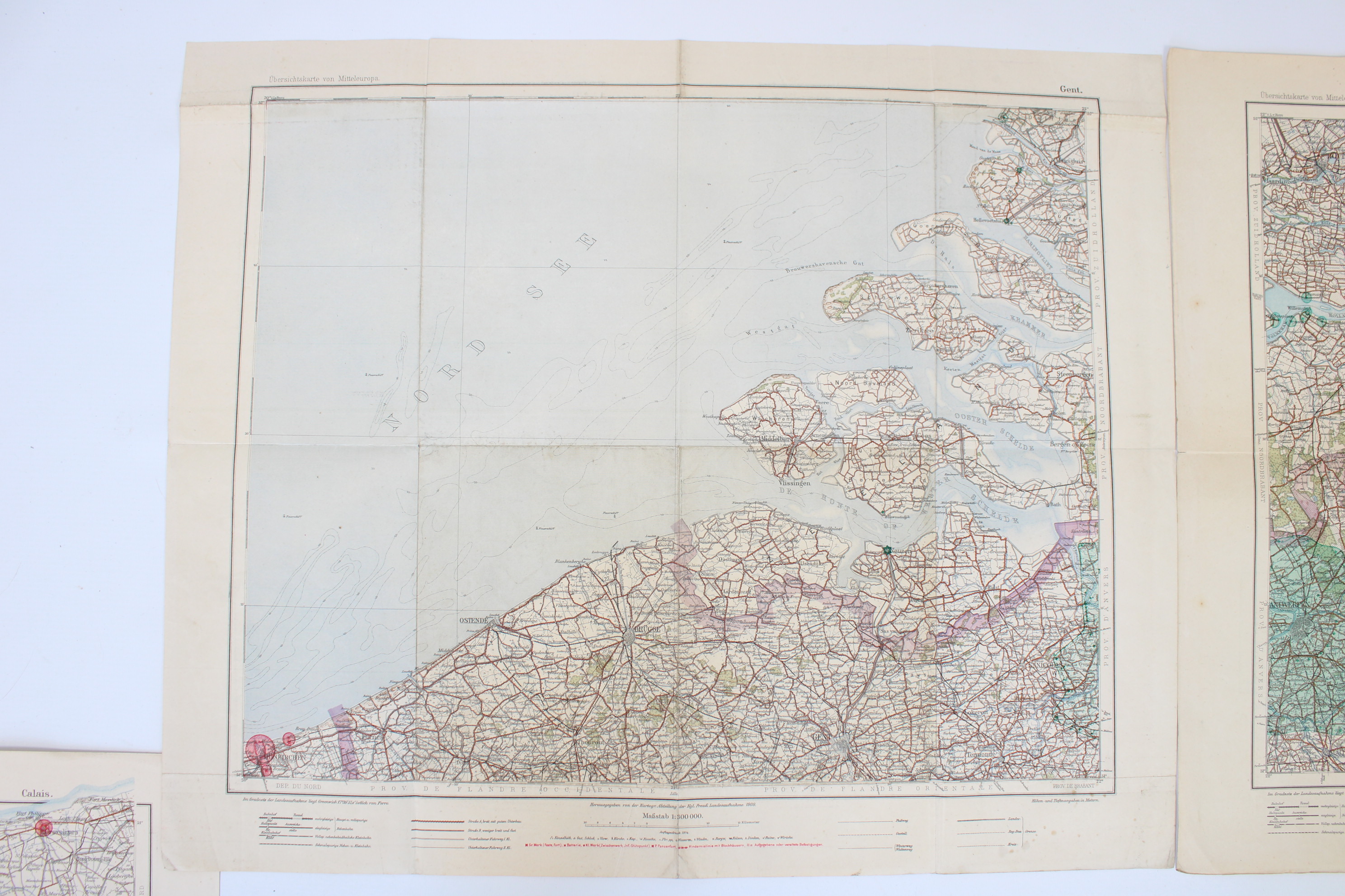
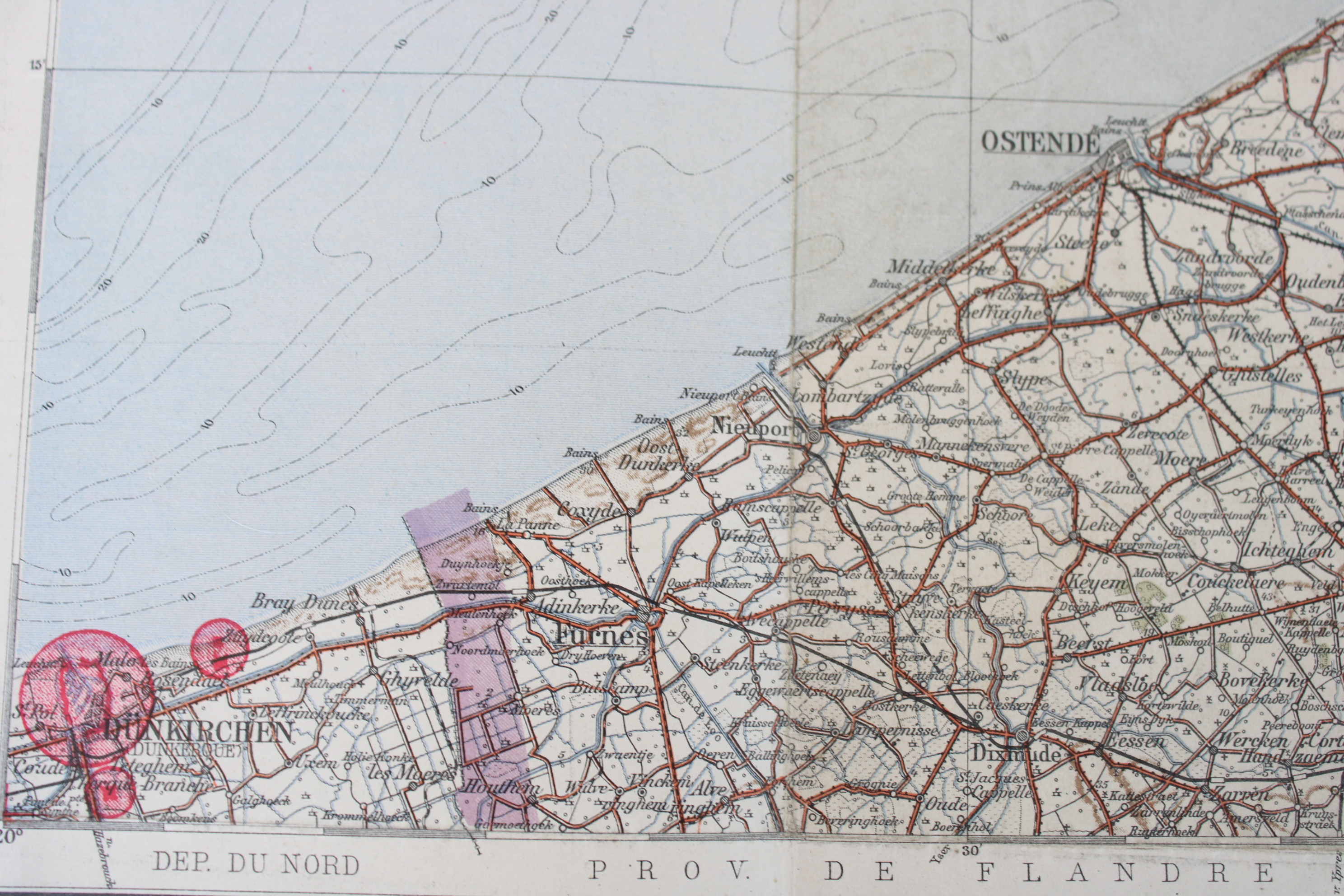
German map from world war I, dated 1909-1914. Scale 1:300.000.
1) Calais. North of France. Calais, Boulogne, Abbeville, Saint-omer, Baie de Somme. 1913.
2) Gent. French and Belgian coast, from Dunkerque up to Zeeuws-Vlaanderen. Cities of Brugge, Oostende, Gent, Veurne, Diksmuide, Torhout, Dendermonde, Lokeren, Sint-Niklaas. 1909-1914
3) Antwerpen. Regions of Mechelen, Kempen, Limburg, Maaseik. And the south part of The Netherlands: Rotterdam, Venlo, Arnhem. 1909-1914.
Dim: 50*46 cm
Prix par pièce
- Shipping Costs
- Shipment possible or pick-up at the store