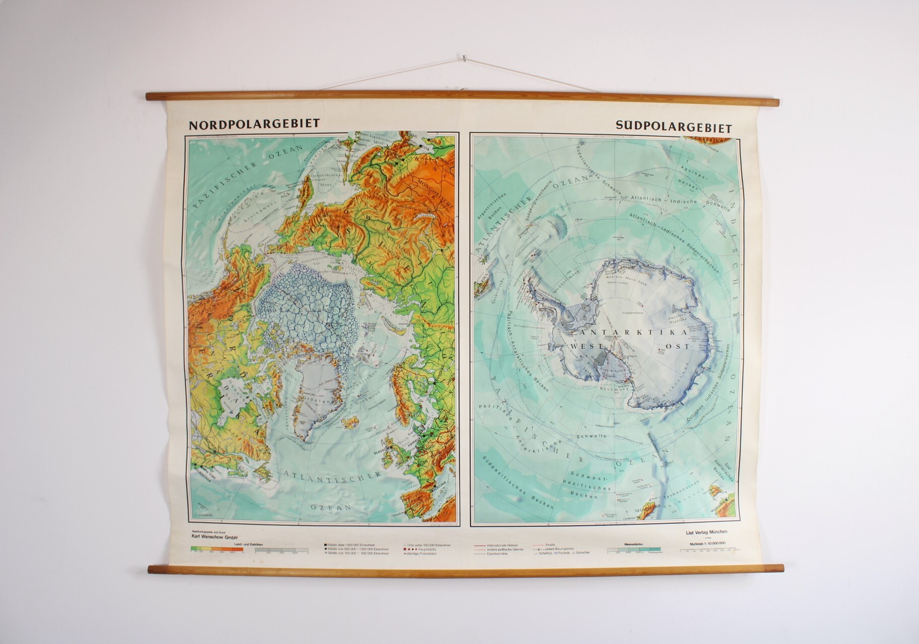
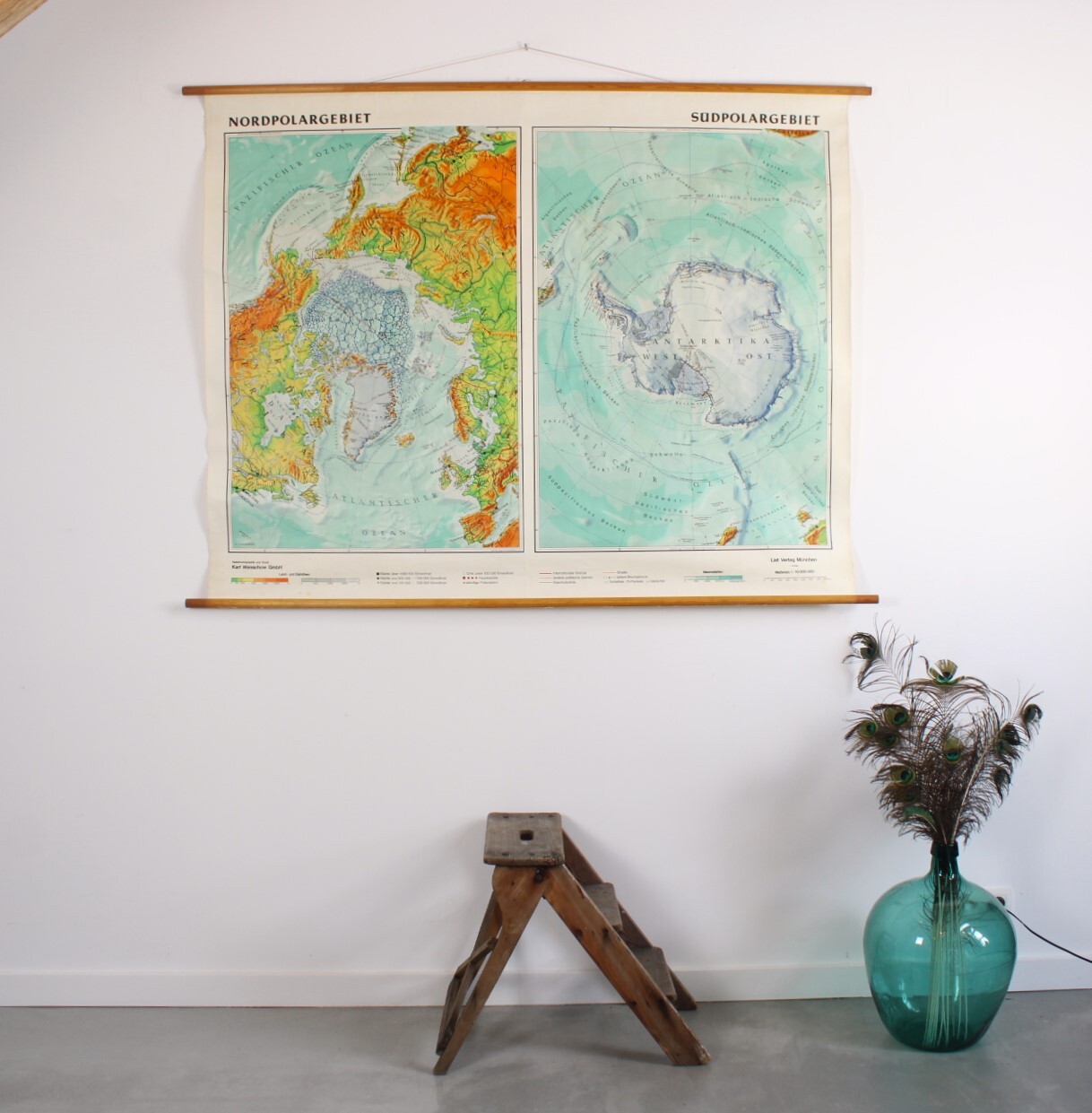
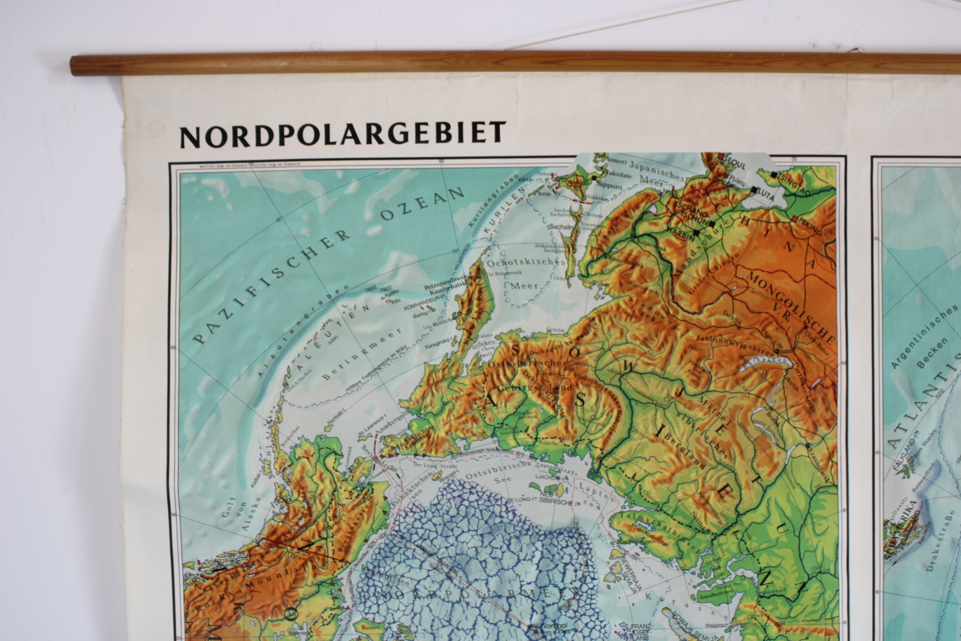
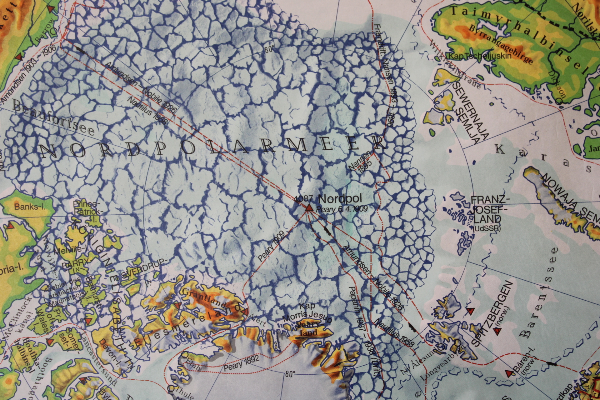
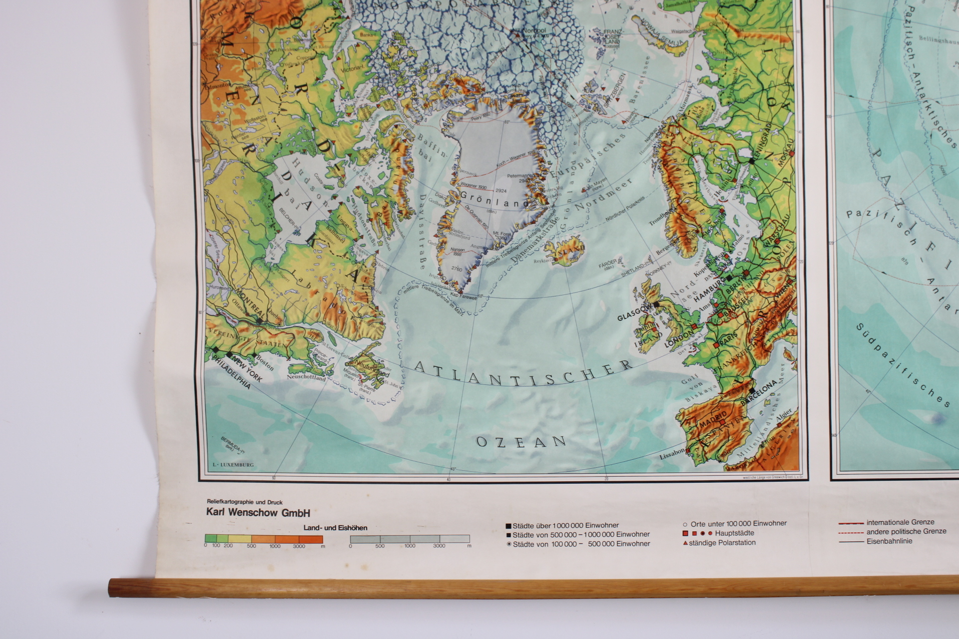
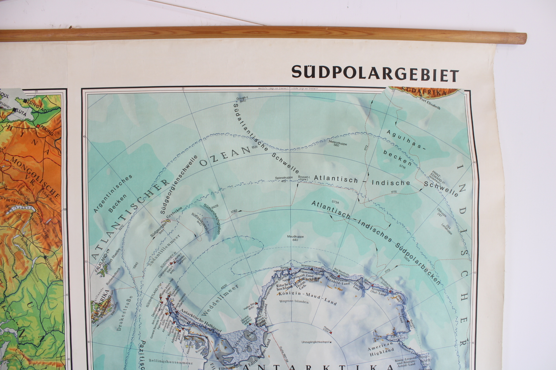
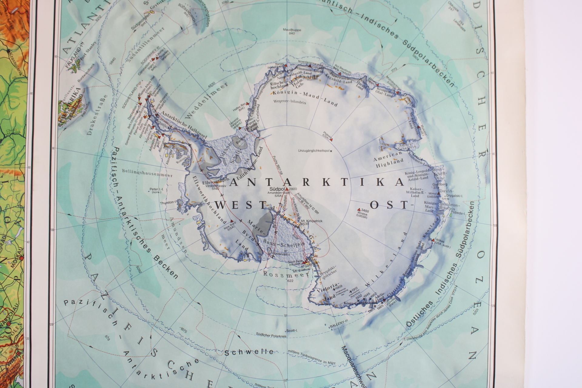
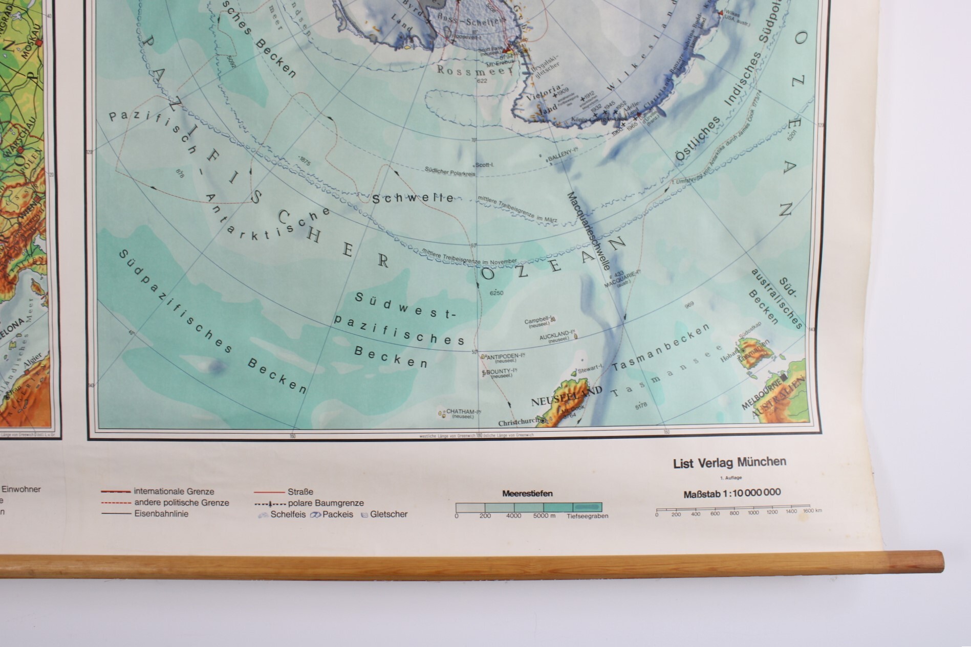
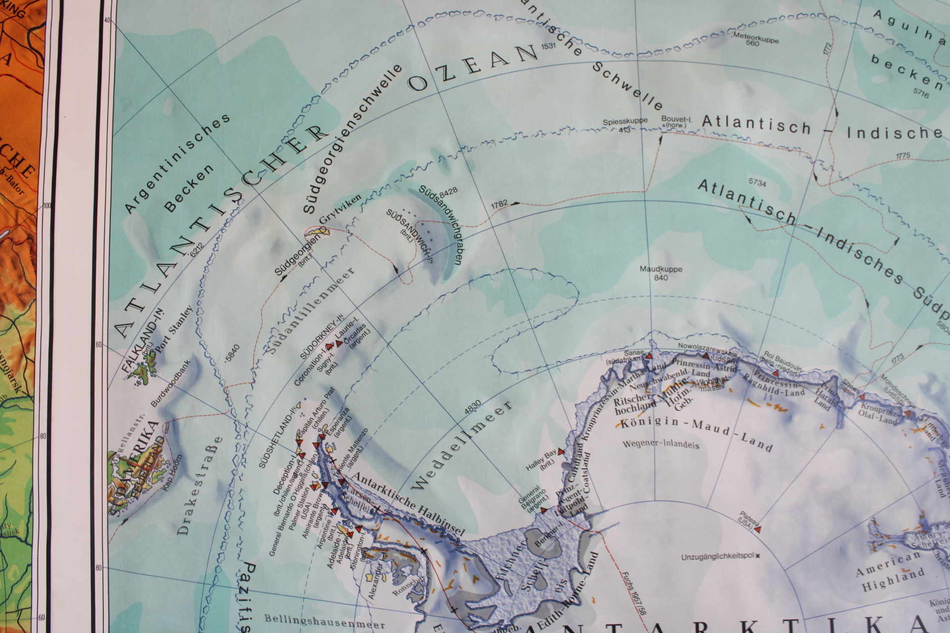
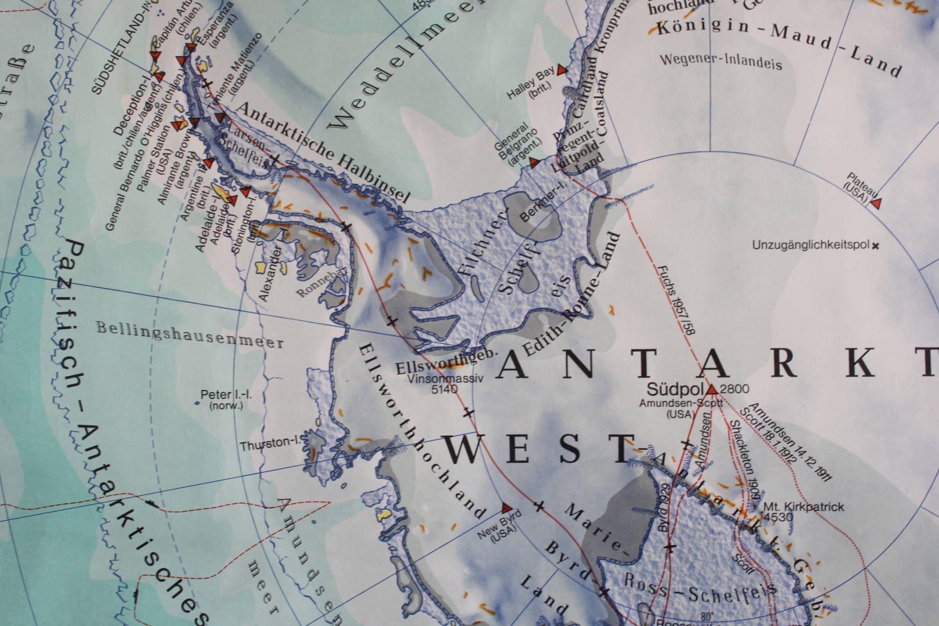
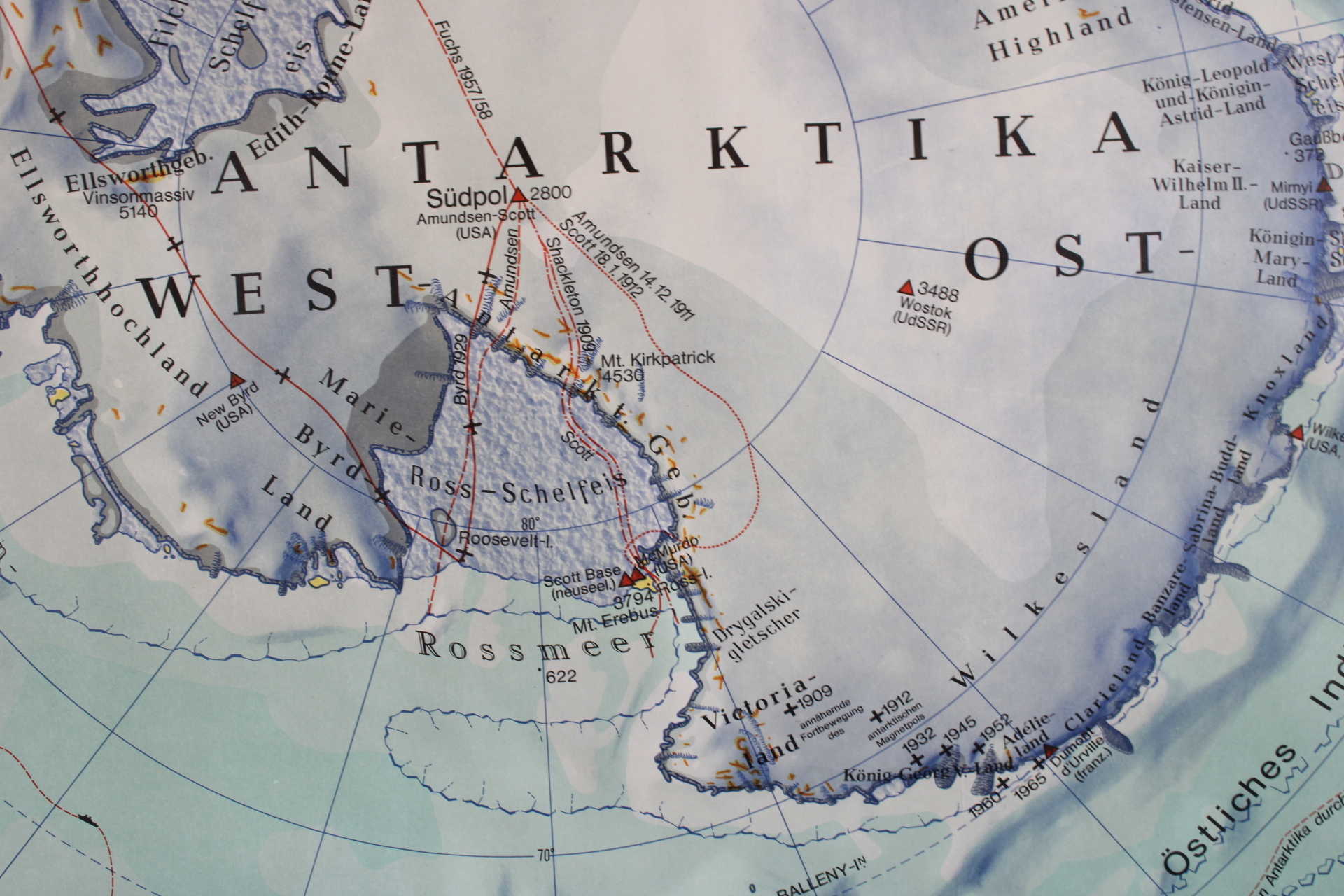
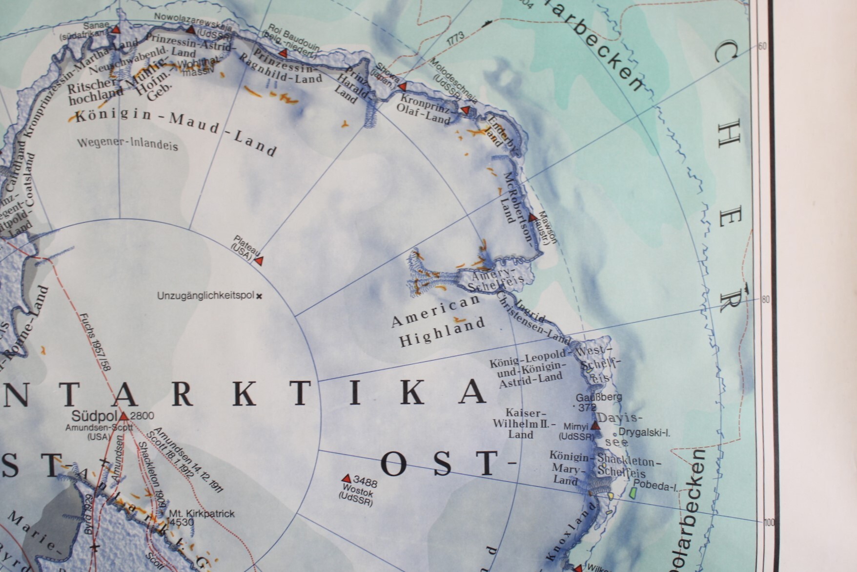
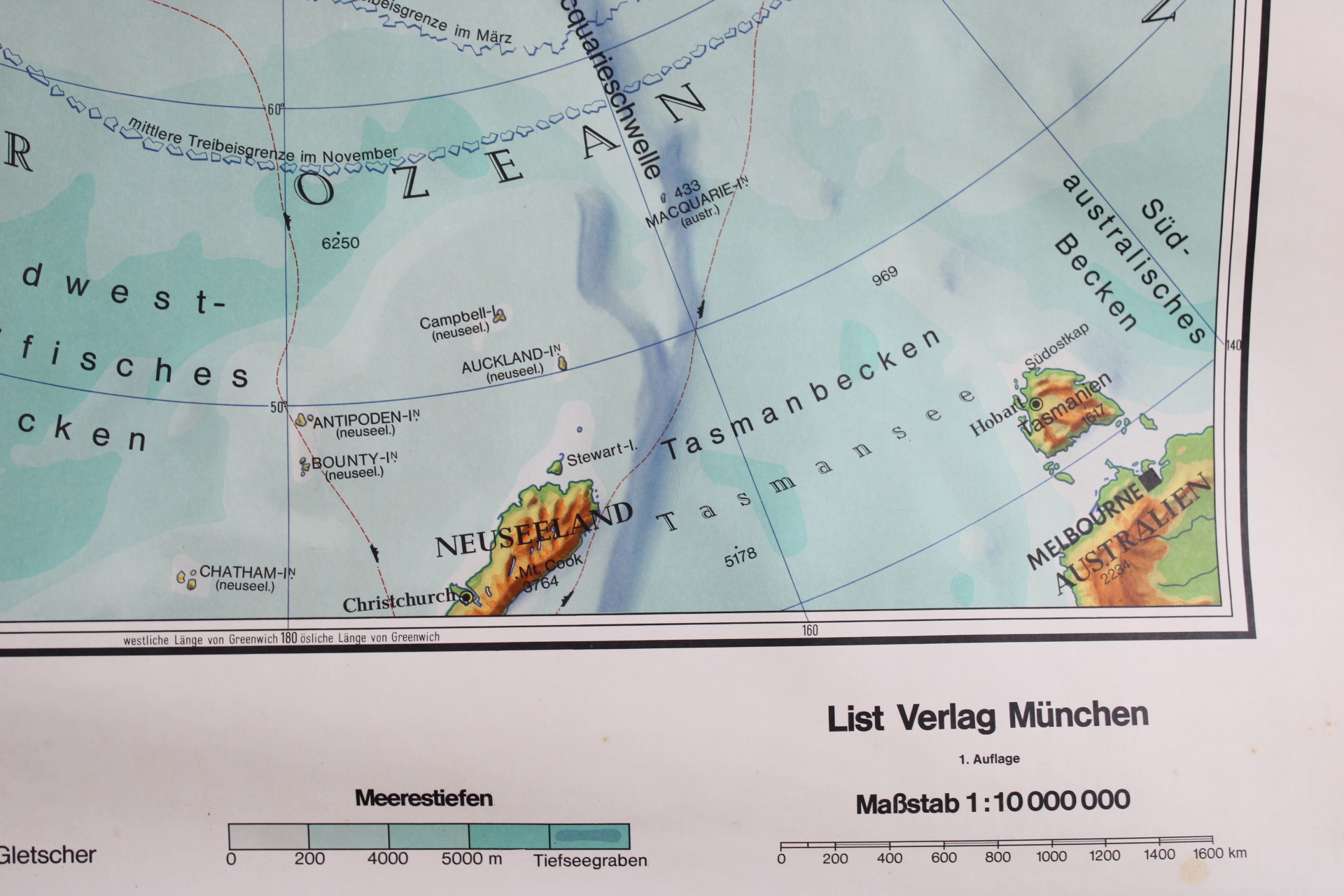
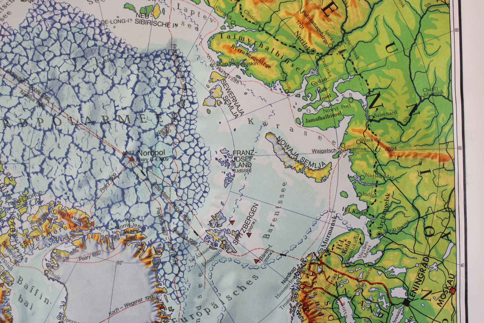
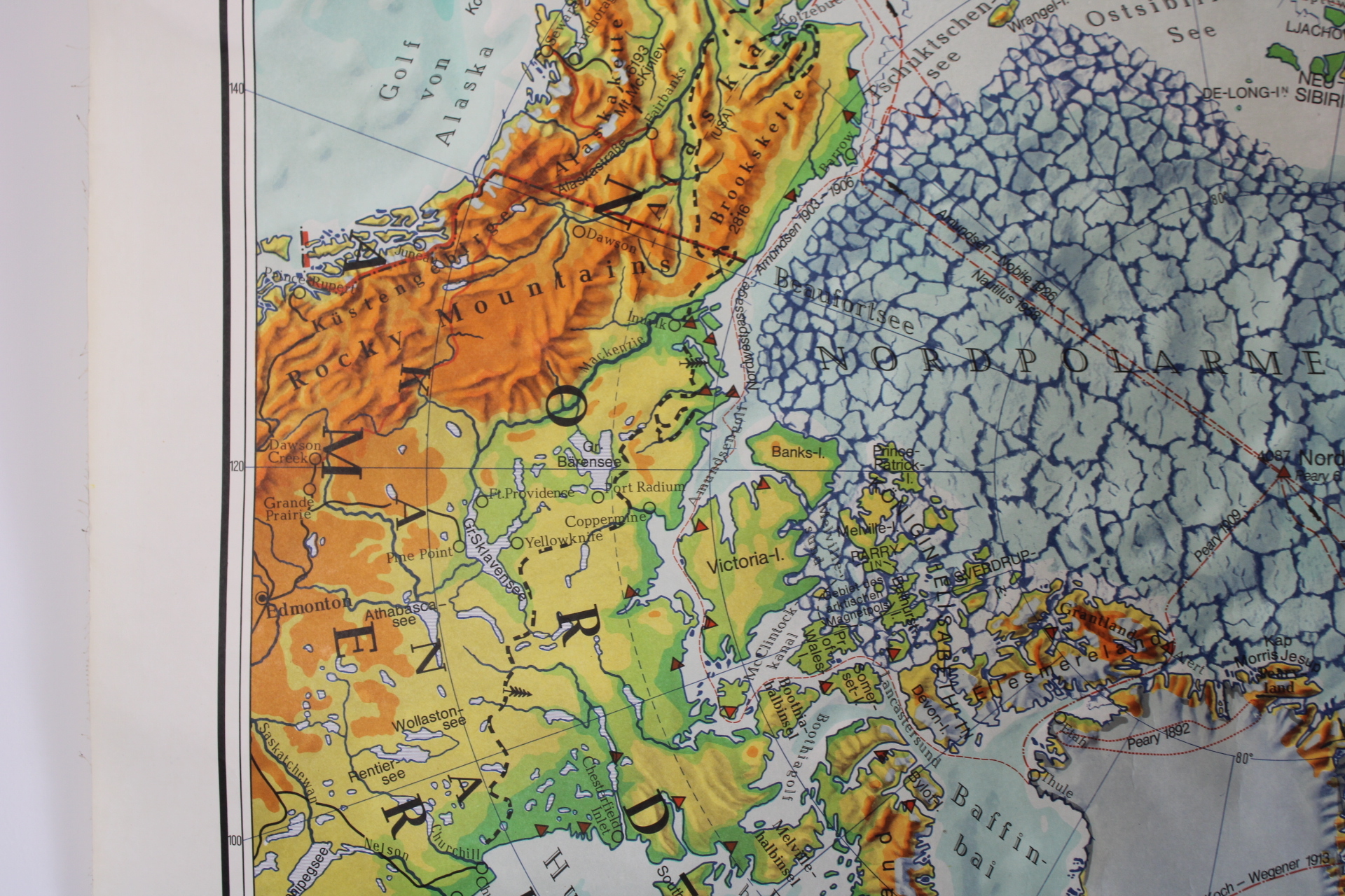
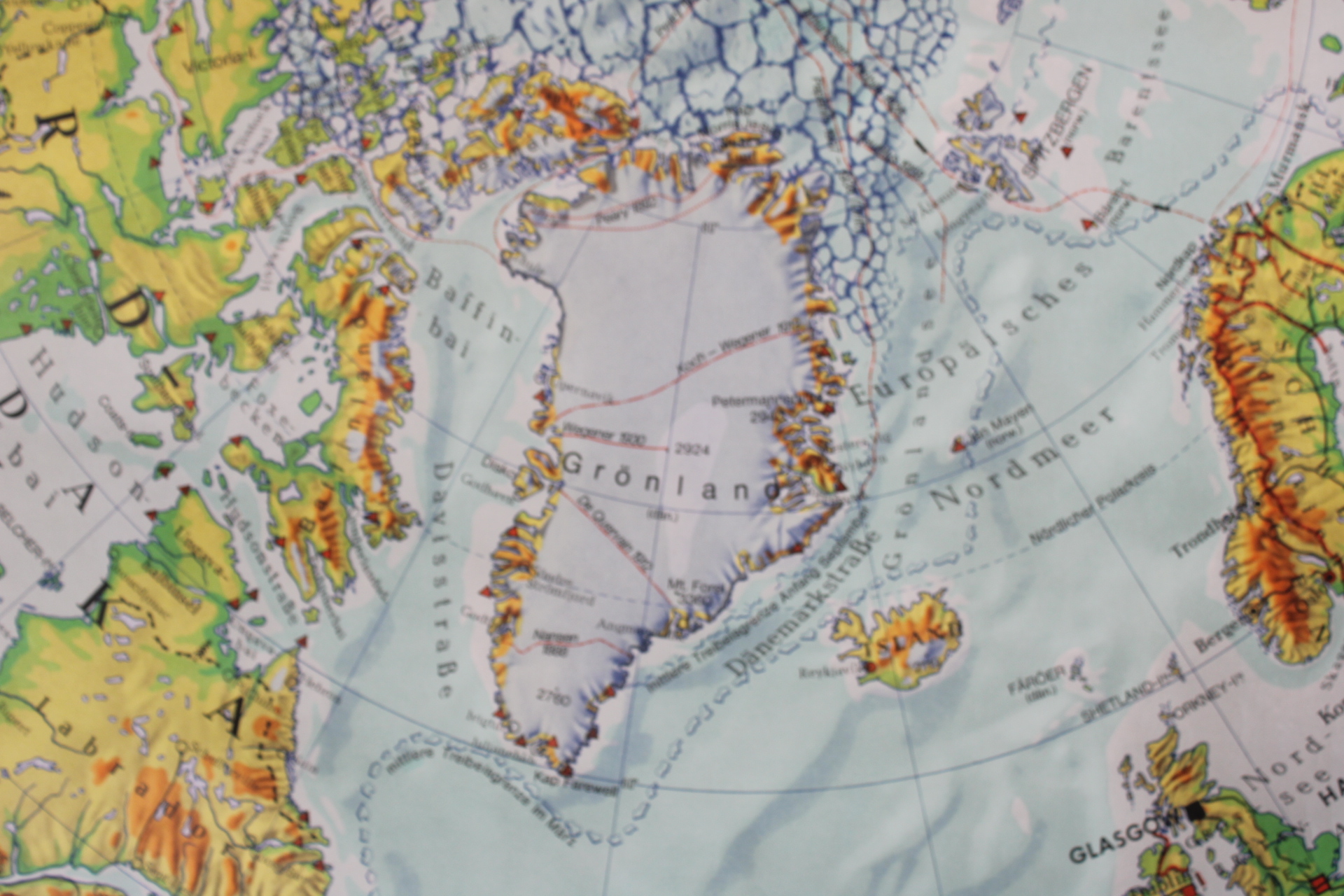
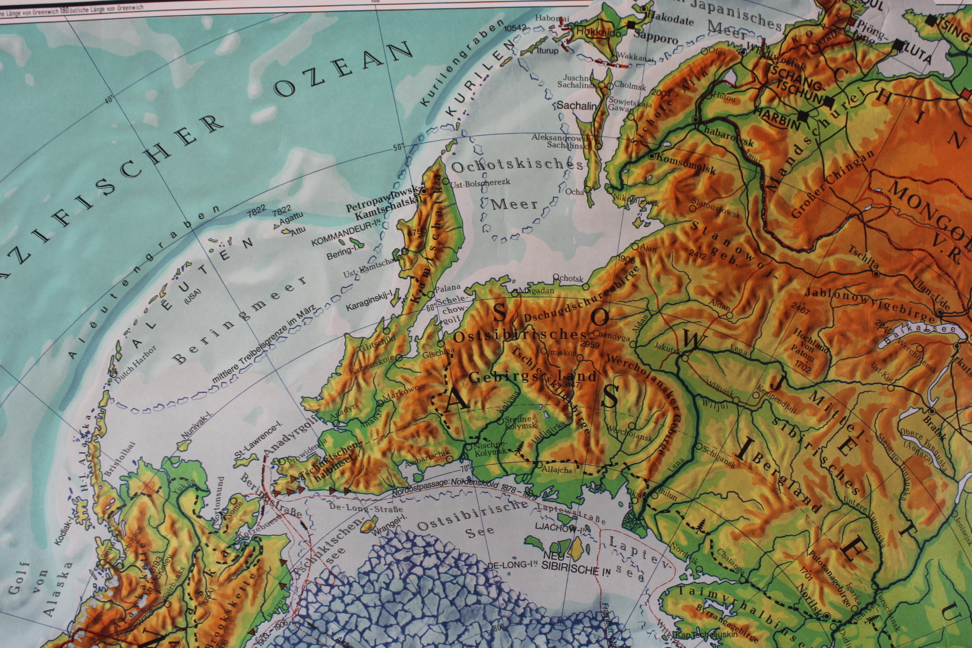
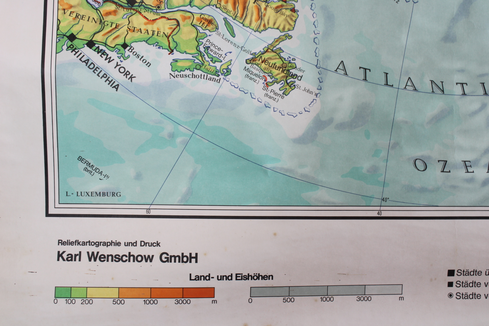
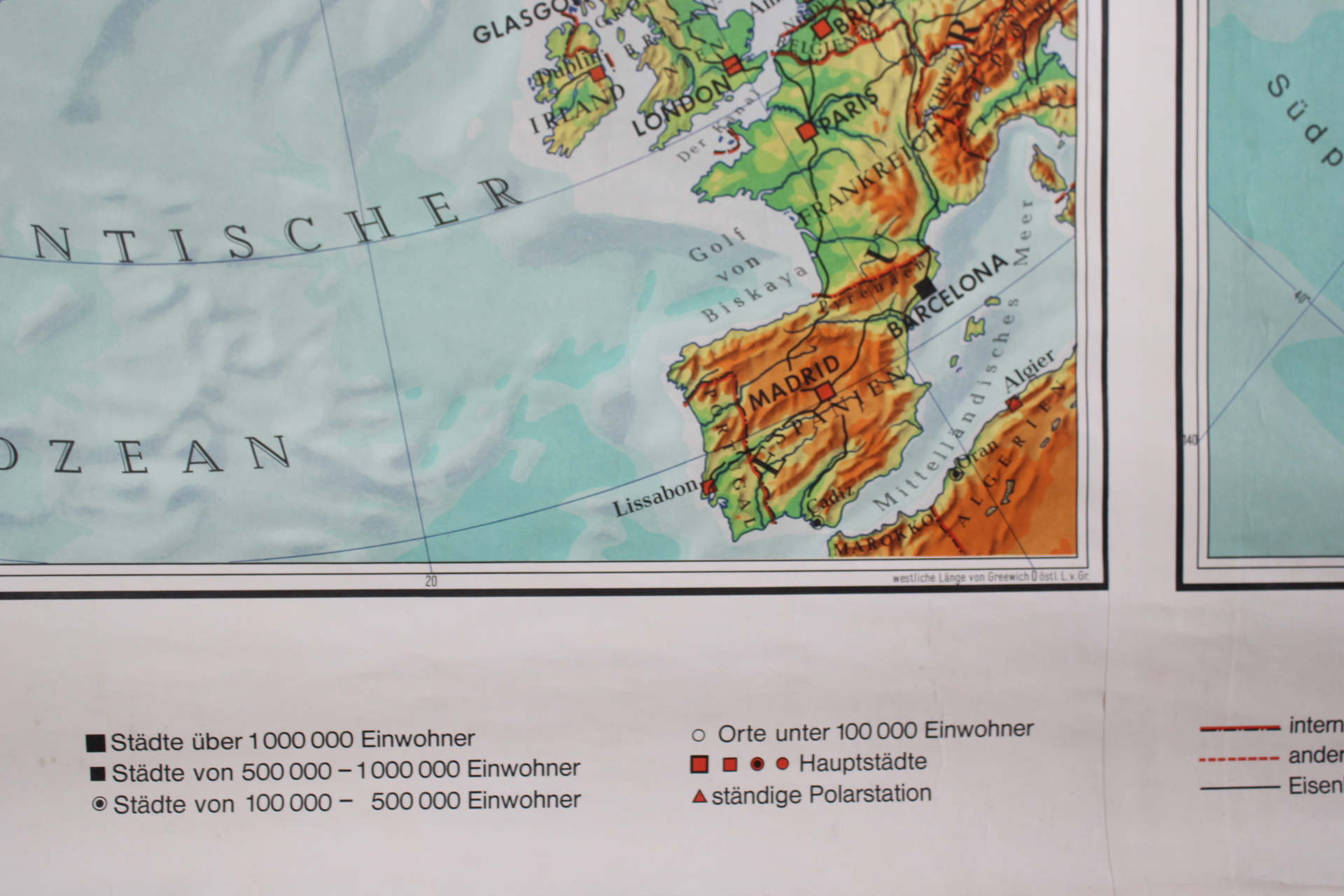
school map with North and South Pole
Sold
Sorry, this product is not available anymore. Follow us on Facebook or subscribe to our newletter to discover our new arrivals.
- Description
A large vintage school map with a detailed representation of the two polar regions: Nordpolargebiet + Südpolargebiet.
Wenschow relief card. Karl Wenschow GmbH. List Verlag Mïnchen . With indications of different types of ice and glaciers, heights of mountains and relief, routes of explorers (e.g. Amundsen who was the first to reach the South Pole in 1911). The map is in good condition.
Width: 168 cm (180 incl wooden sticks)
Height: 136 cm
- Shipping Costs
- Shipment possible or pick-up at the store