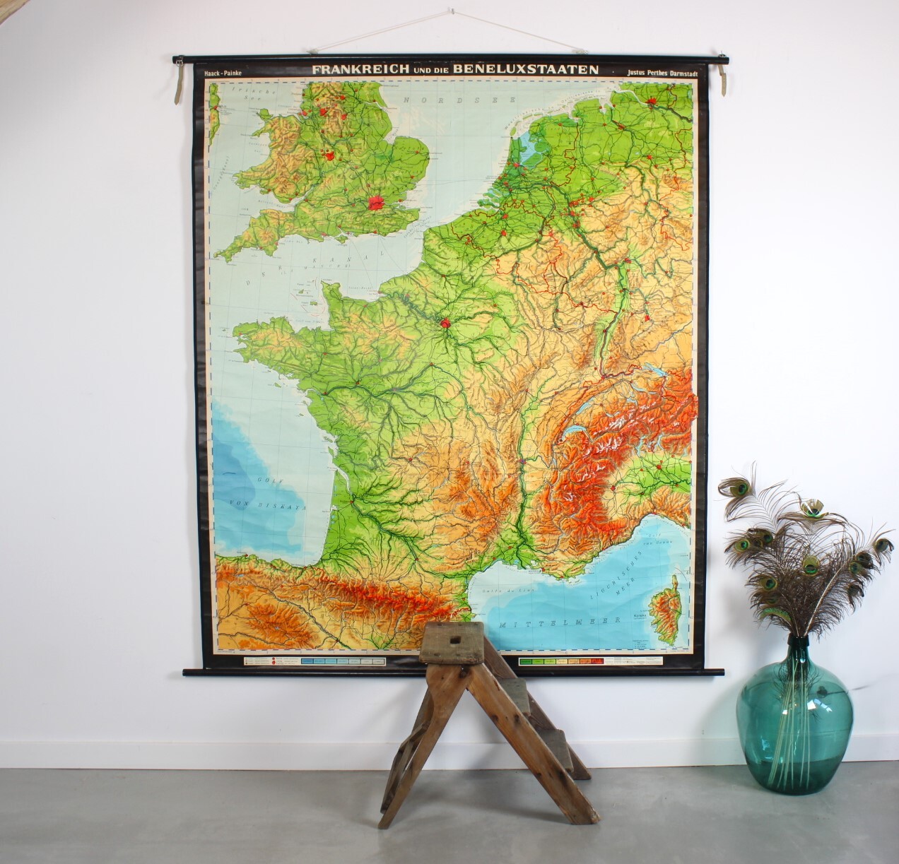
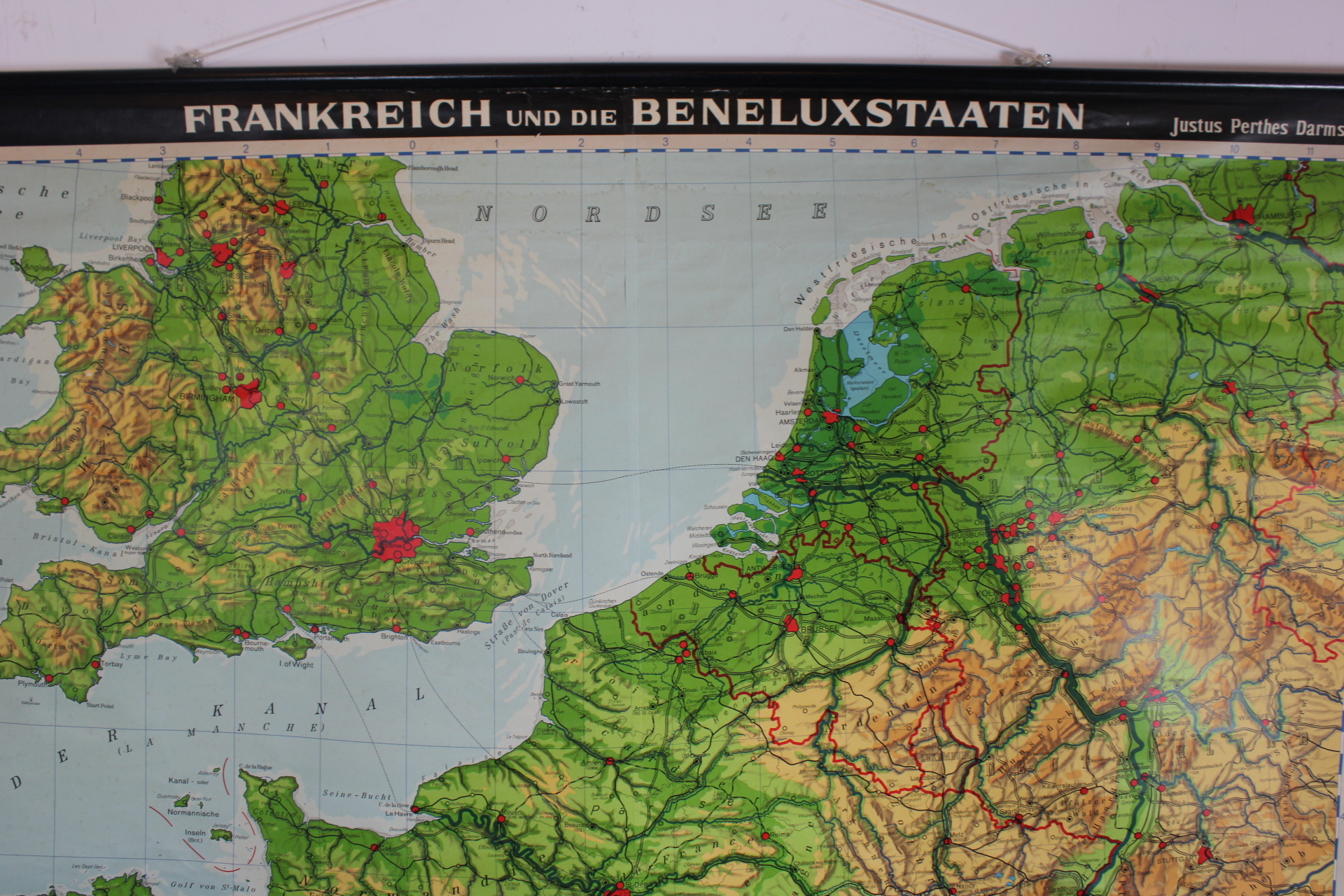
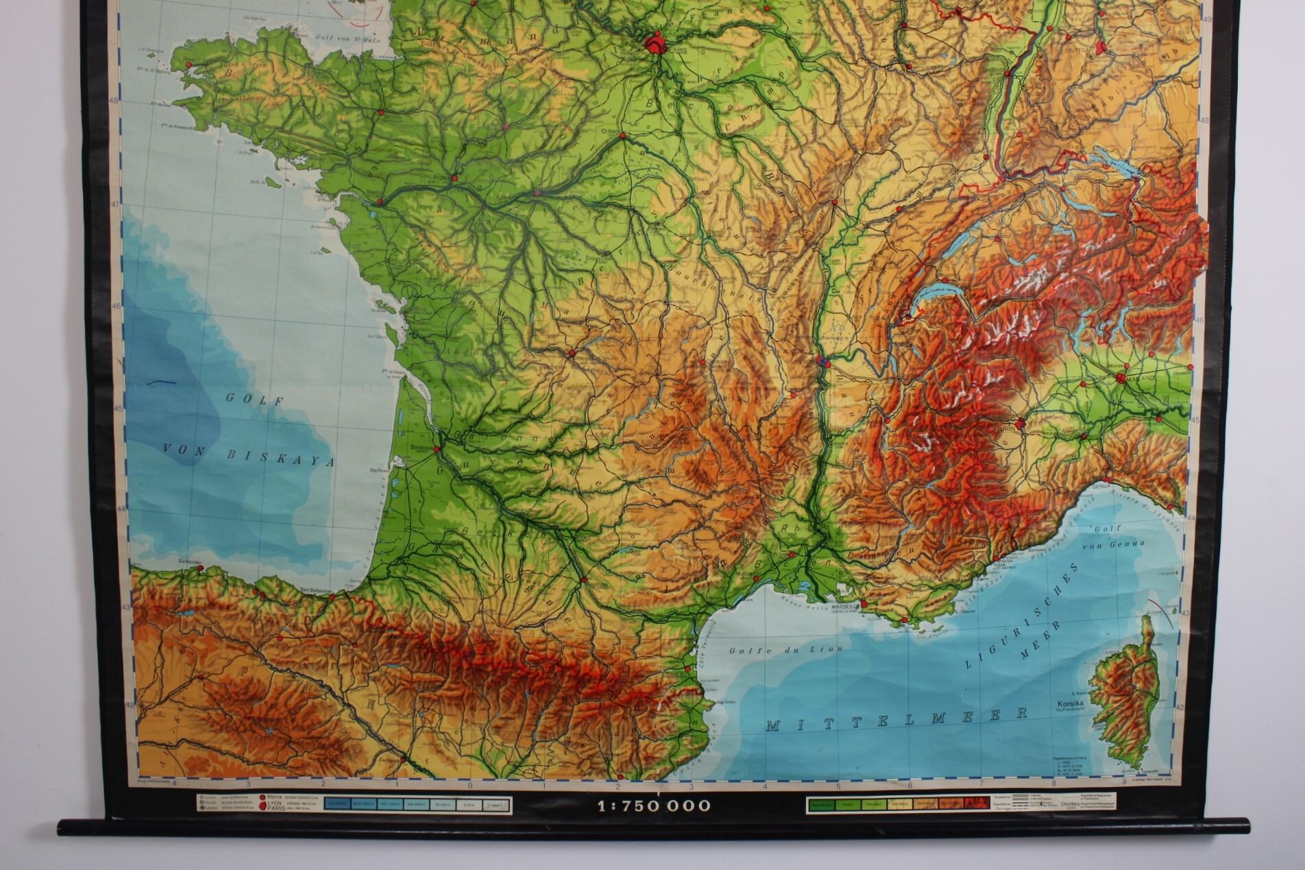
school map France + Benelux
Sold
Sorry, this product is not available anymore. Follow us on Facebook or subscribe to our newletter to discover our new arrivals.
- Description
A very large vintage school map of the Benelux and France from the 1960s-1970s. "Frankreich und die Beneluxstaaten". Colorful map with the physical features of the landscape, the colors represent the height differences. Indicating rivers, cities, highest mountains, bays, roads, etc.
Haack-Painke, Justus Perthes Darmstadt, Kartographie: Gerhard Fischer., 2. Auflage (Darmstadt) 375, Print: DVG Darmstadt. Scale: 1:750,000. Paper on linen, black wooden sticks. In vintage condition.
Height: 205 cm. Width: 170 cm (including poles: 182 cm)
- Shipping Costs
- in store pick-up only