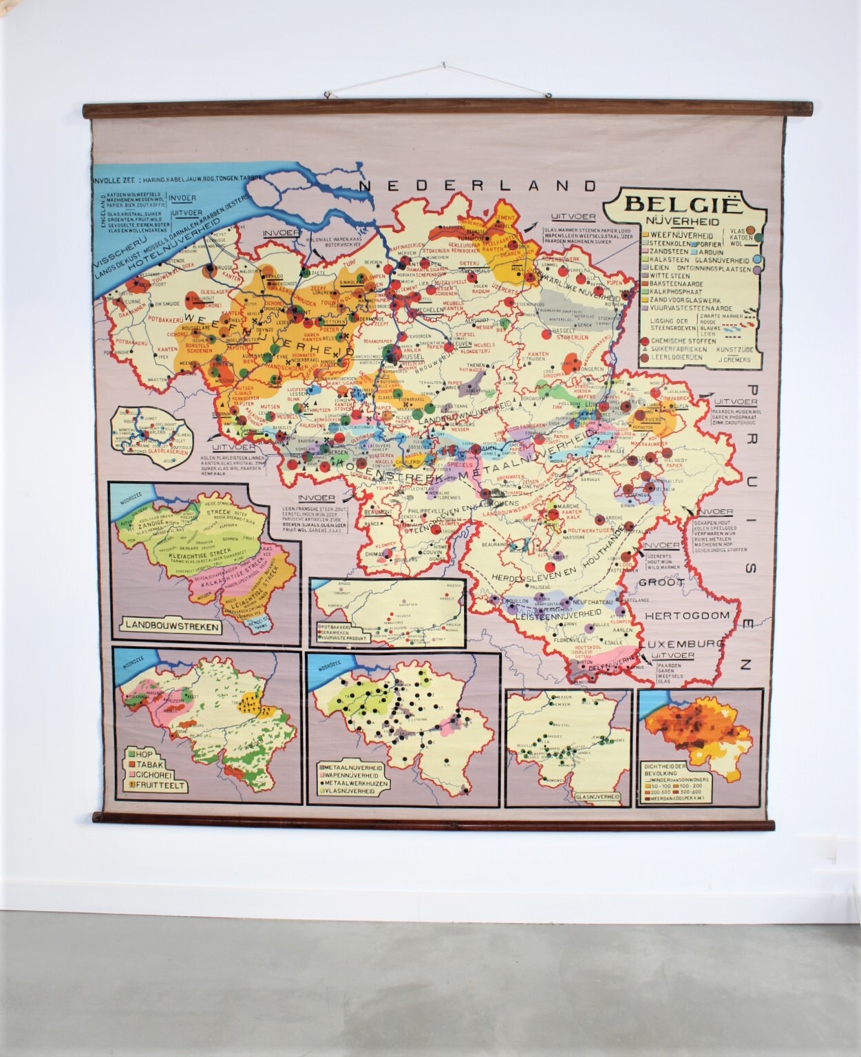
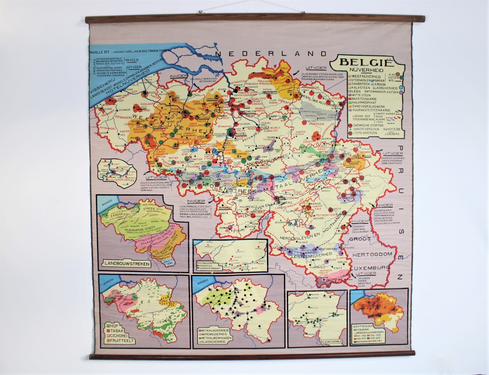
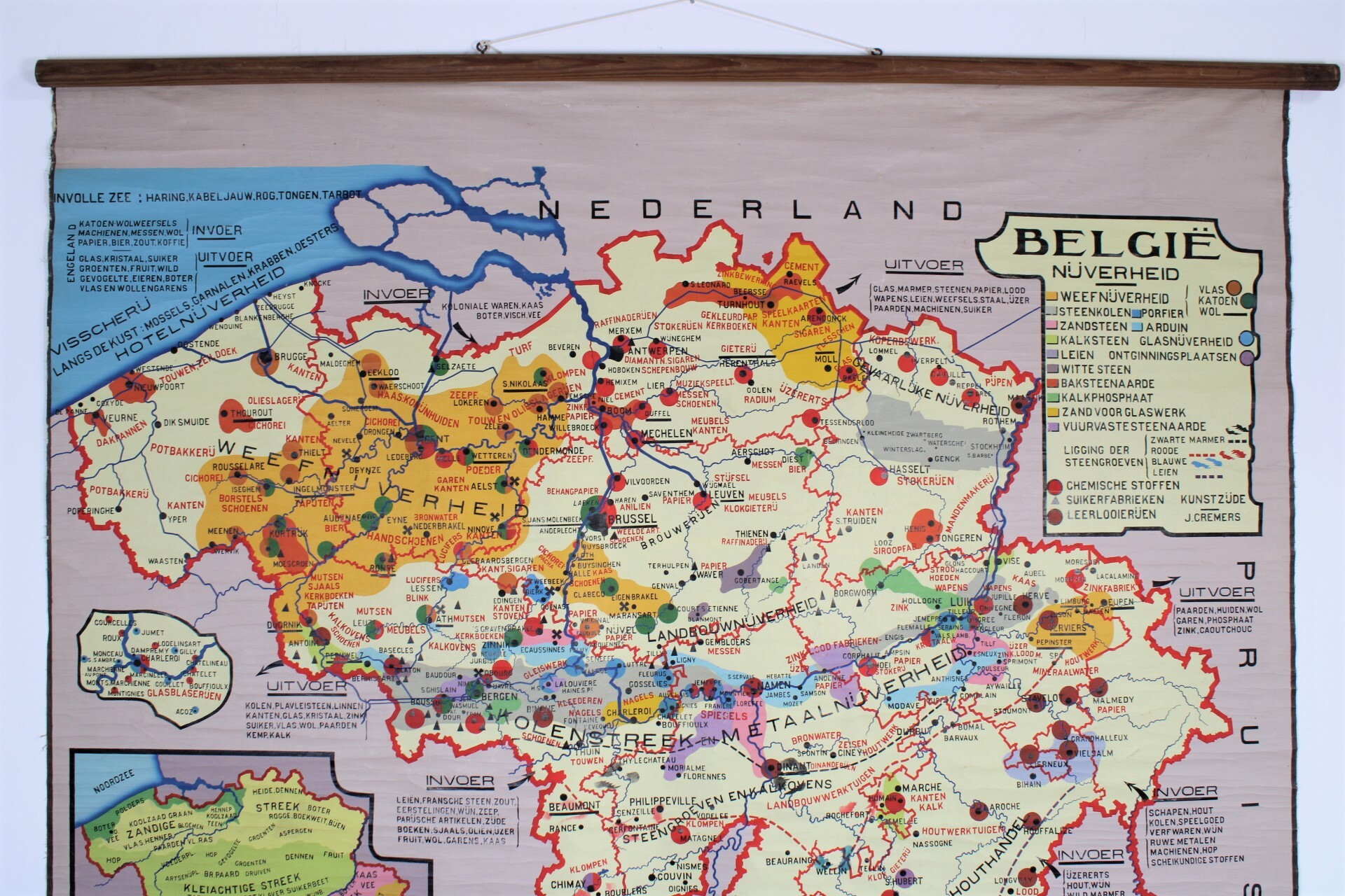
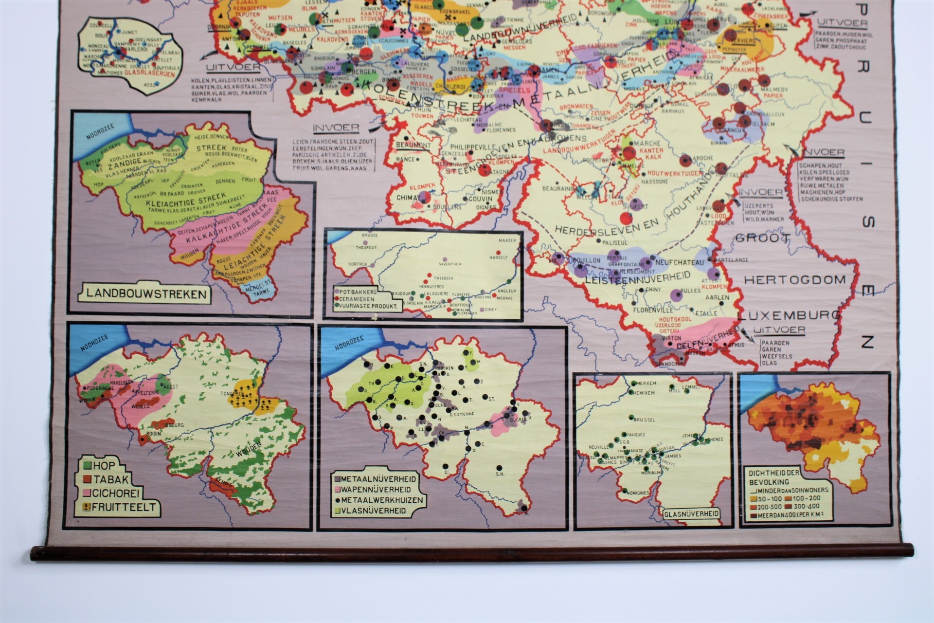
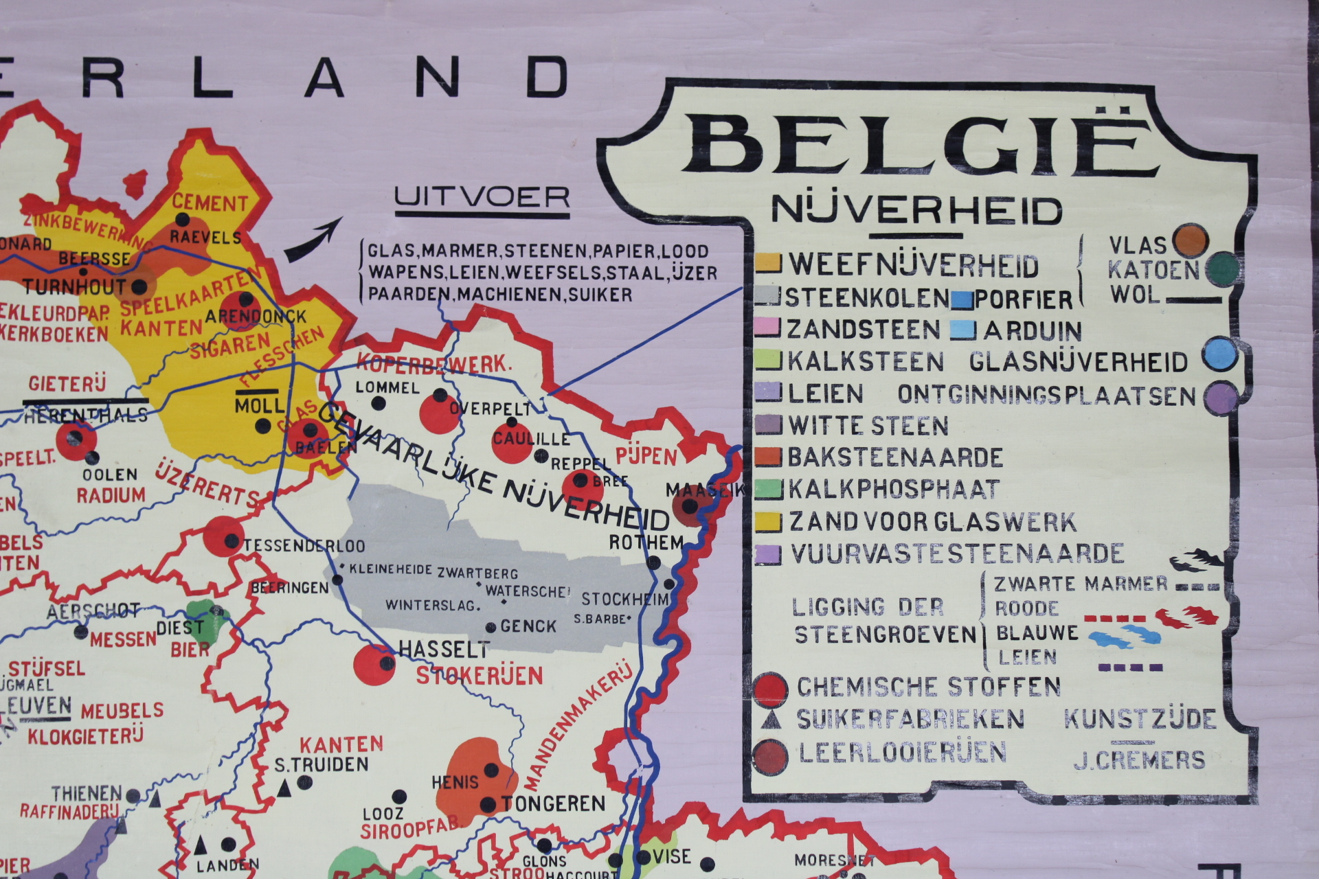
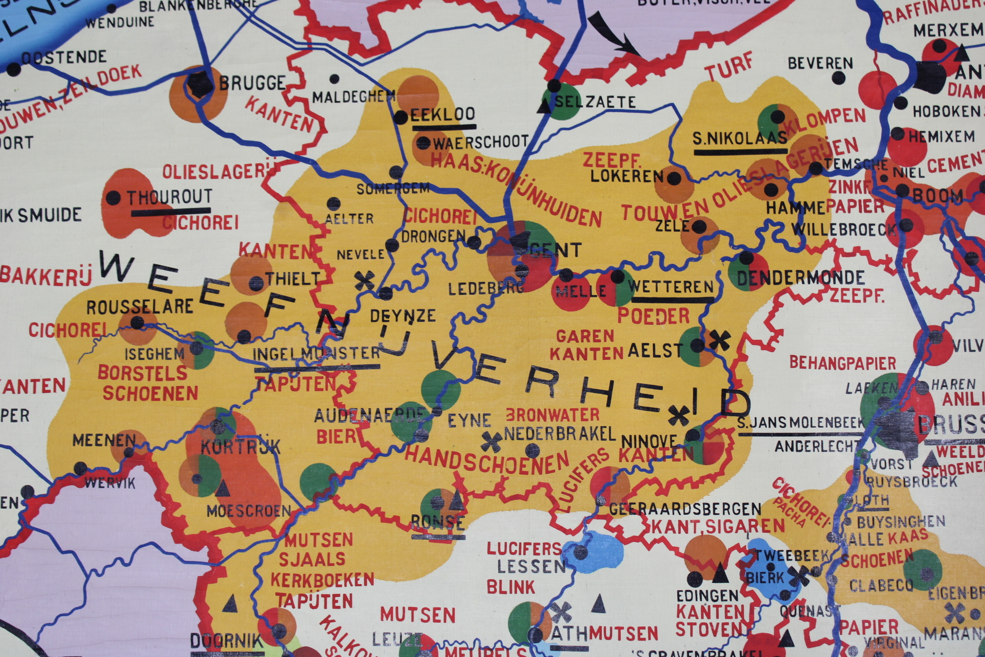
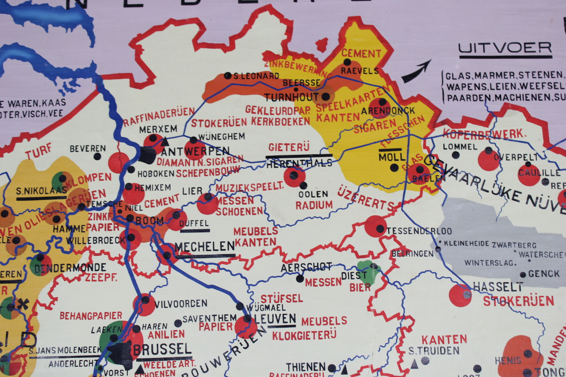
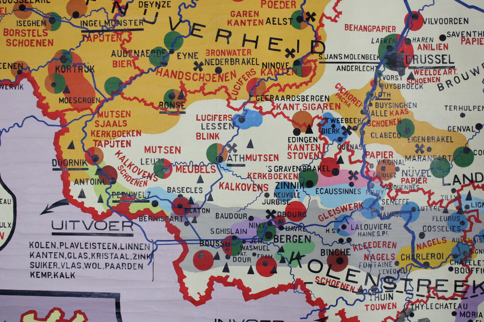
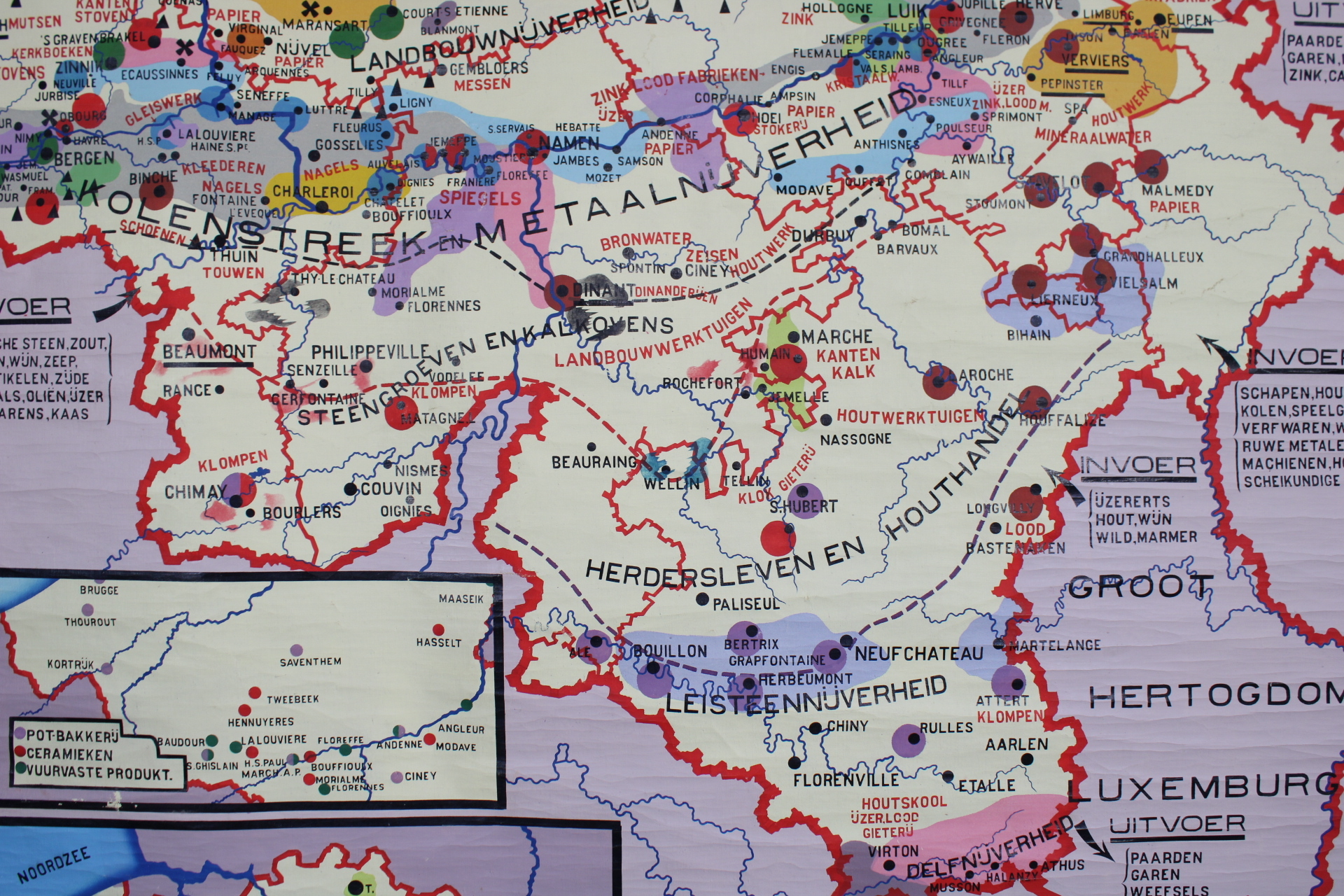
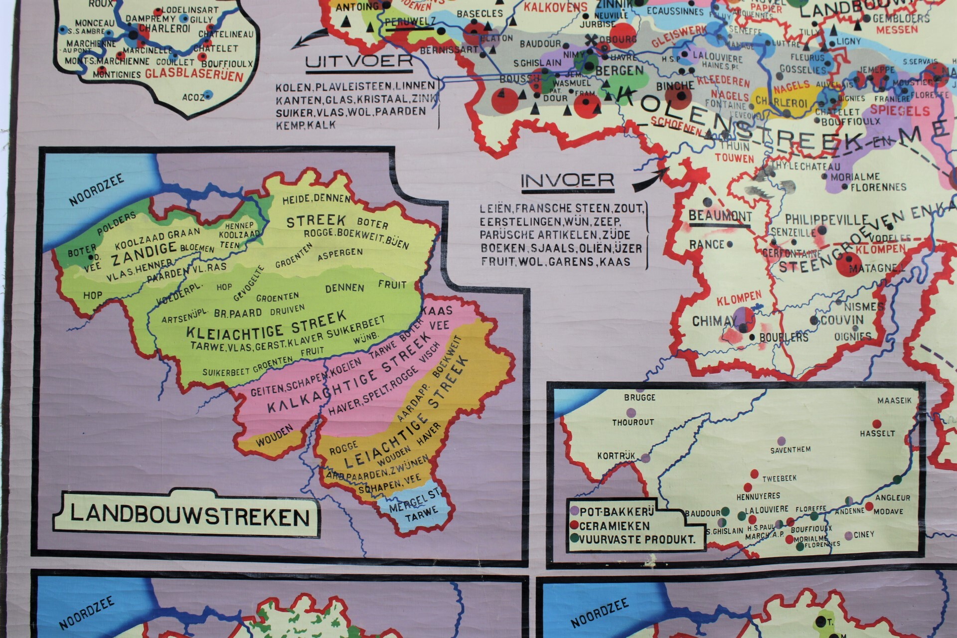
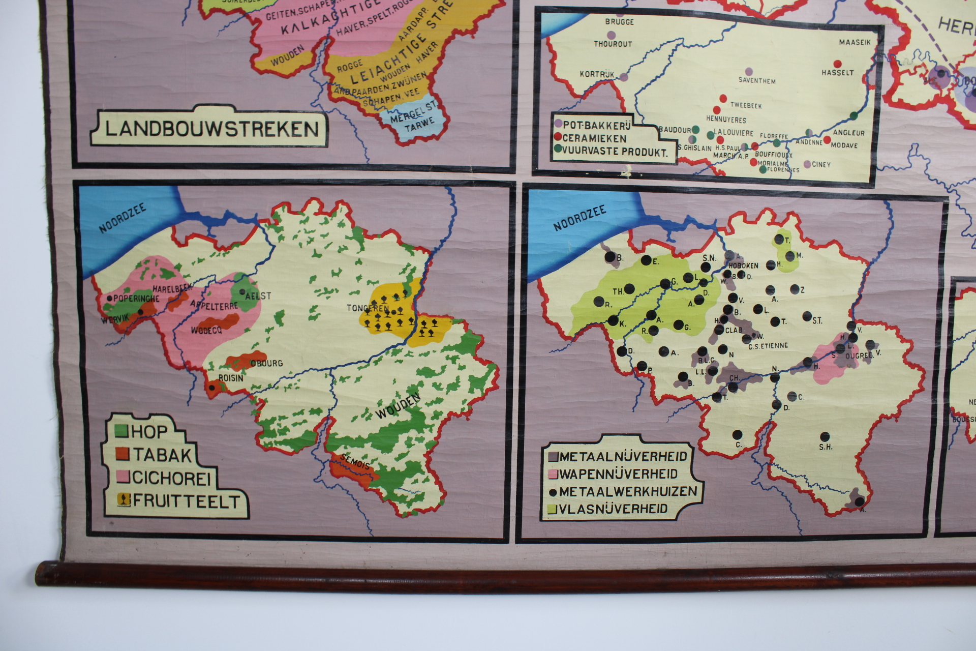
old school map of Belgium: Nijverheid, 30's
Sold
Sorry, this product is not available anymore. Follow us on Facebook or subscribe to our newletter to discover our new arrivals.
- Description
Very old and large wall map of the industry in Belgium, first half of 20th century. Detailed overview of all industrial activities in regions and cities. A lot of information available, almost like an atlas. Also smaller maps per sector. Old way of writing: Rousselare, Thourout, Thienen, Aelst, Pruisen instead of Germany, Visscherij,... Nice colours. Painted on linen. From the 30's. J. Cremers. In very good condition.
Very large wall map, dim: 200*215 cm (the height can be reduced by 13 cm at the top if needed)
- Shipping Costs
- in store pick-up only