
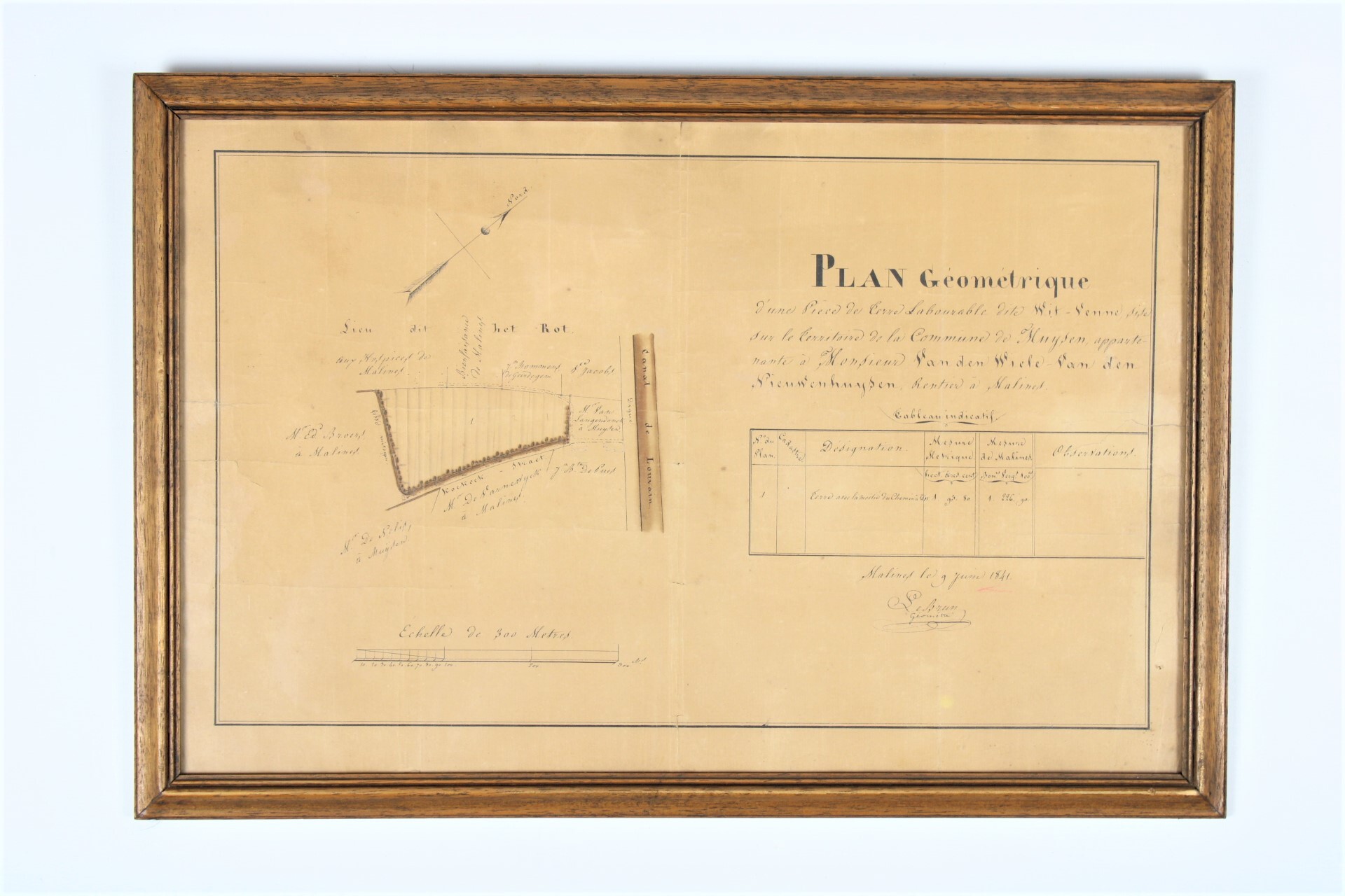
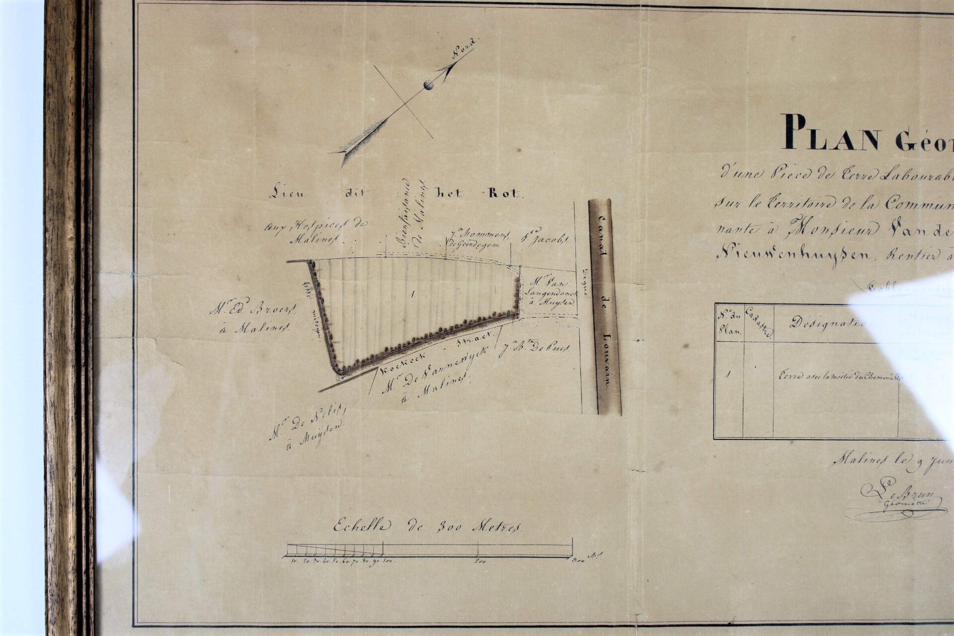
An old map in Muizen-Mechelen, 1841
€75,00
- Description
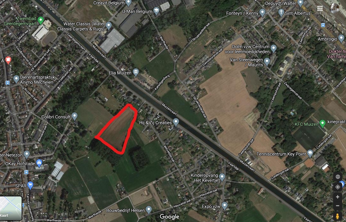
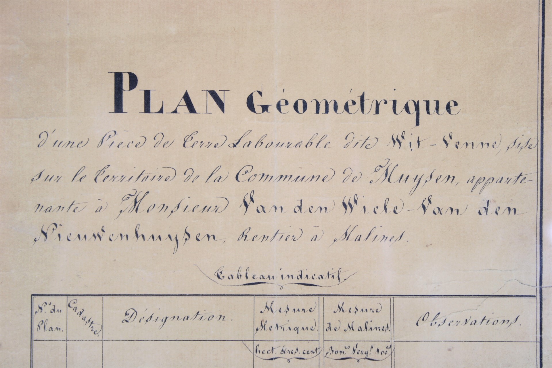
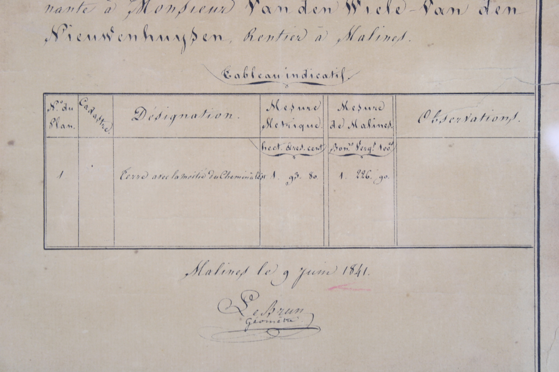
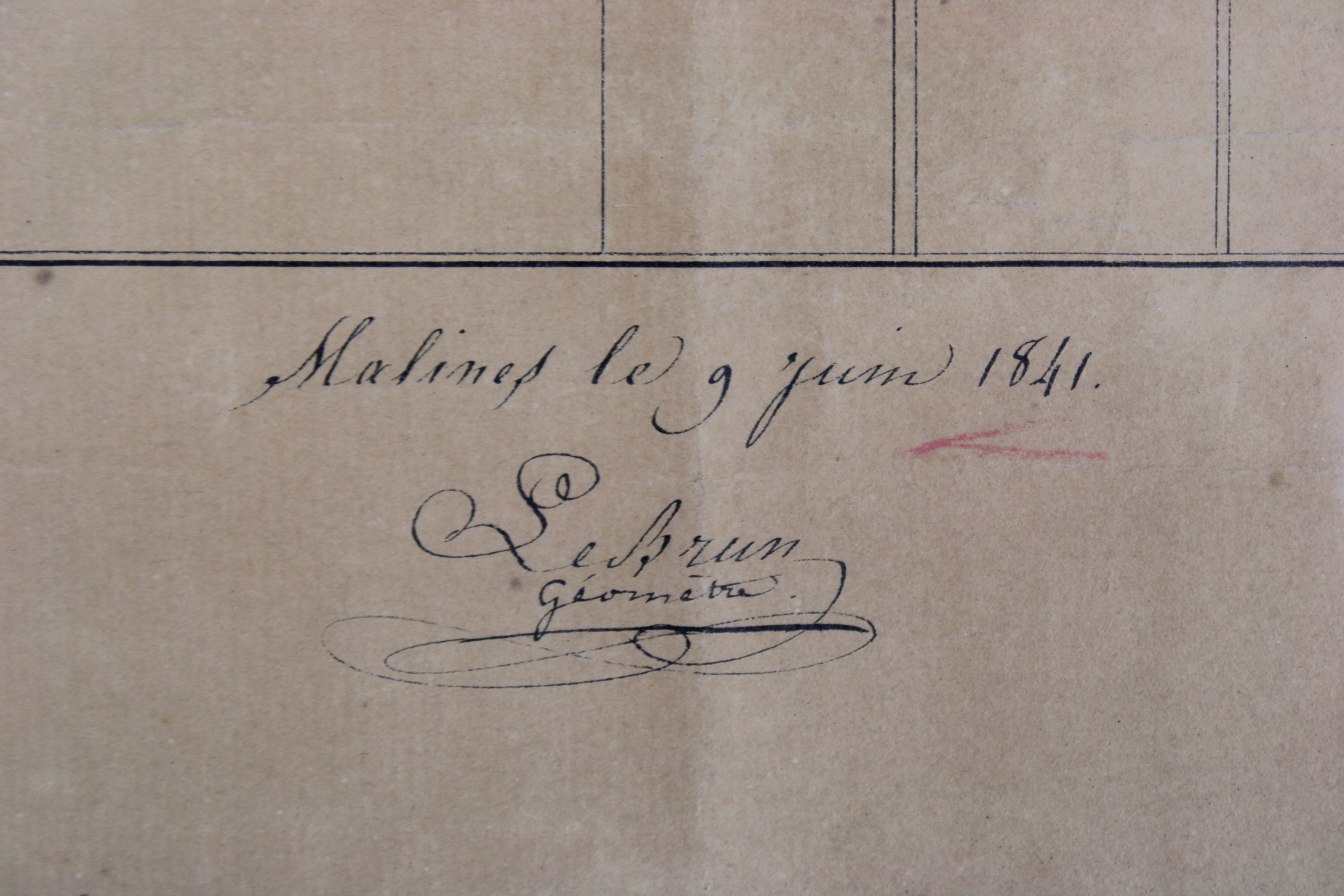
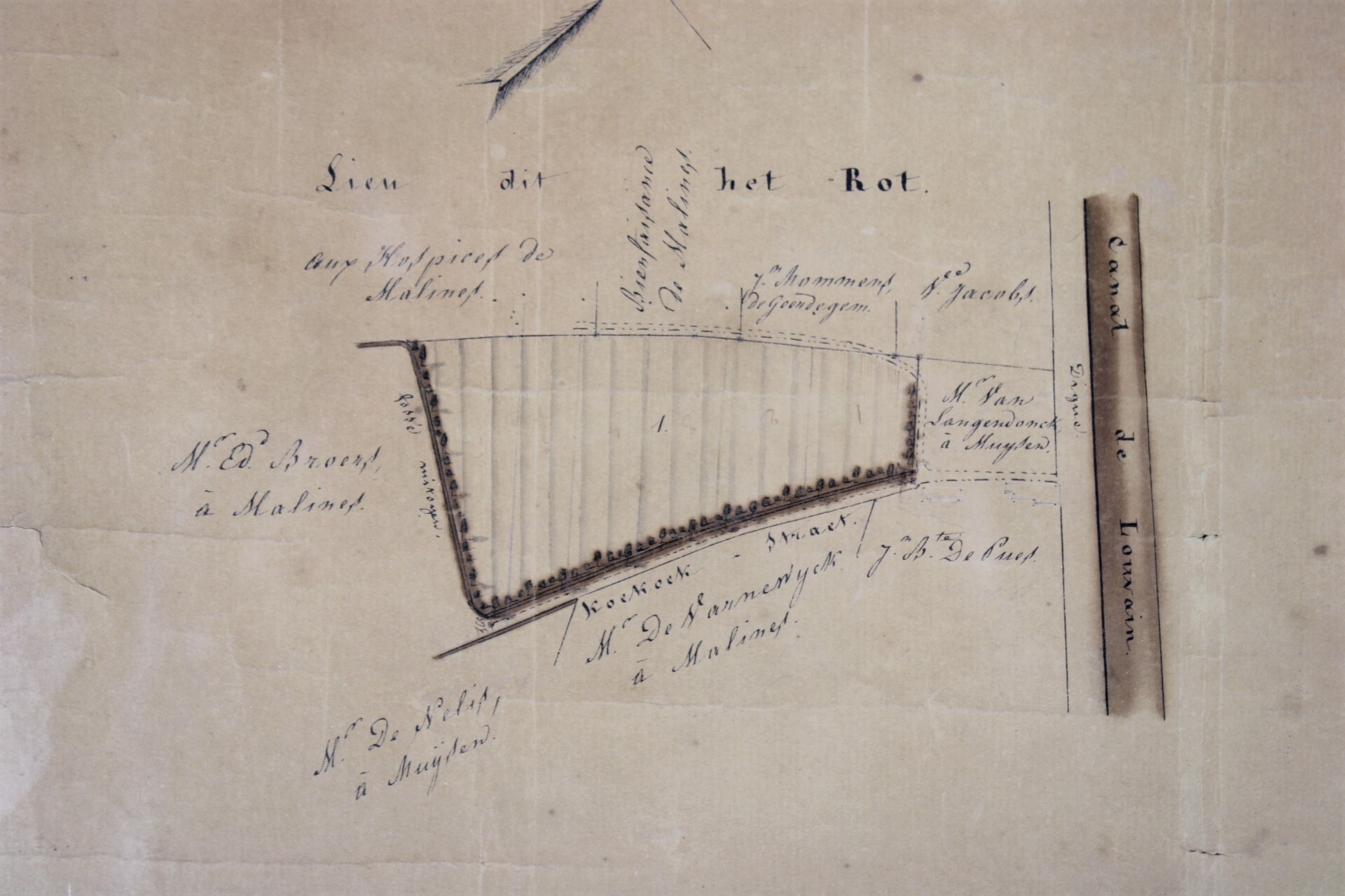
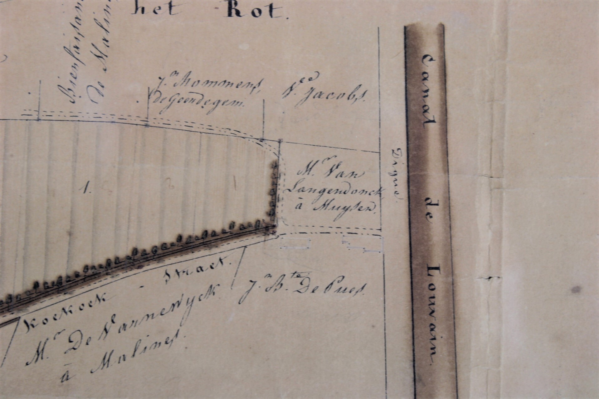
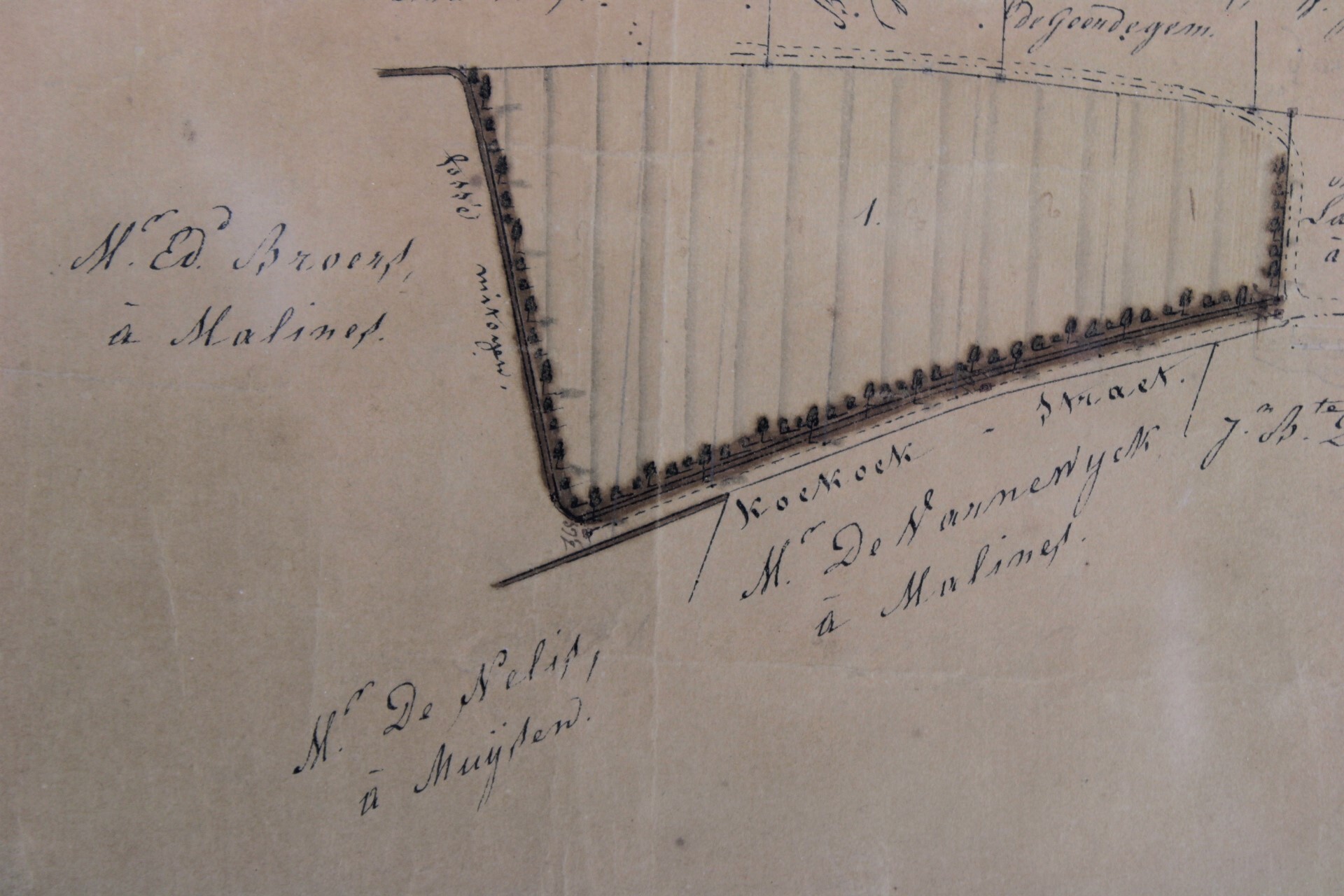
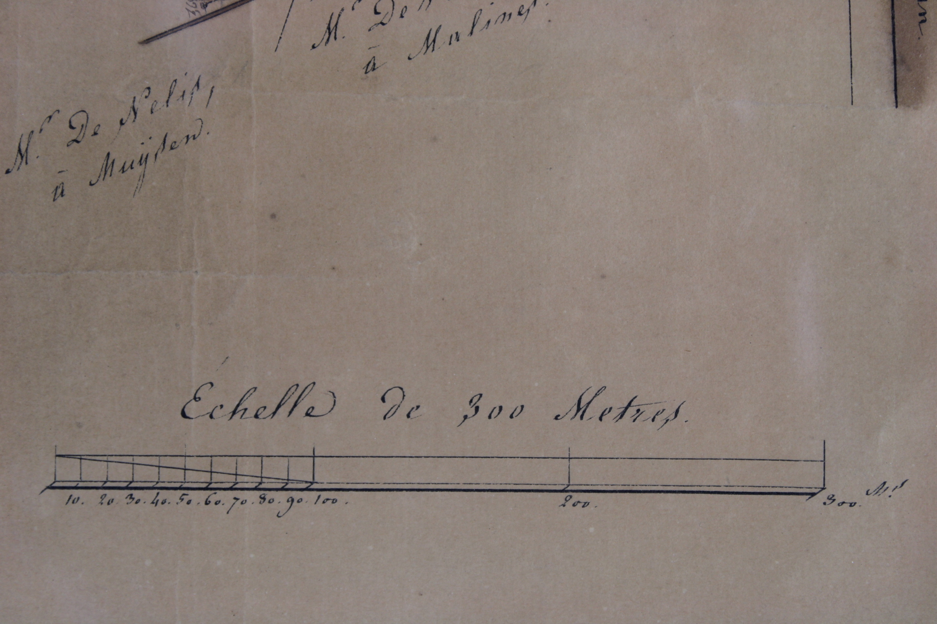
A 'Plan Géométrique' of a piece of land in the Koekoekstraat in Muizen-Mechelen. This street name has been changed meanwhile into Vaartdijk, near the Witveldstraat and the canal 'Leuvense vaart'. This map has been made in 1841 by the géomètre Lebrun at june 9th 1841 in Mechelen. "Plan géométrique d'une pièce de terre labourable dit Wit-Venne; sur le territoire de la commune de Muysen, appartenante à monsieur van den Wiele - Van den Nieuwenhuysen, rentier à Malines". Also called 'Lieu dit Het Rot'.
Wooden frame: 50*34 cm.
- Shipping Costs
- Shipment possible or pick-up at the store