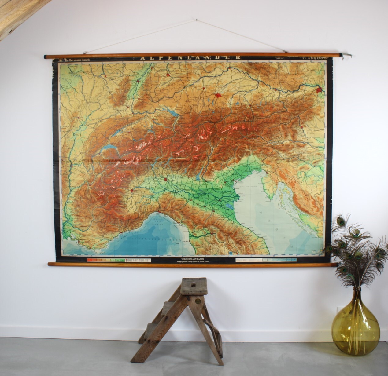
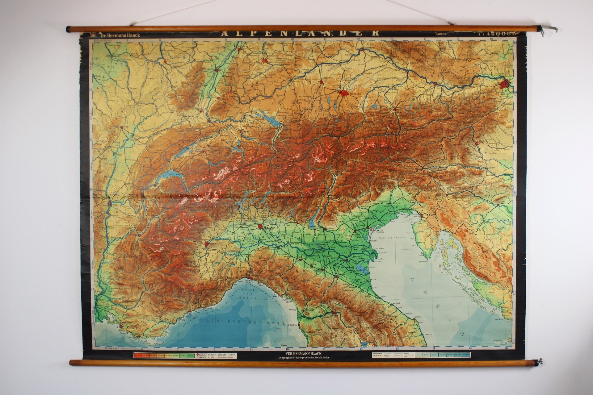
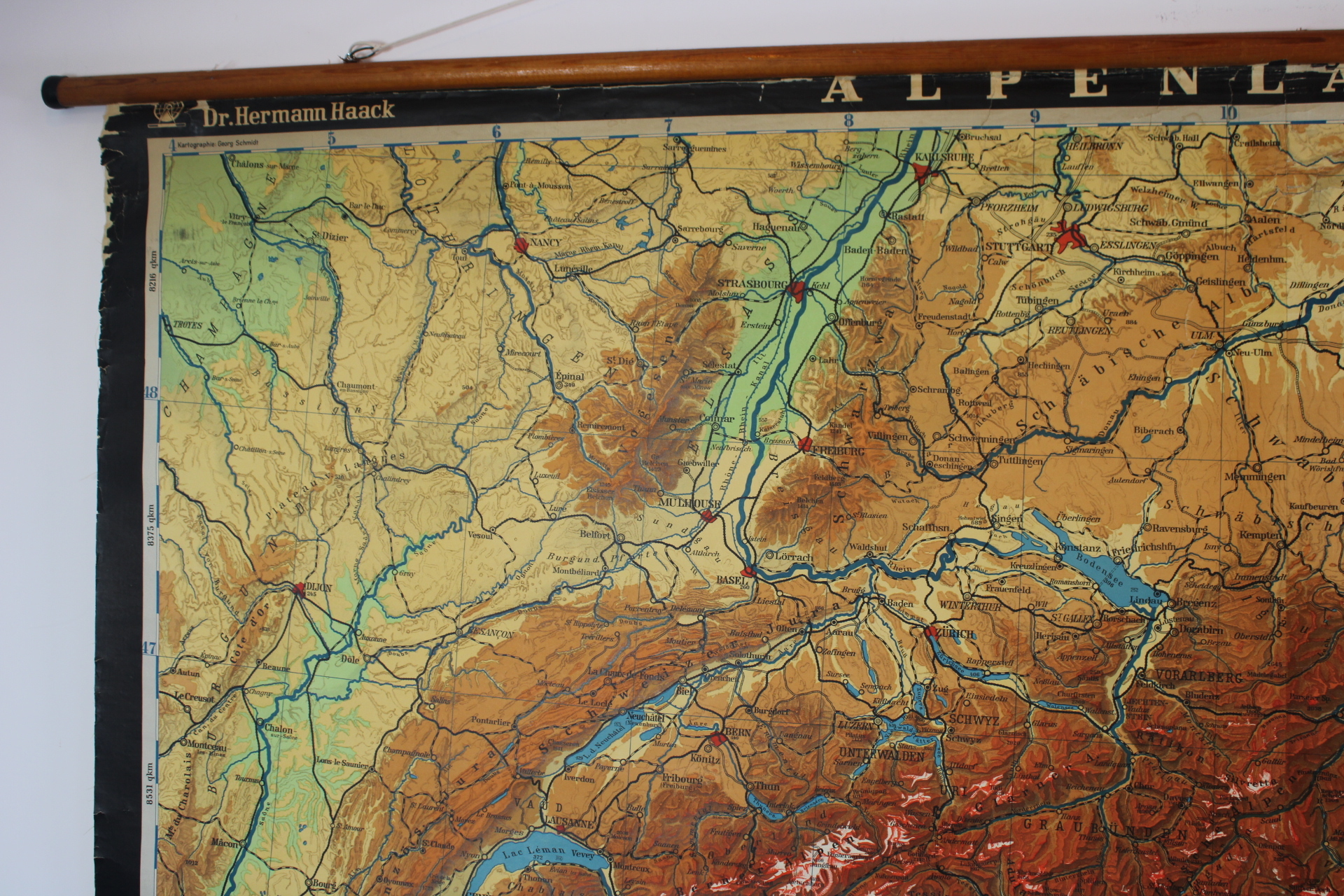
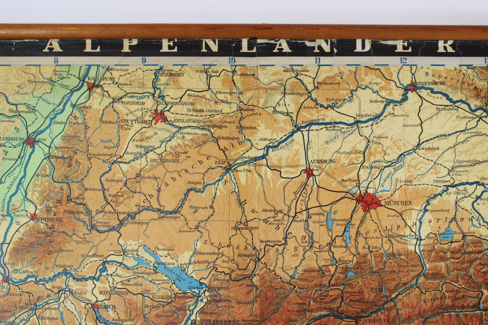
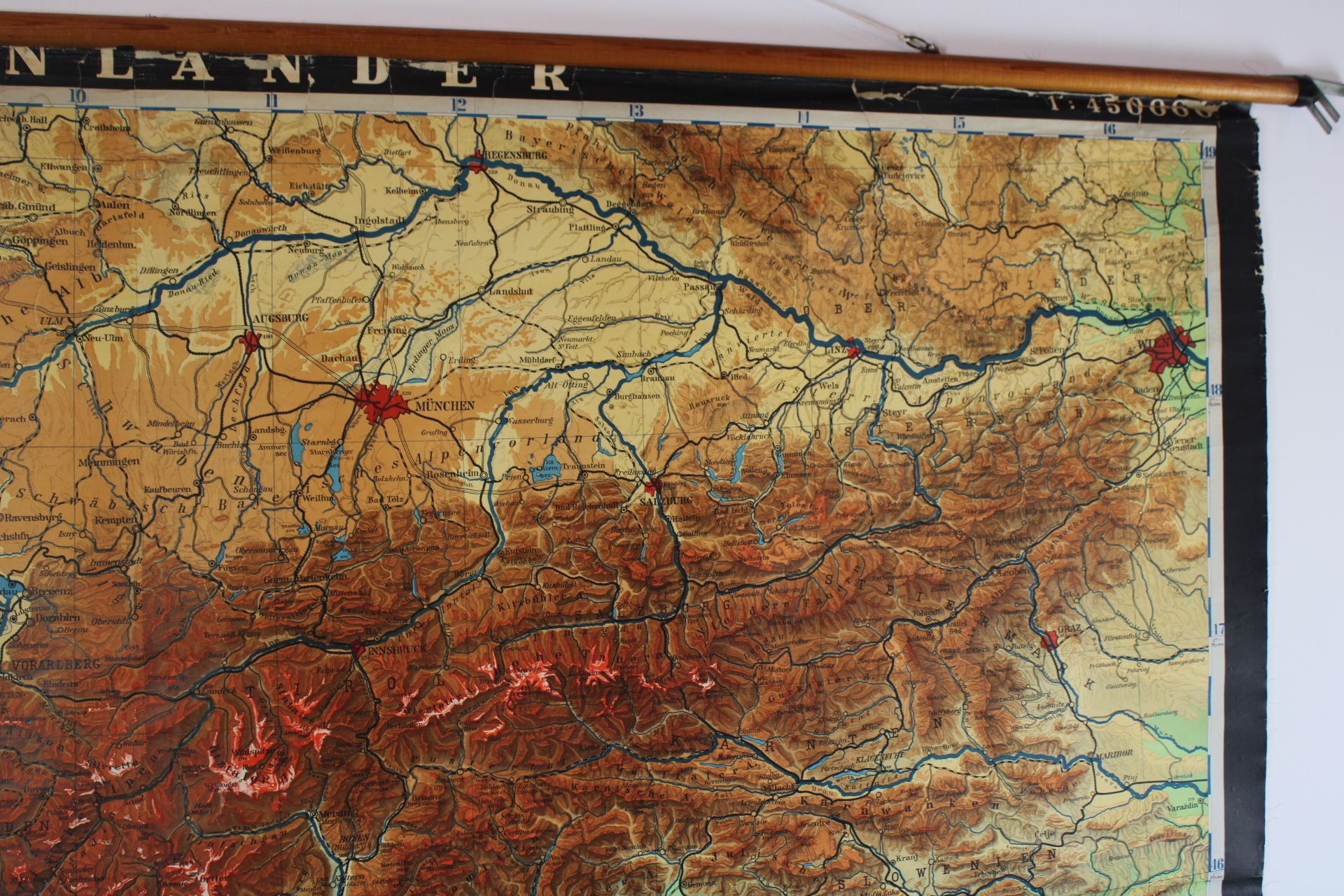
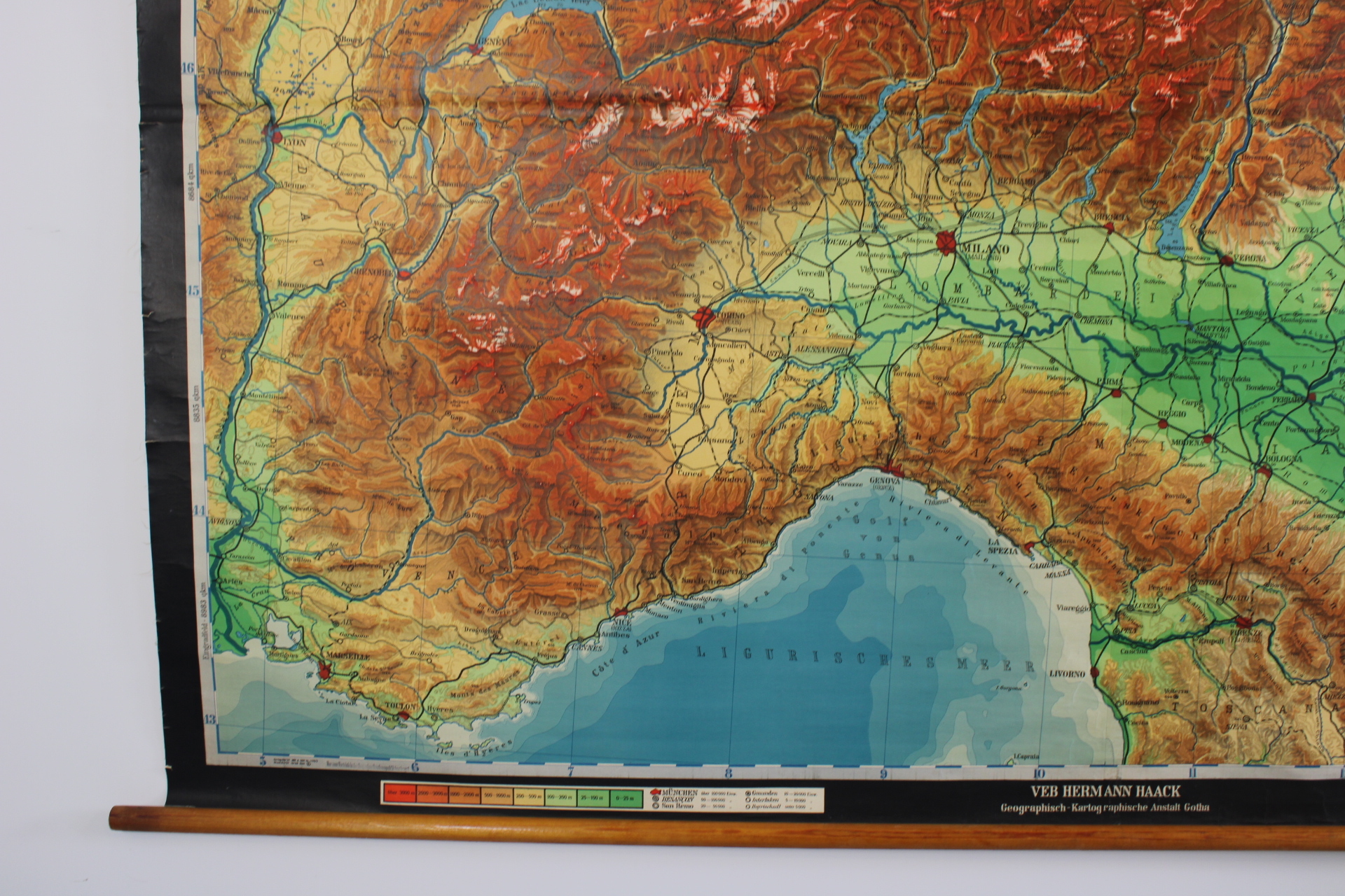
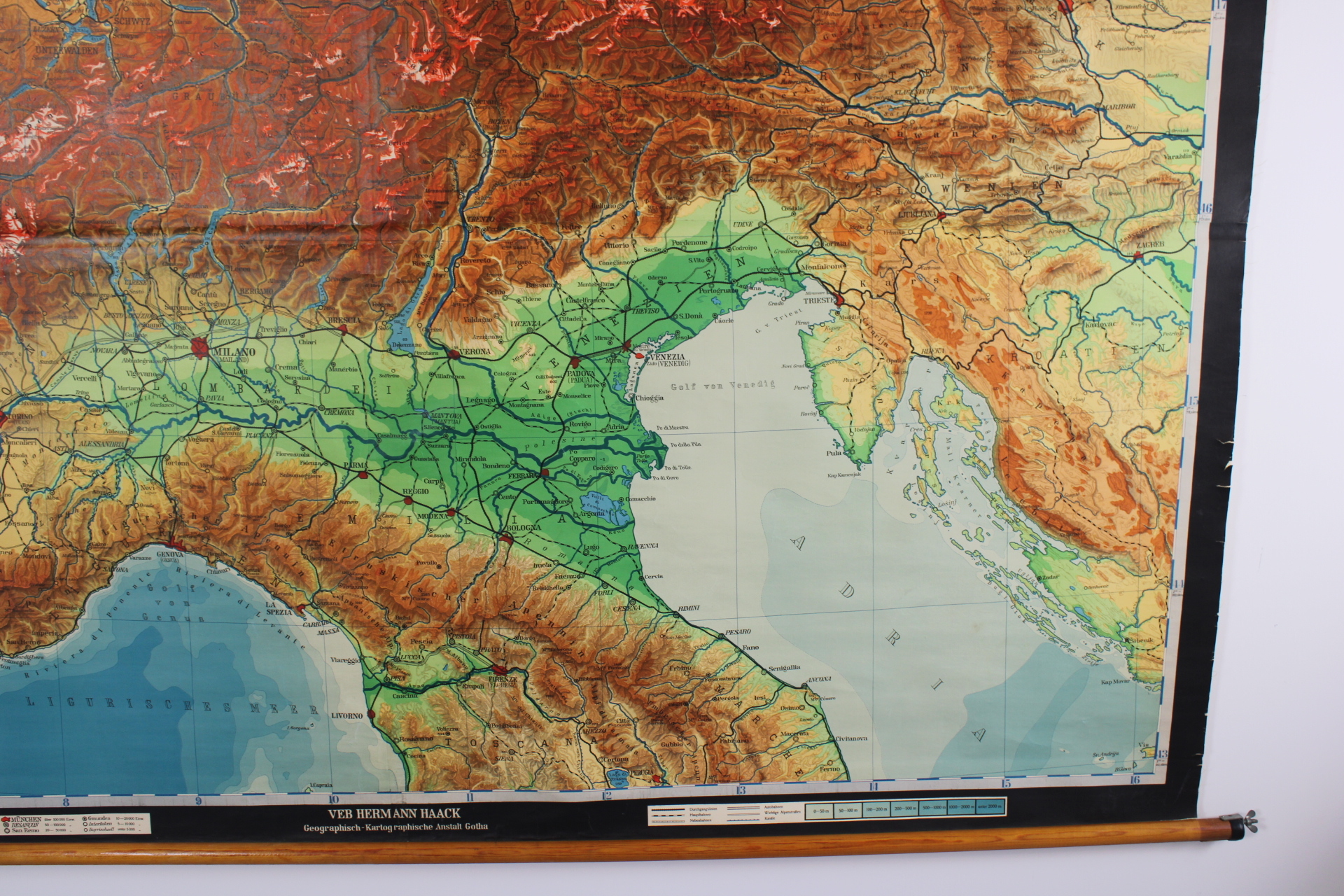
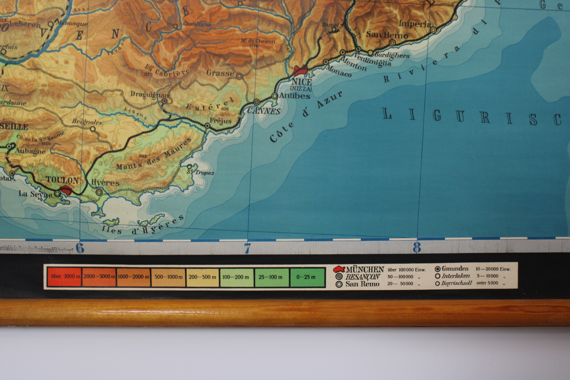
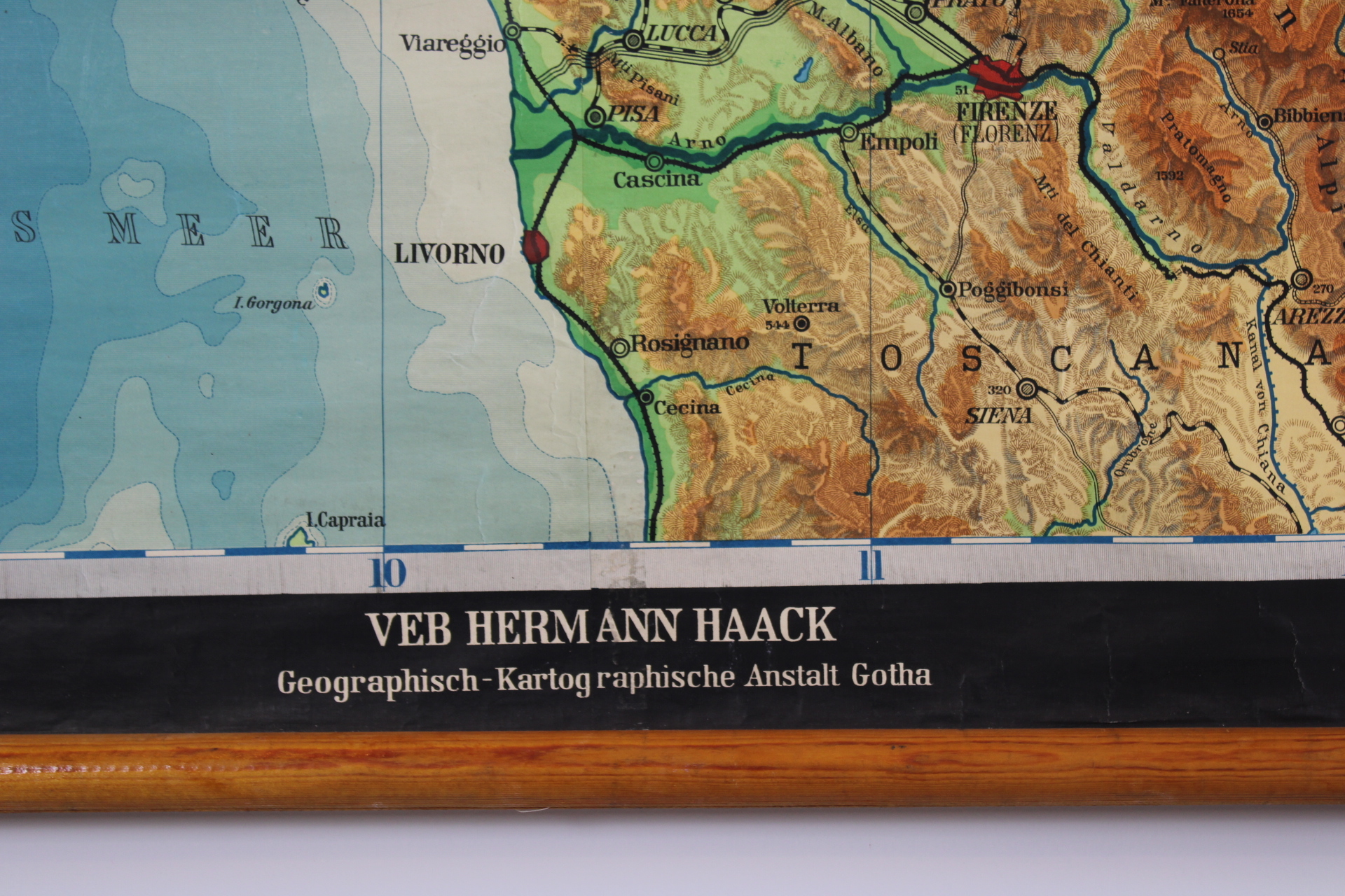
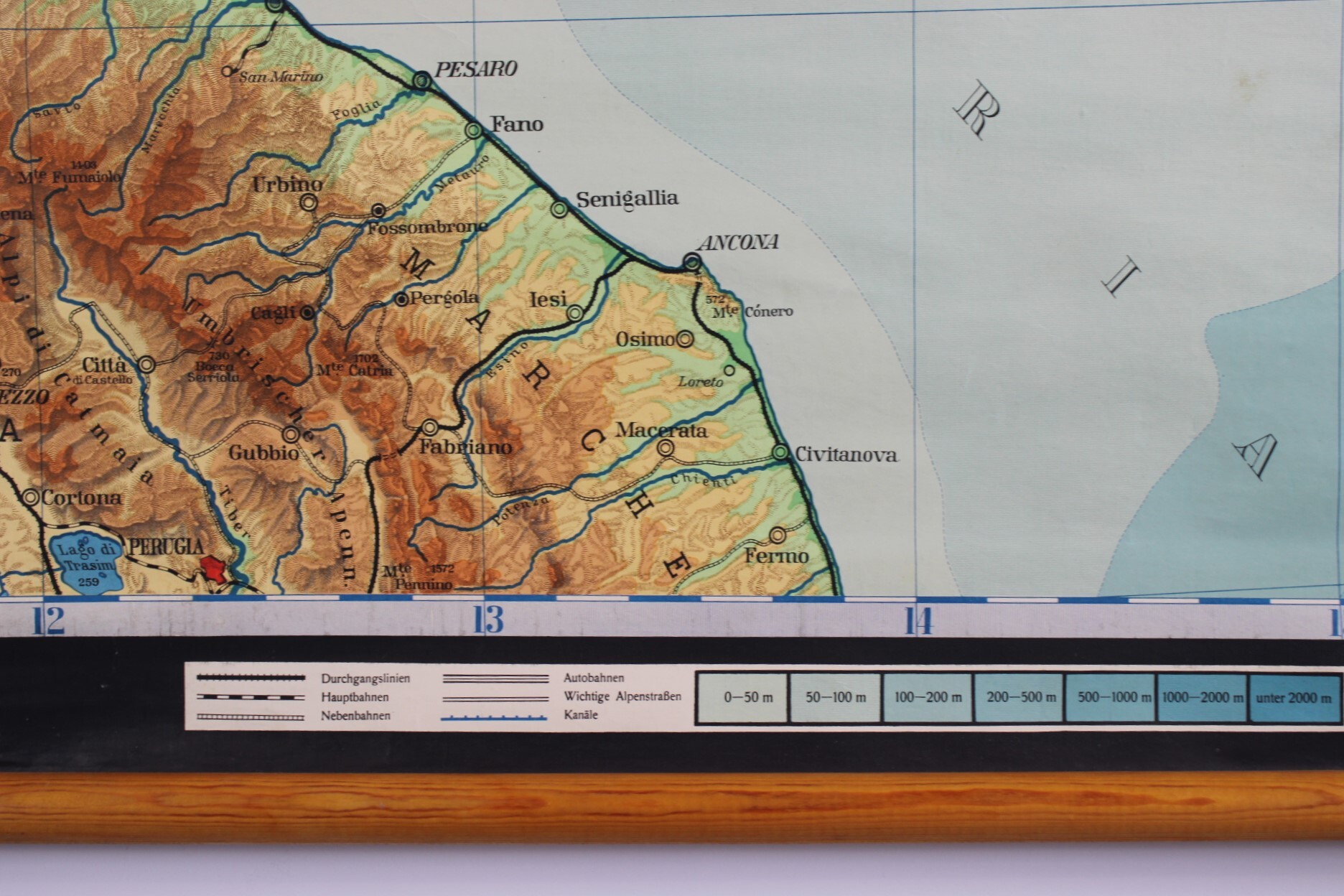
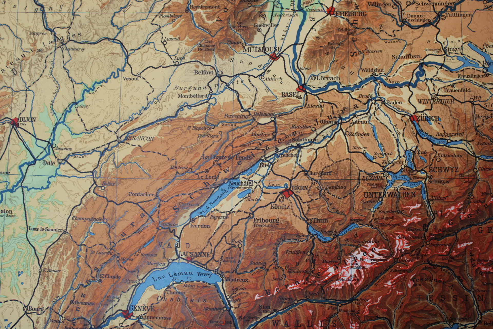
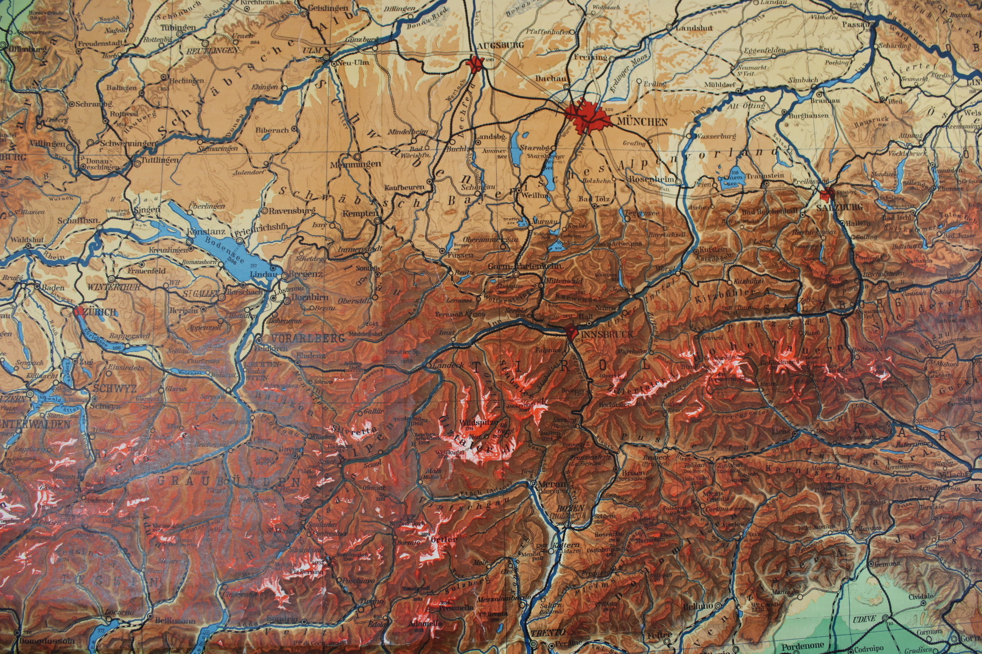
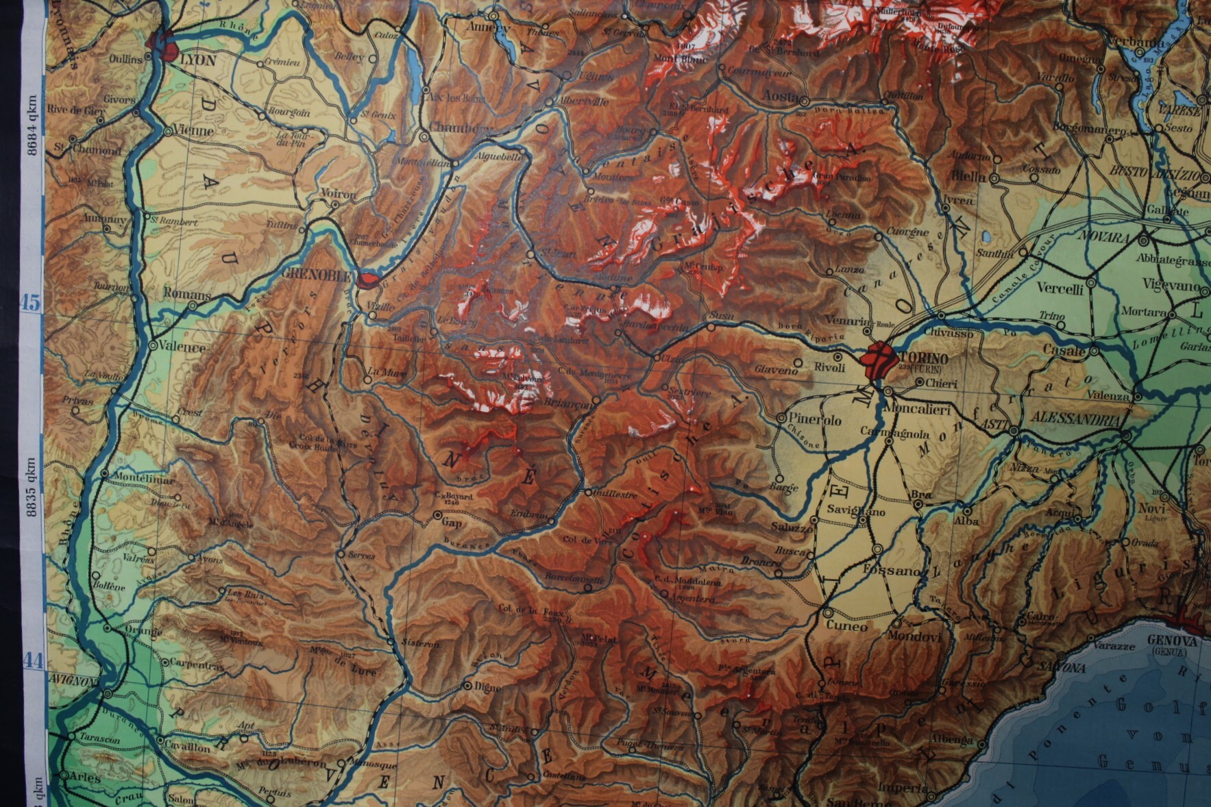
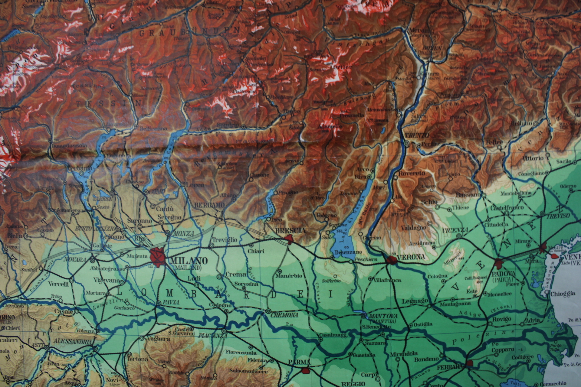
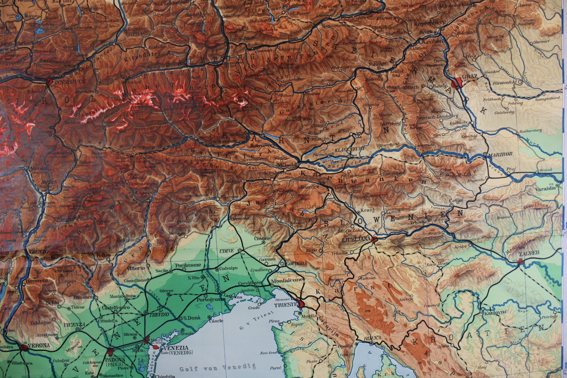
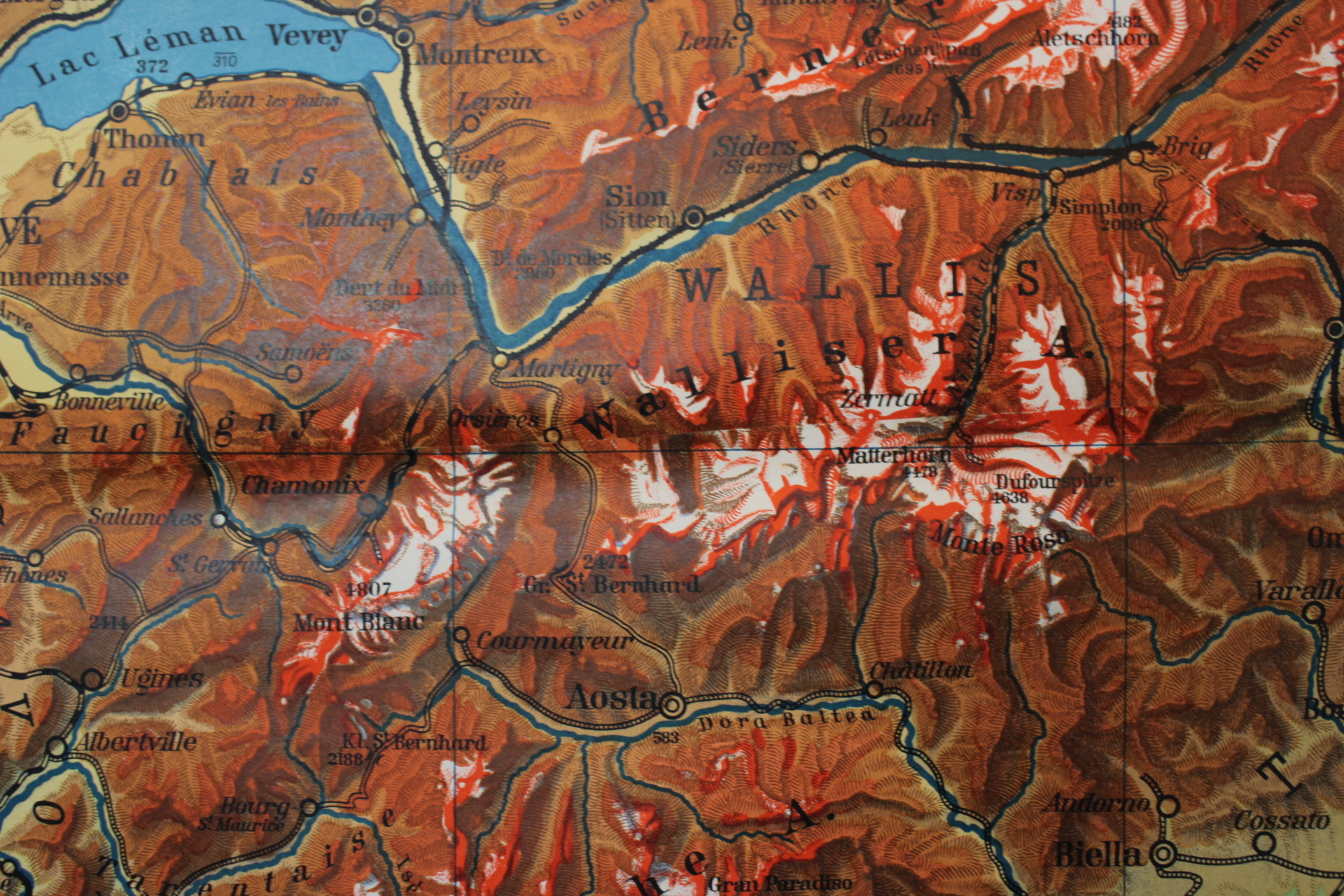
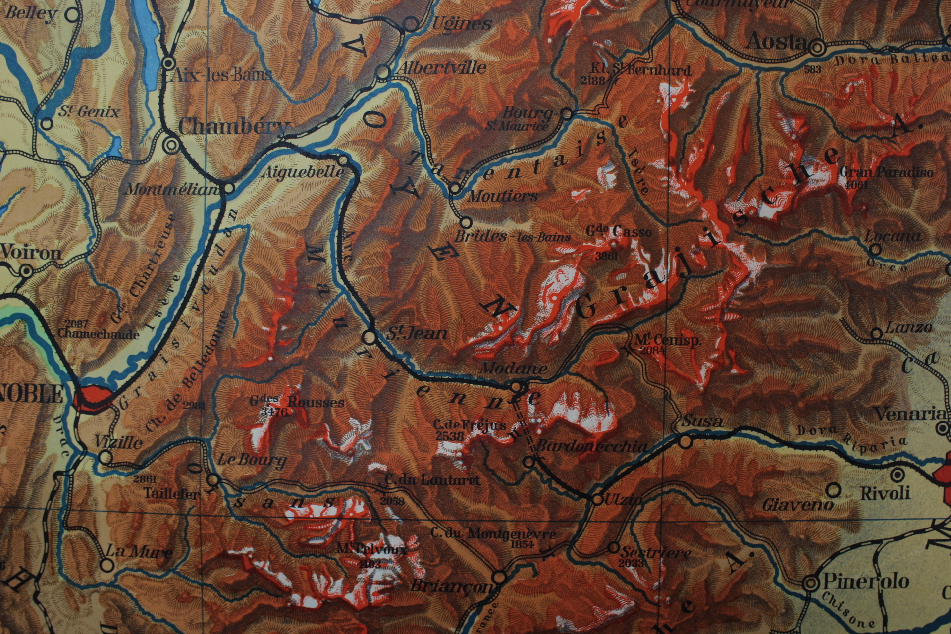
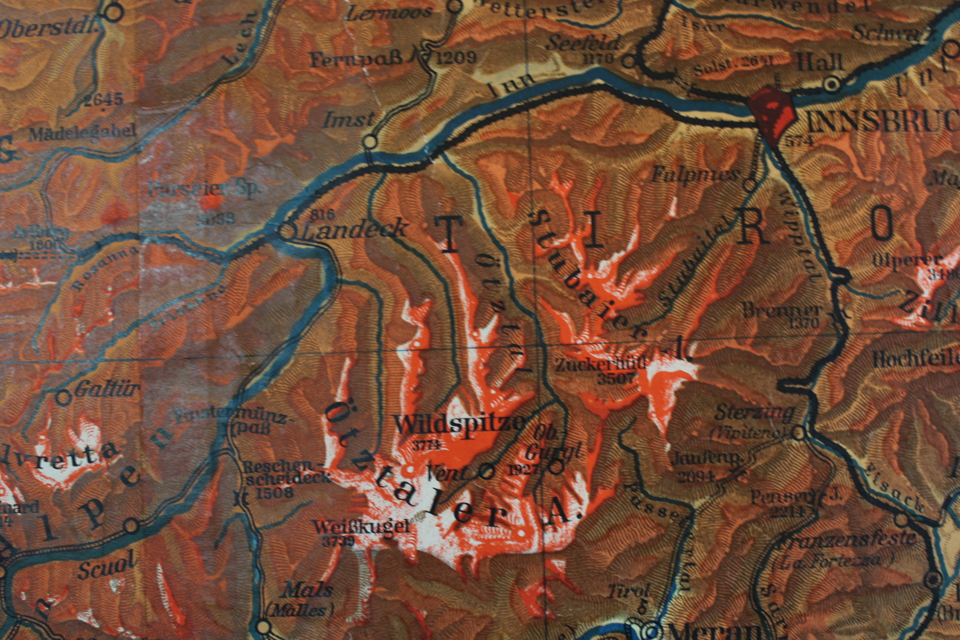
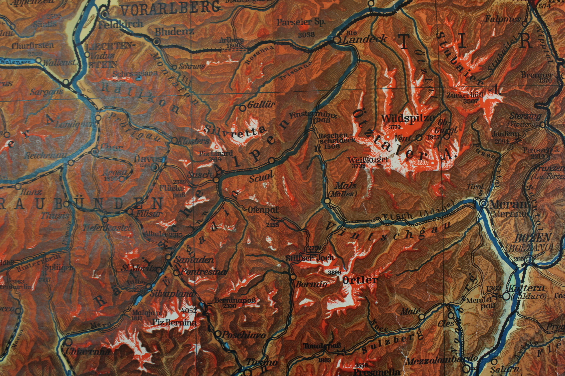
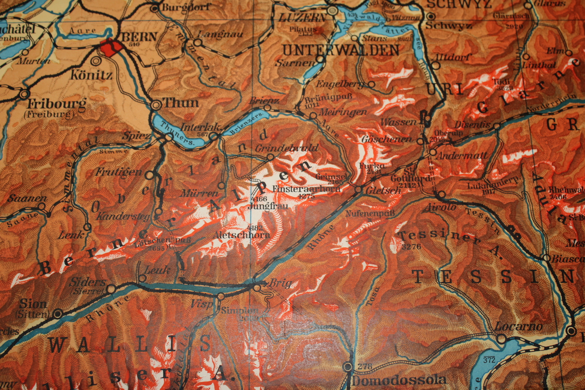
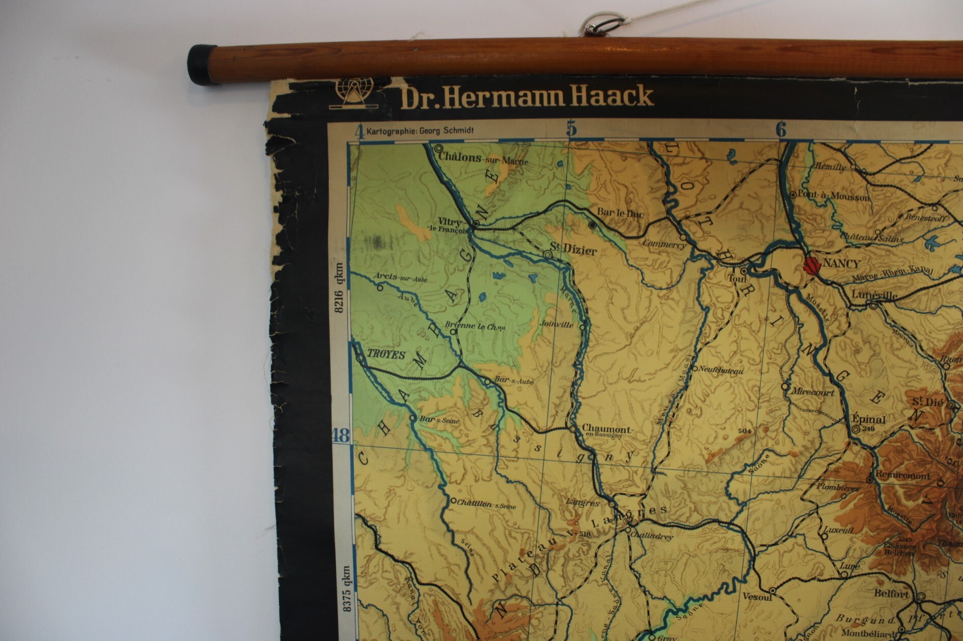
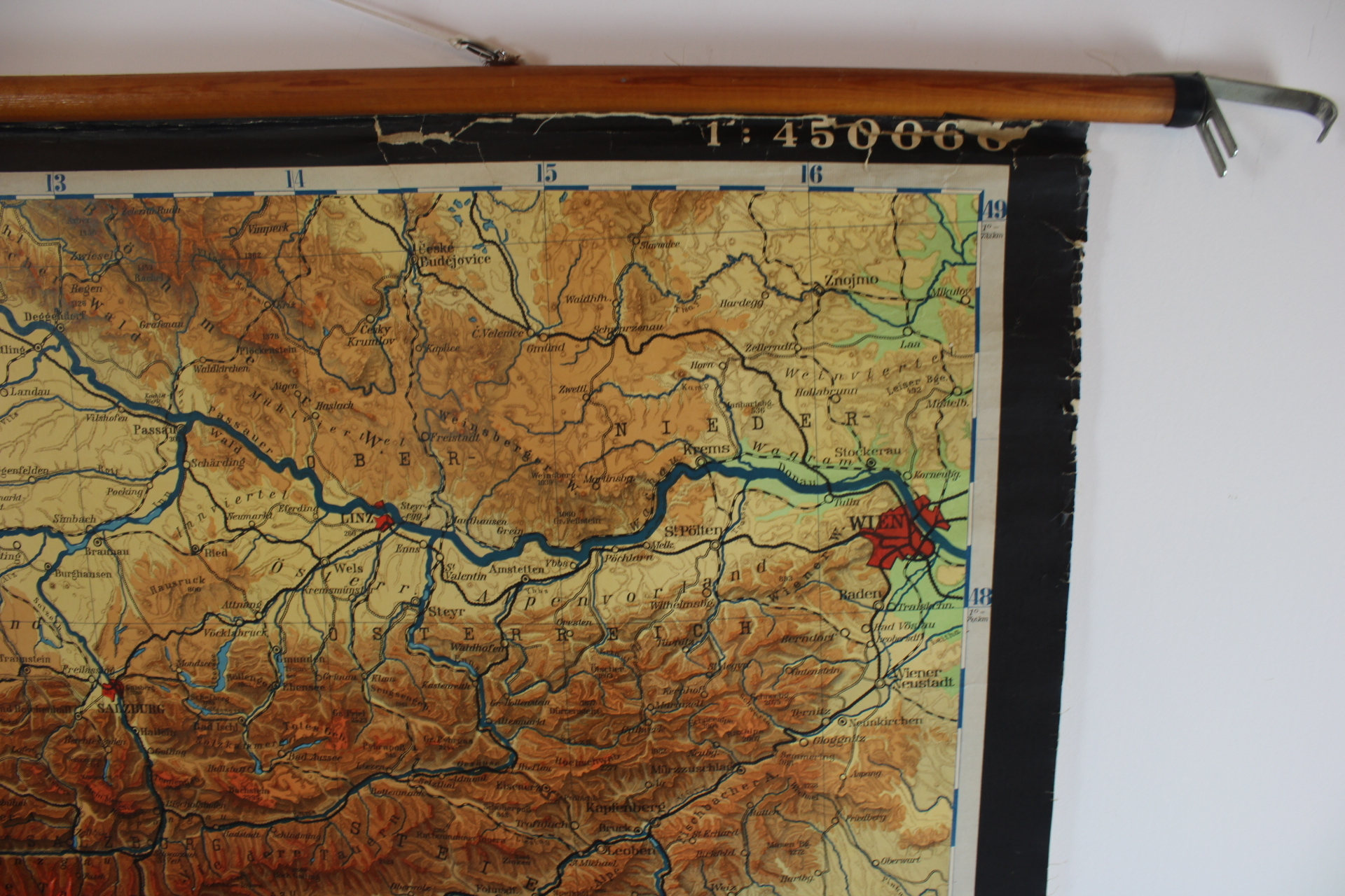
old school map of the Alps
Sold
Sorry, this product is not available anymore. Follow us on Facebook or subscribe to our newletter to discover our new arrivals.
- Description
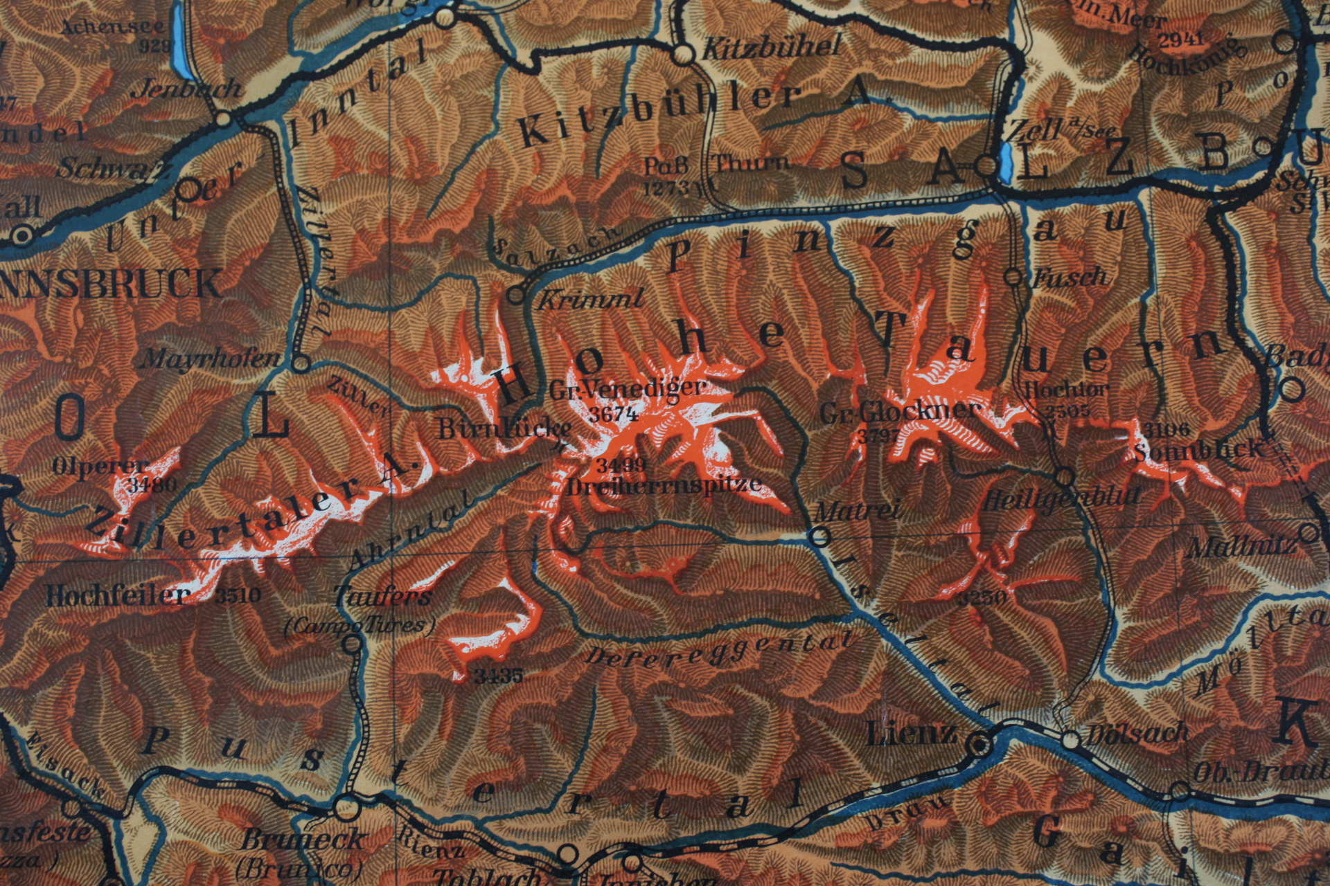
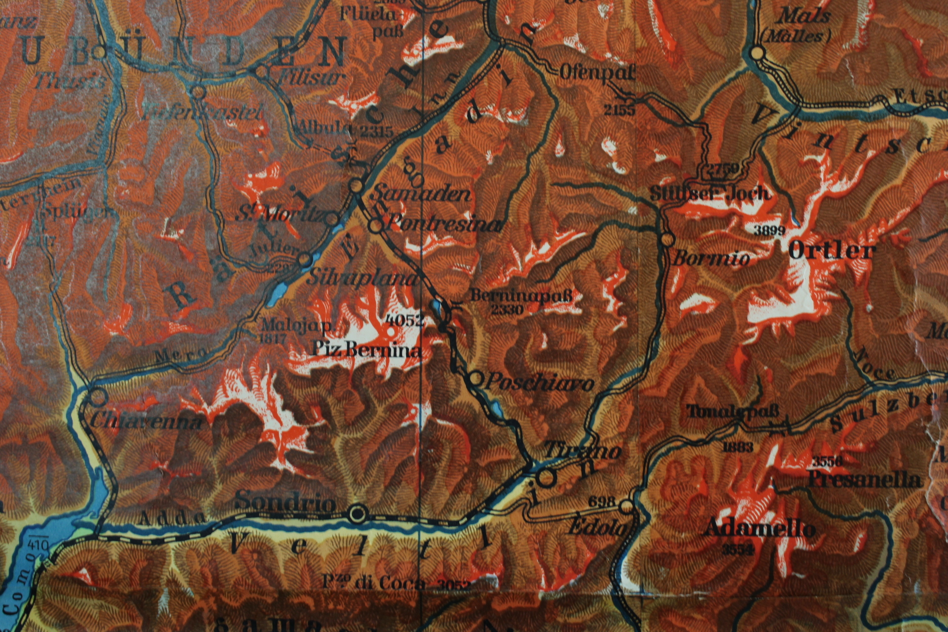
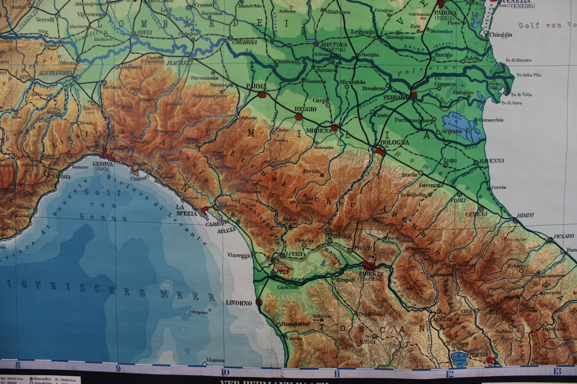
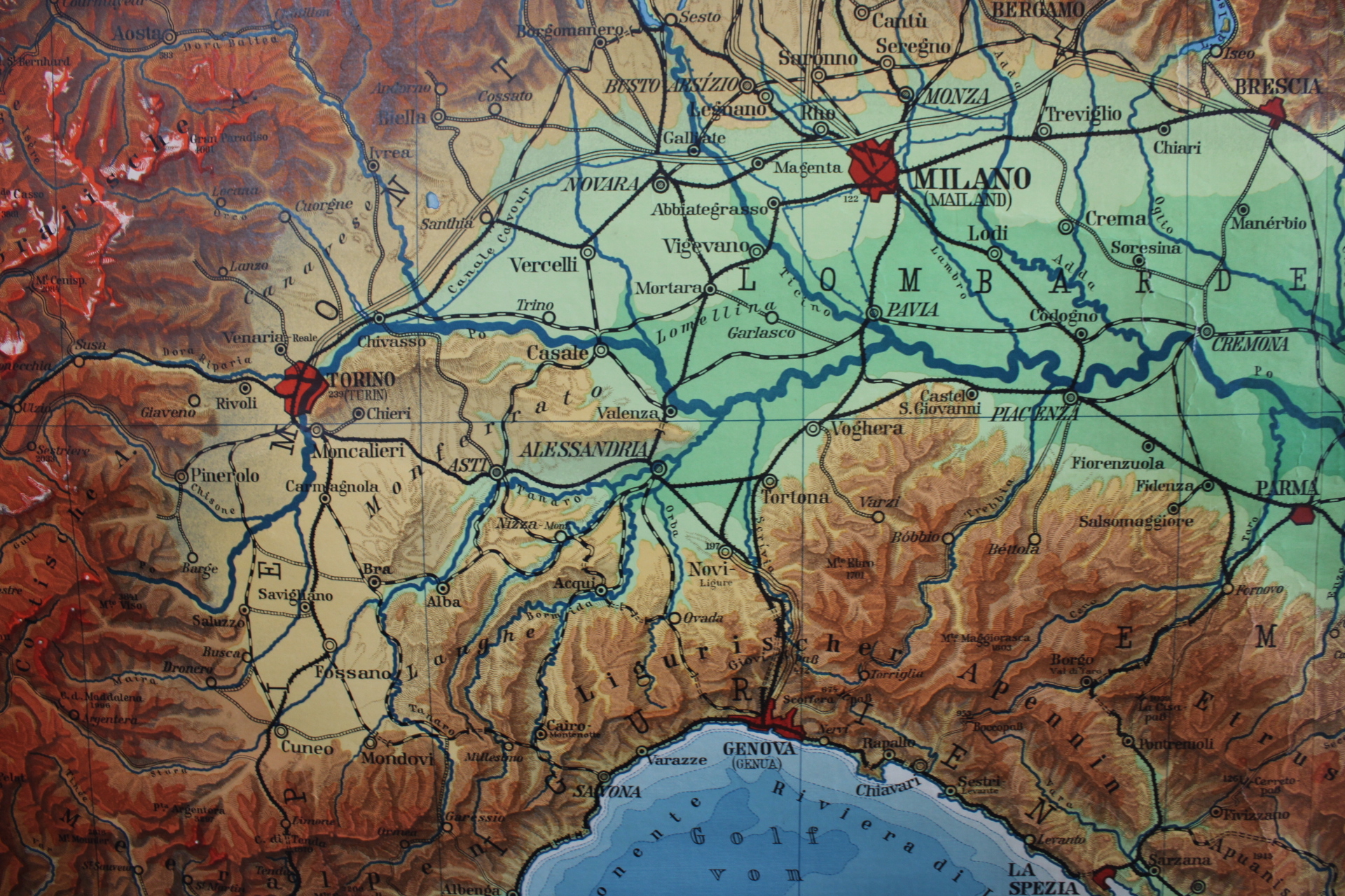
A very large old school map of the Alps and the surrounding area. Title: Alpenländer. With indication of relief, names and heights of mountains, rivers and lakes, roads. Detailed map. Quite rare wall chart of the Alps.
VEB Hermann Haack, Geographisch-kartographische Anstalt Gotha / 1:450,000. 1950s.
In reasonably good condition considering the age, some damage at the top.
Height 166 cm, width 218 cm (including wooden sticks 235 cm)
- Shipping Costs
- Shipment possible or pick-up at the store