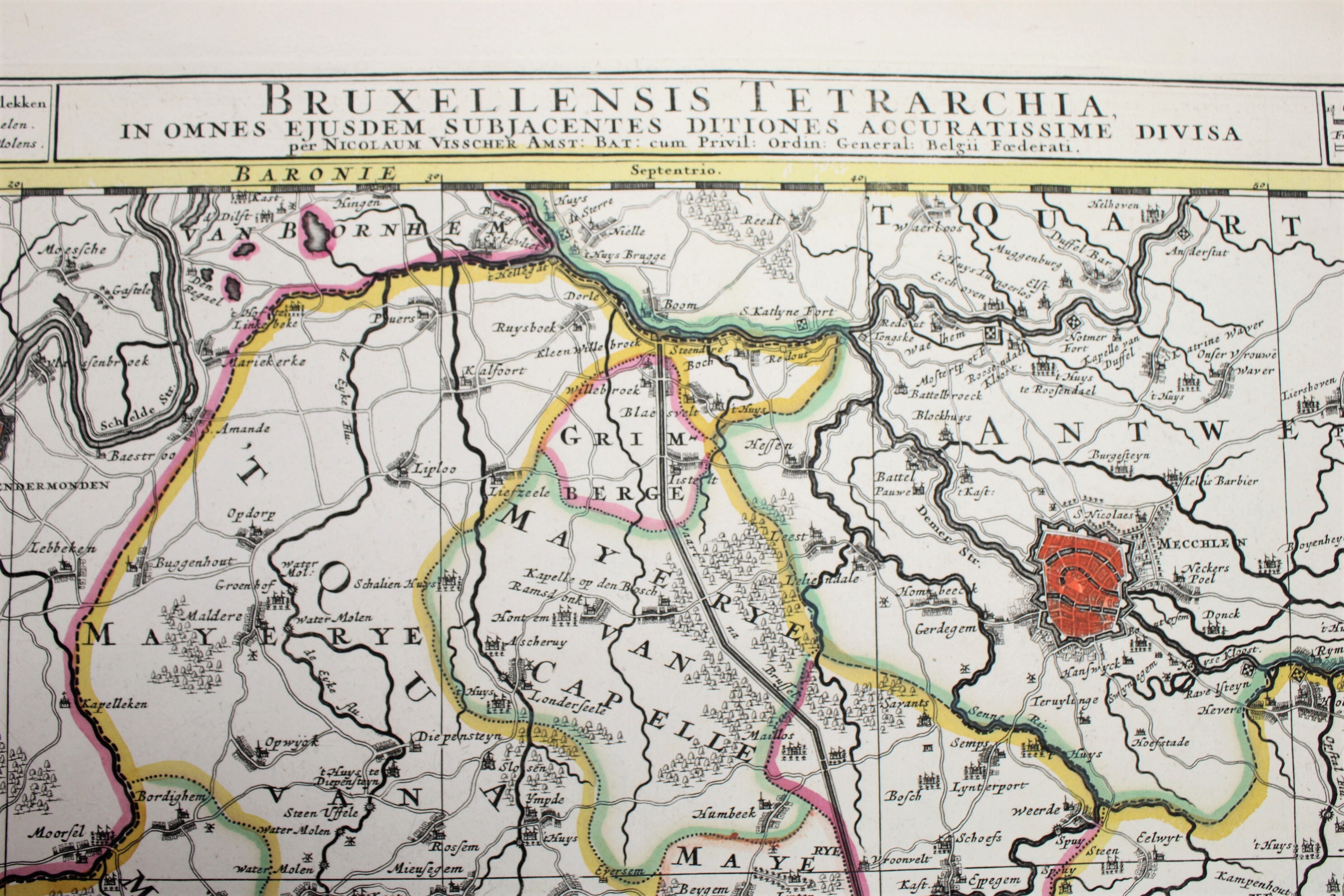
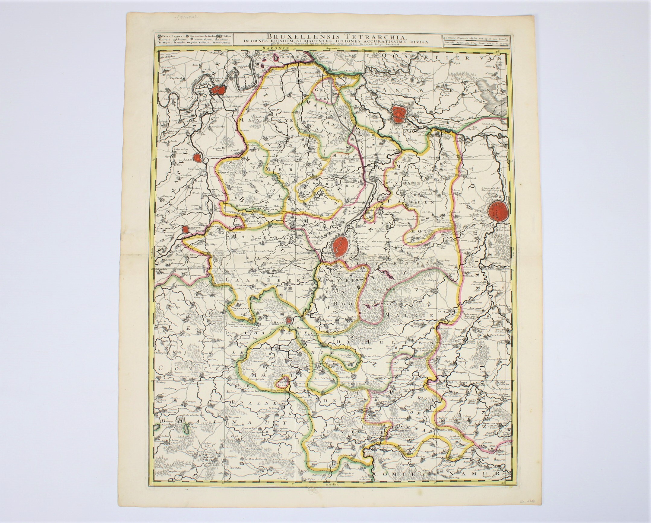
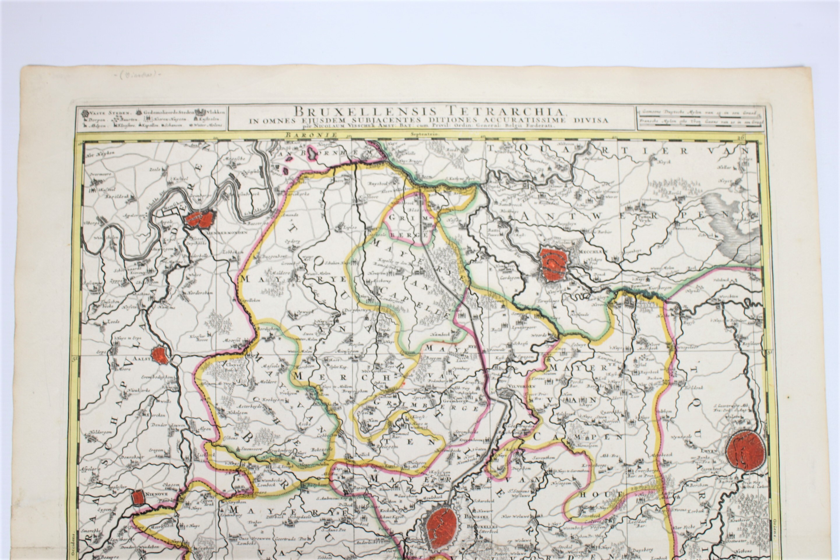
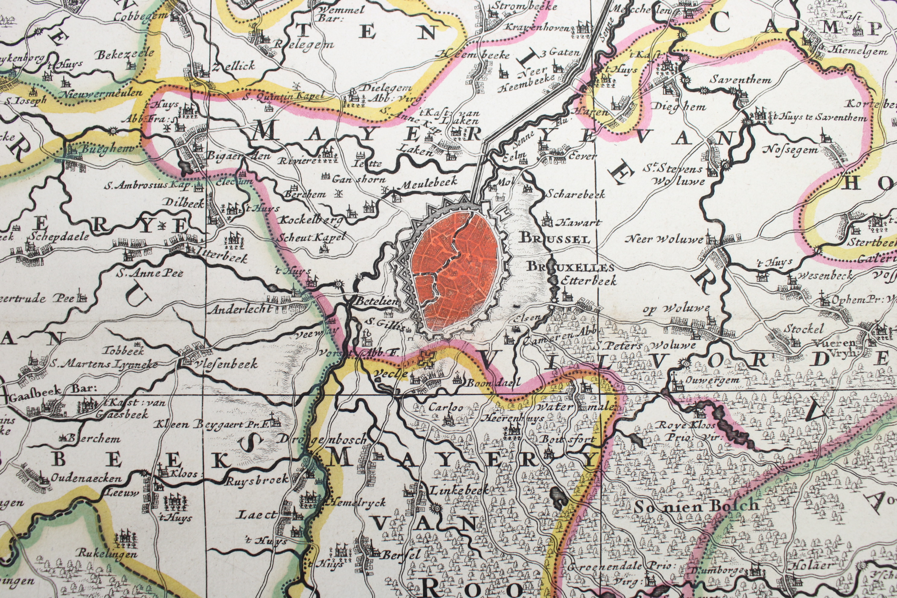
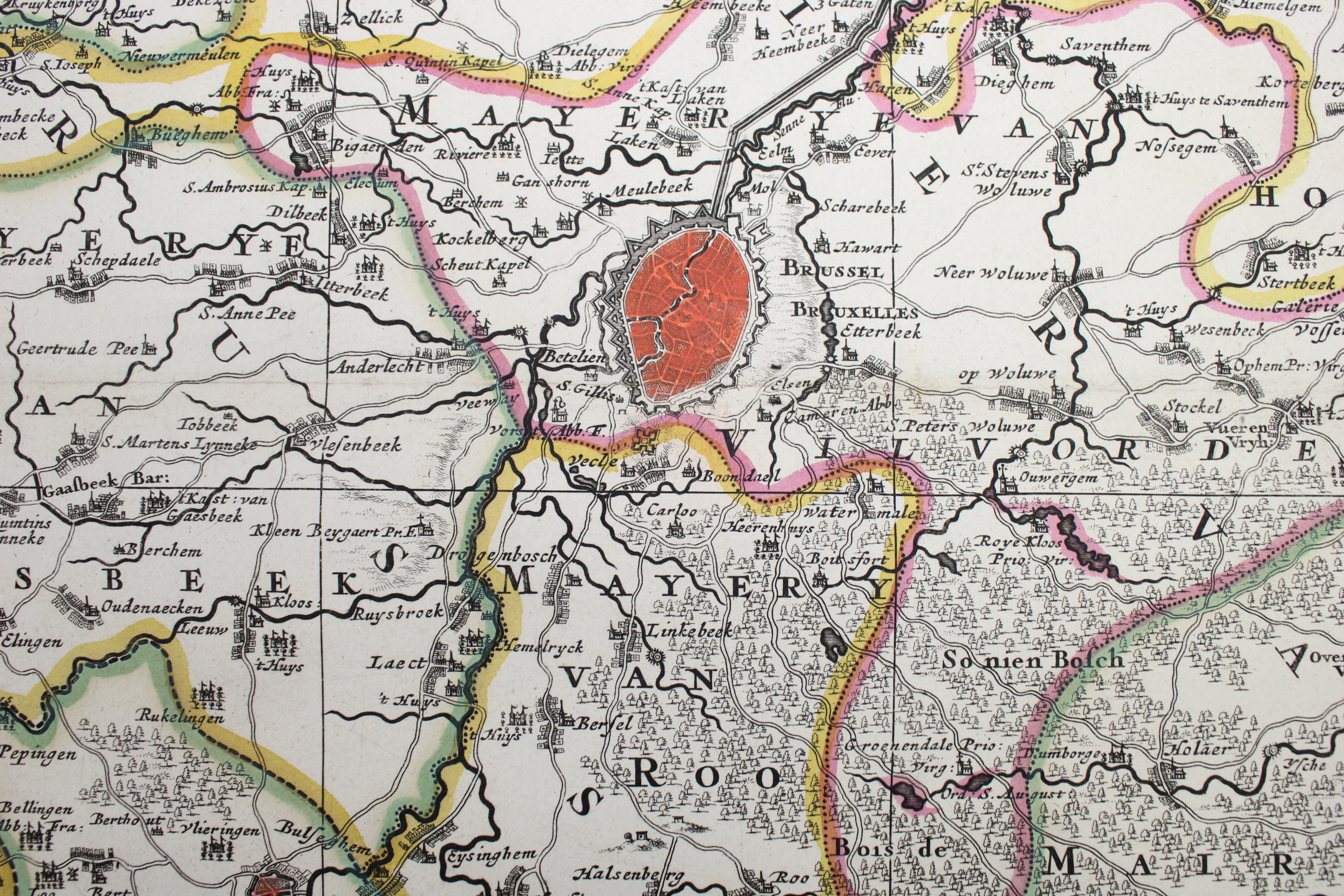
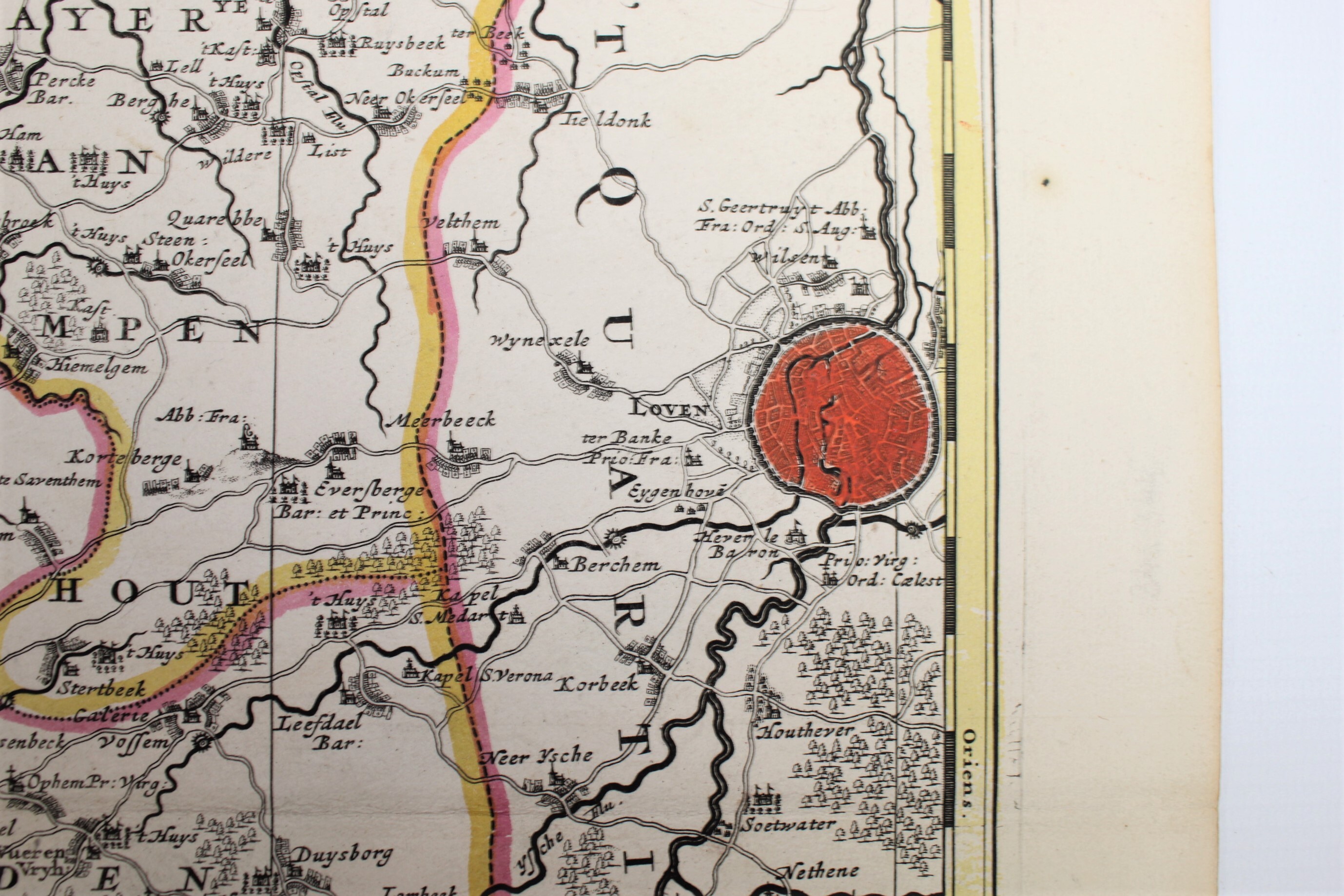
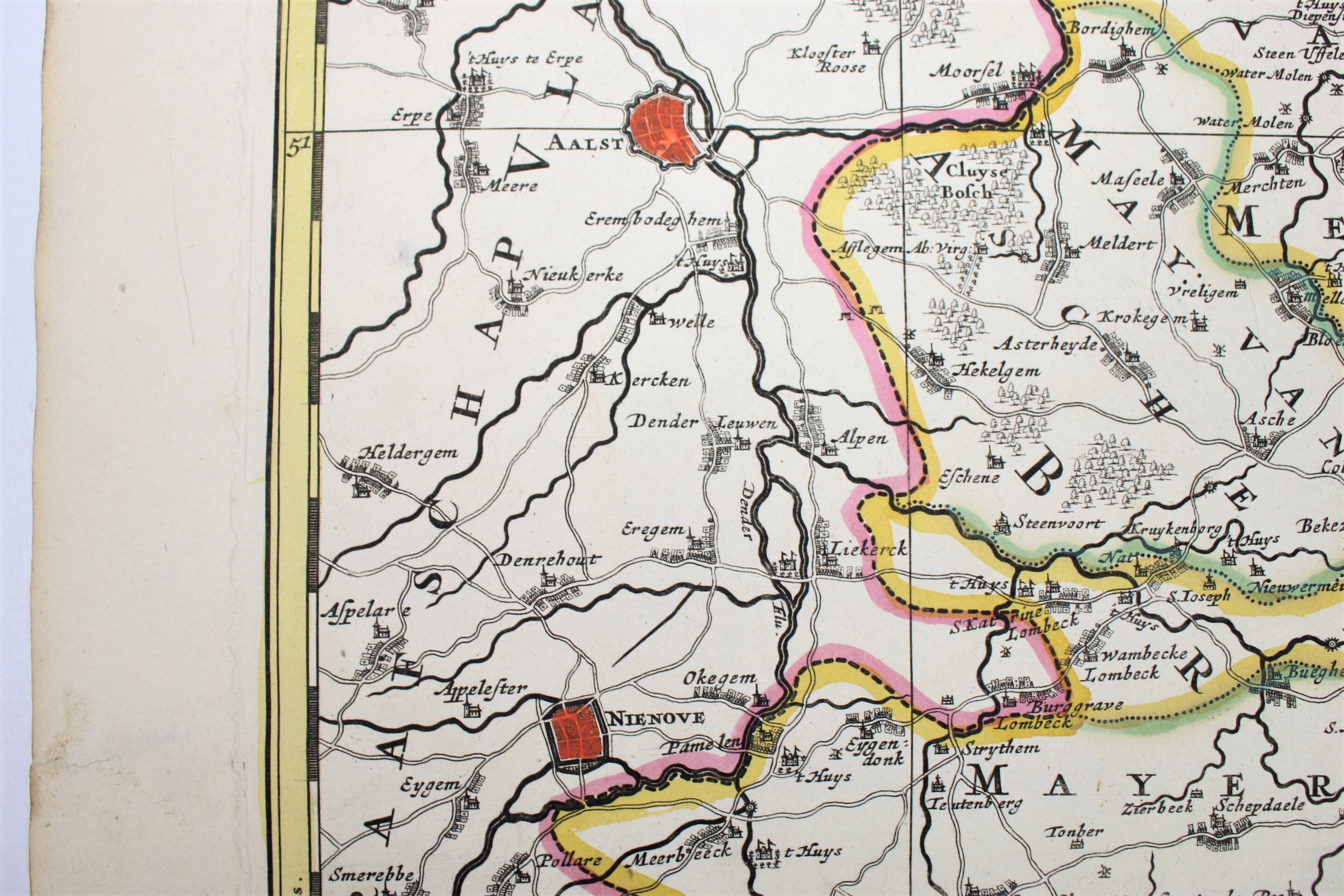
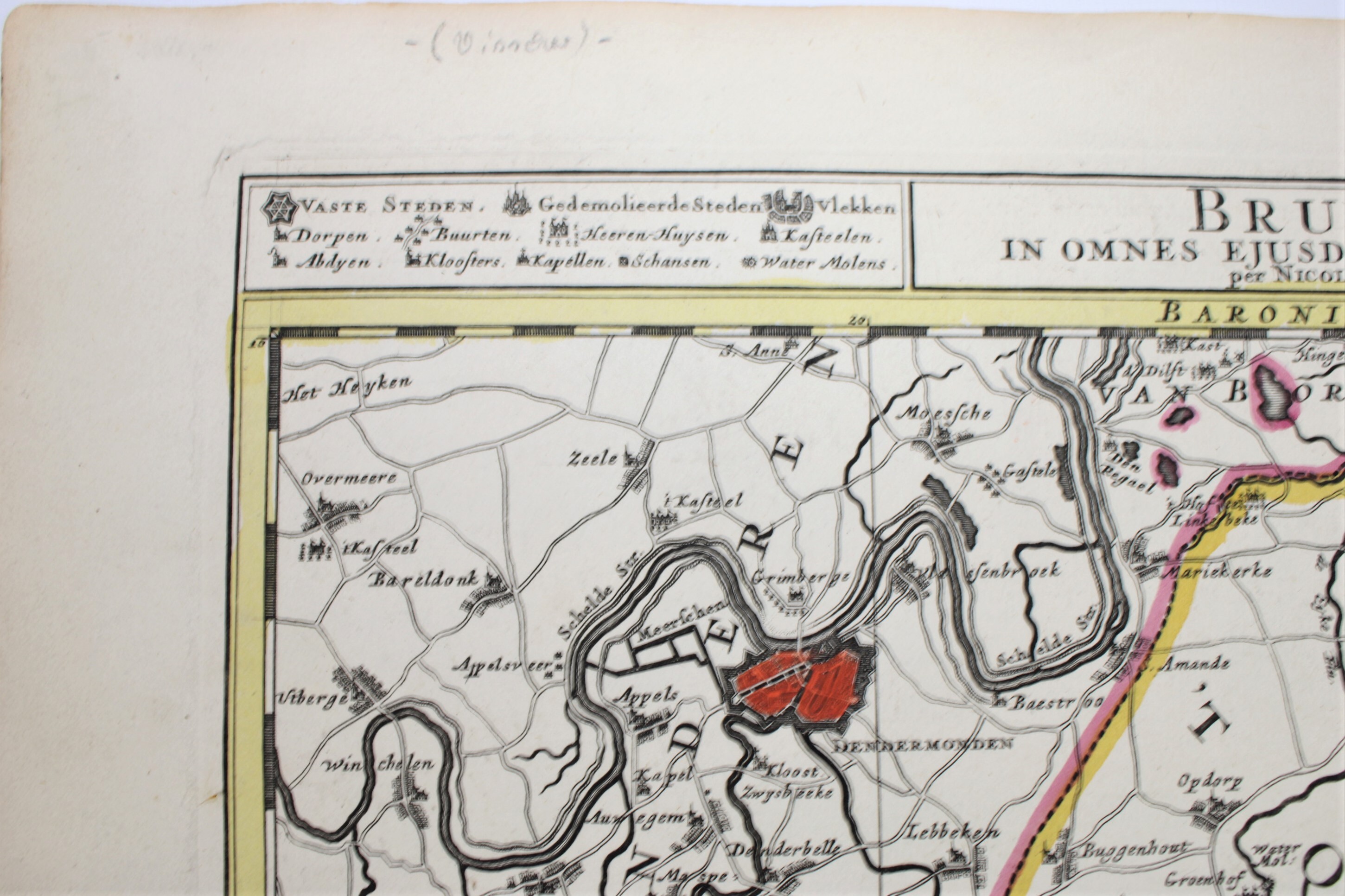
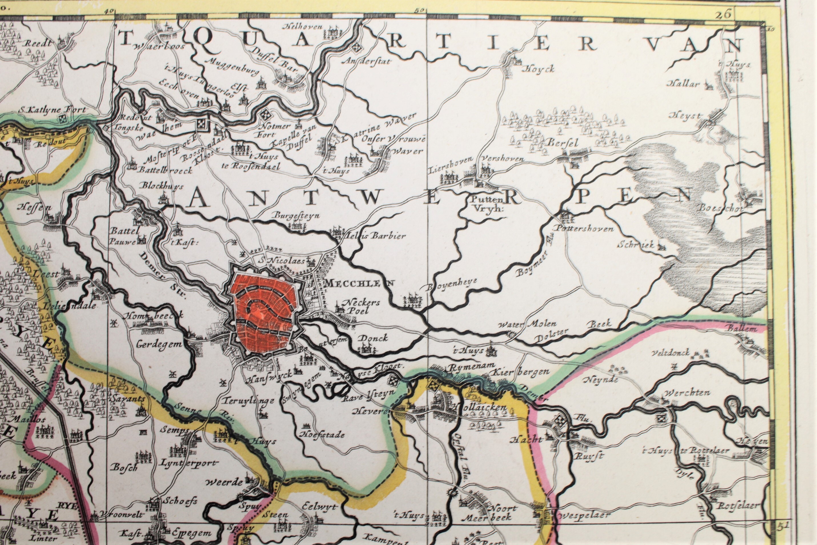
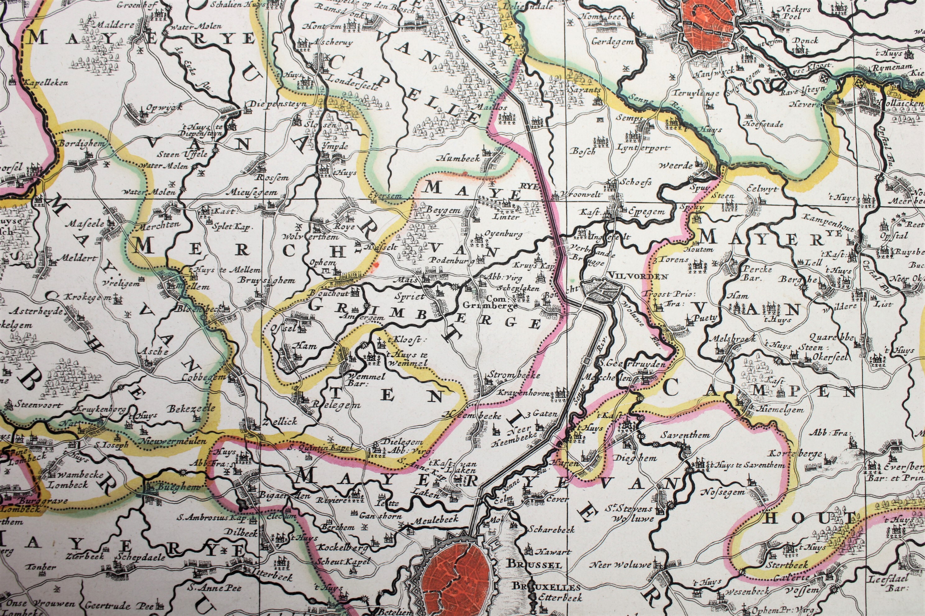
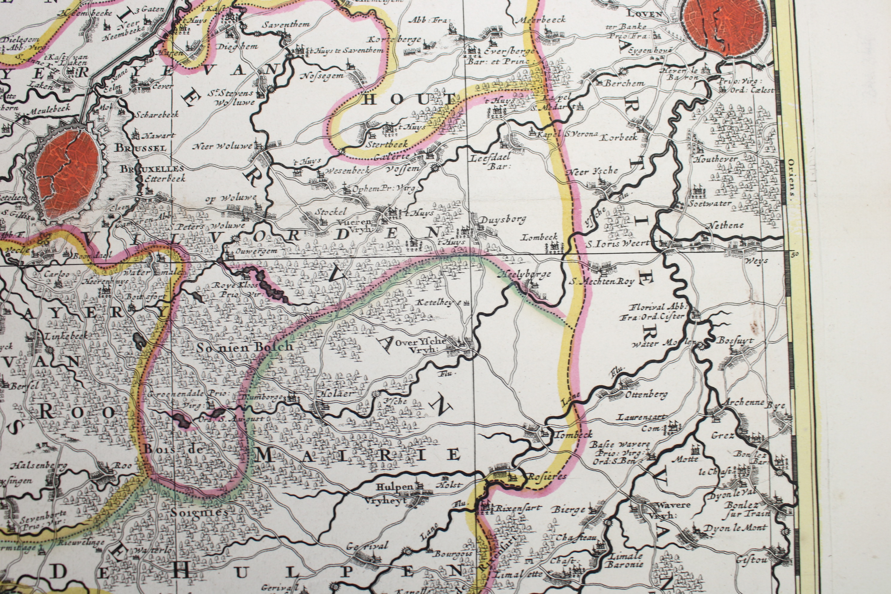
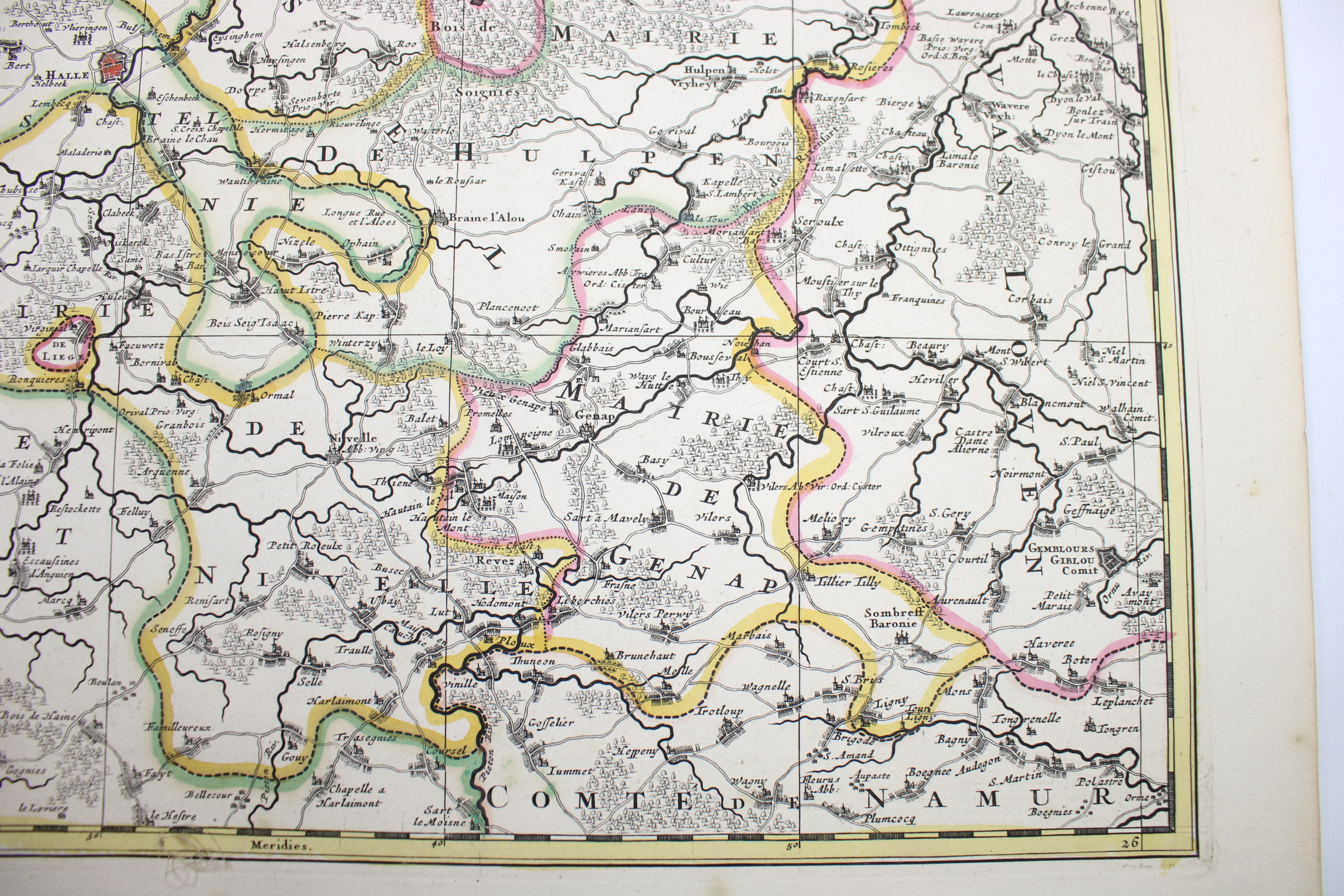
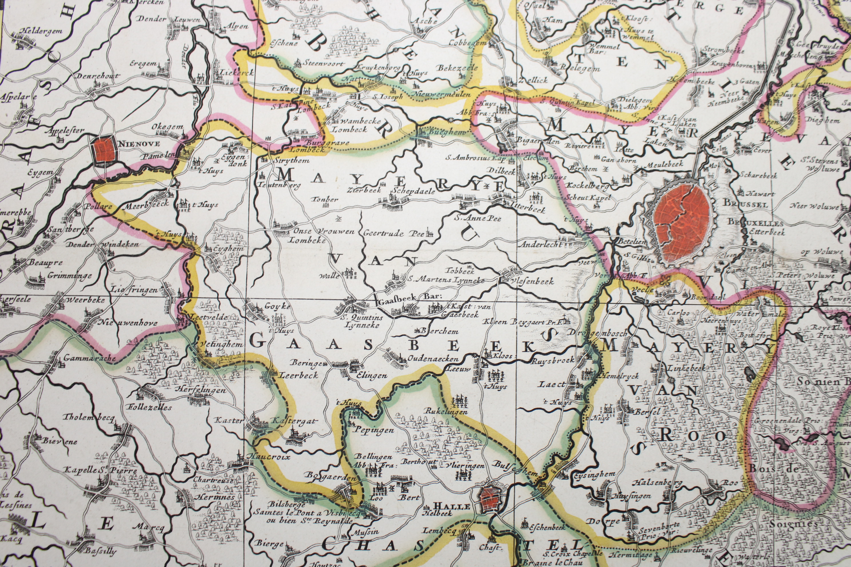
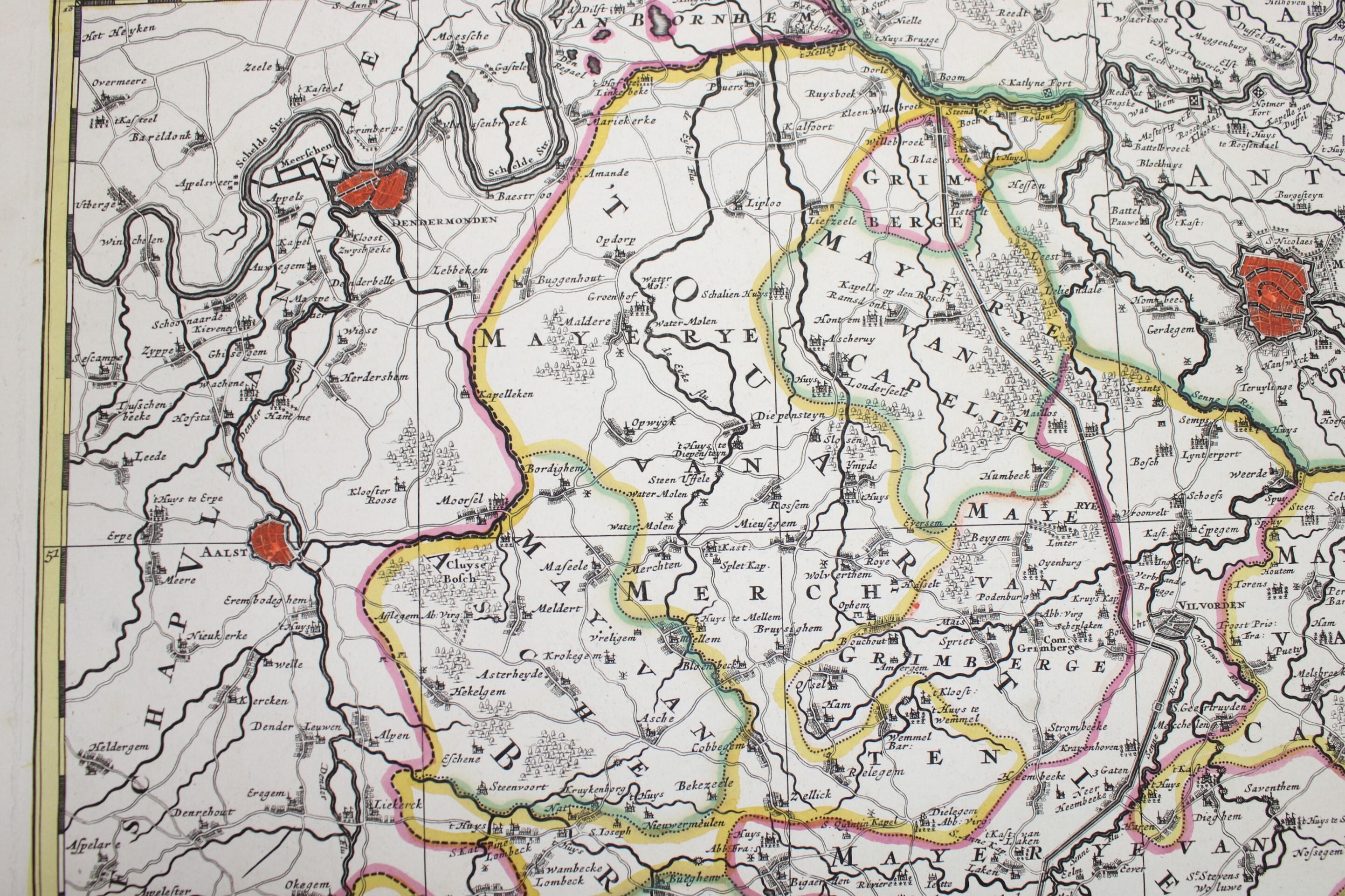
map of region Brussels, 17th century
€295,00
- Description
A hand colored copper engraving "Bruxellensis Tetrarchia". An antique map of the wider area of Brussels, Brabant, with the cities of Mechelen, Leuven, Lier, Dendermonde, Ninove, Aalst, Halle. Full title: 'Bruxellensis Tetrarchia, in omnes ejusdem subjacentes ditiones accuratissime divisa per Nicolaum Visscher Amst: Bat: cum Privil: Ordin: General: Belgii Foederati." By the cartographer Nicolaes Visscher and published in atlases in the second half of the 17th century, like Atlas Minor, sive geographia compendiosa qua orbis terrarum.
Dim: 53.5*63 cm, 47*58.5 cm
- Shipping Costs
- Shipment possible or pick-up at the store