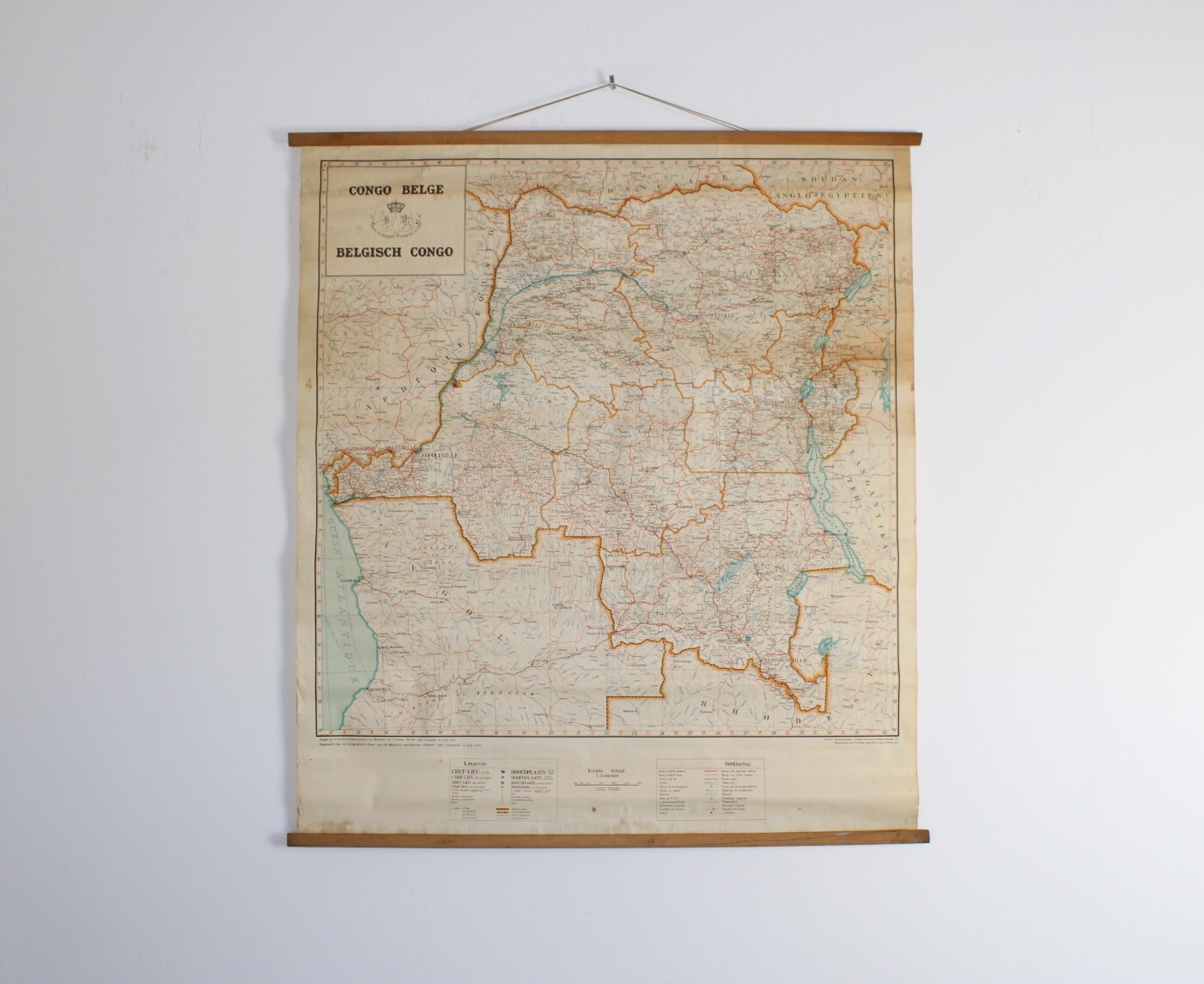
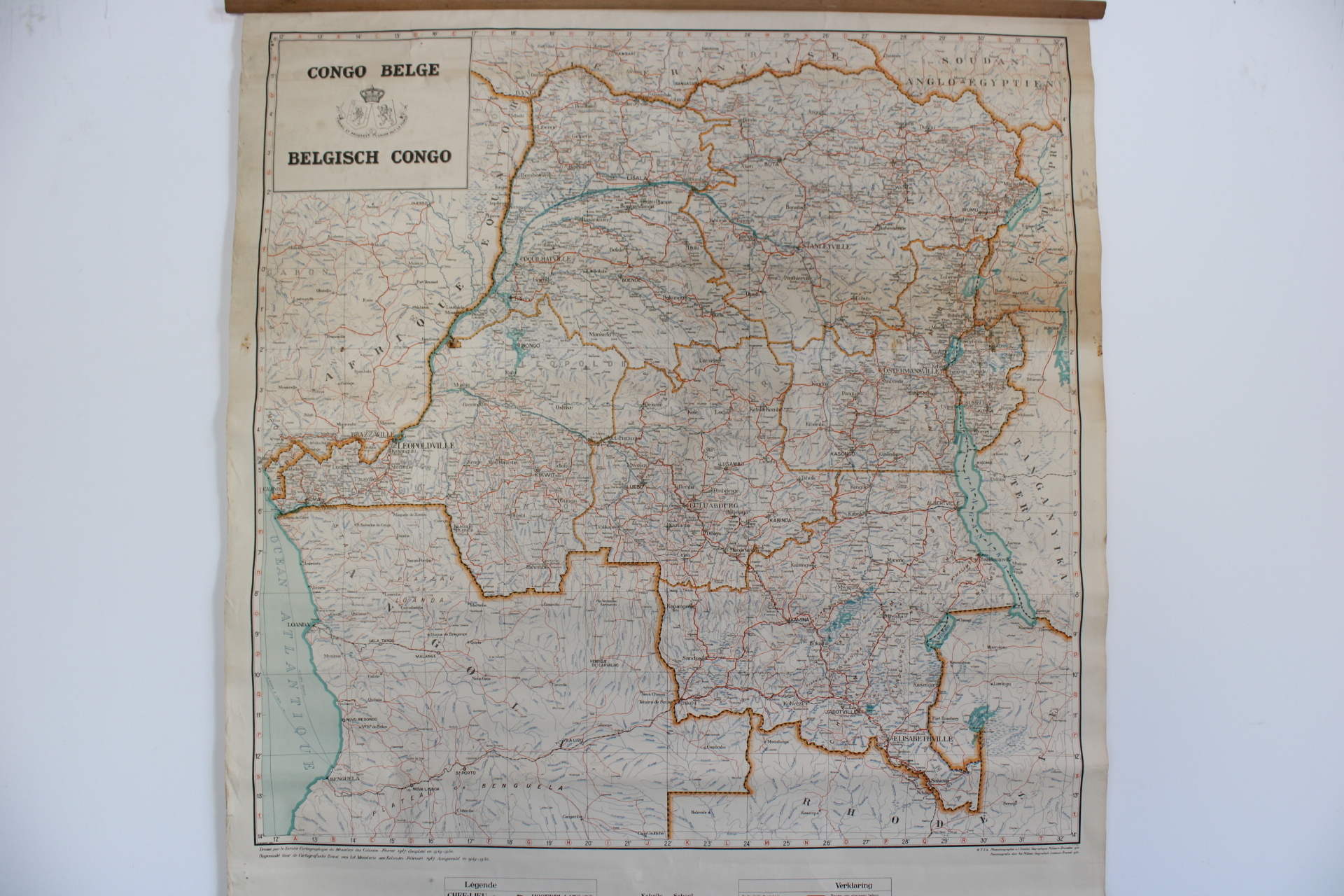
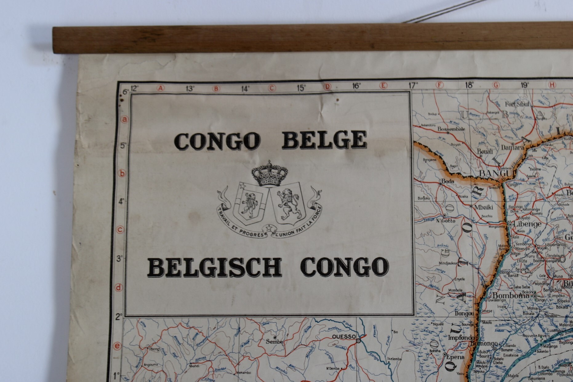
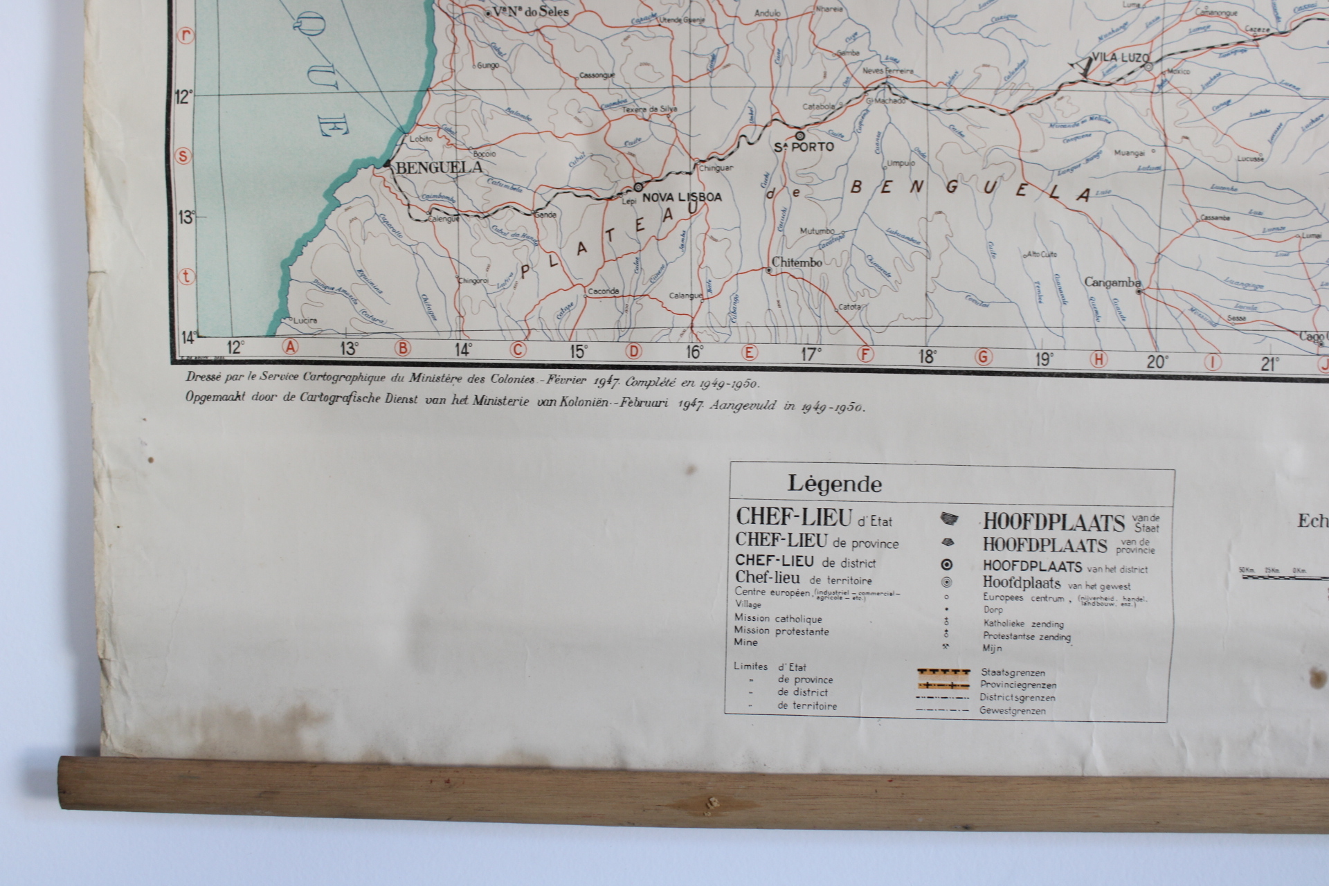
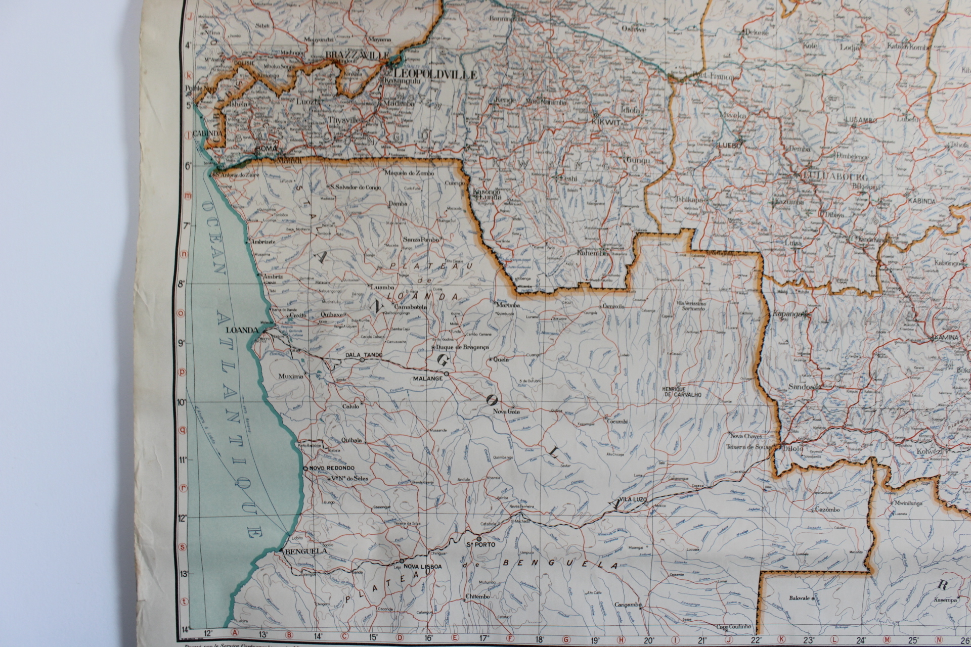
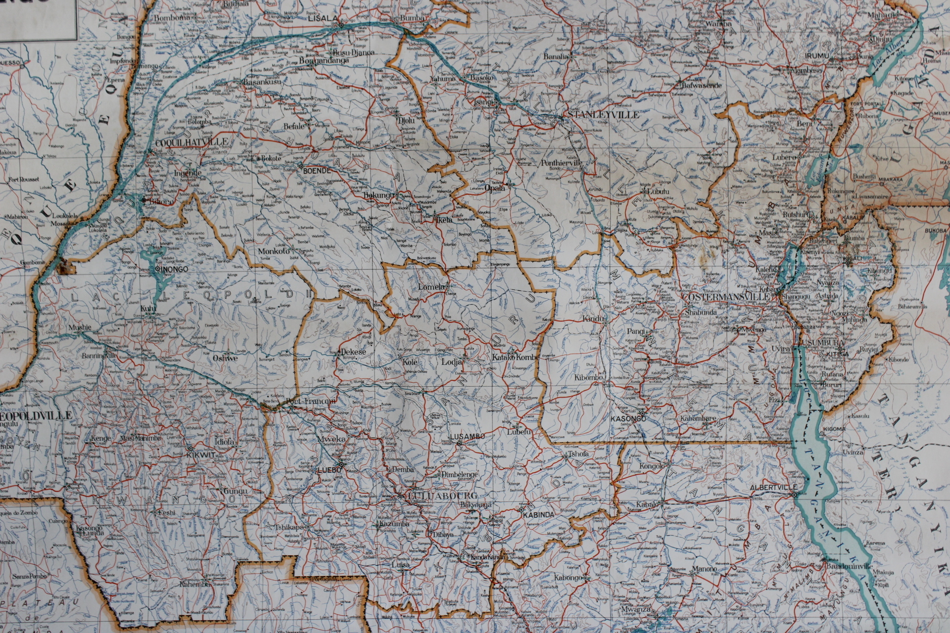
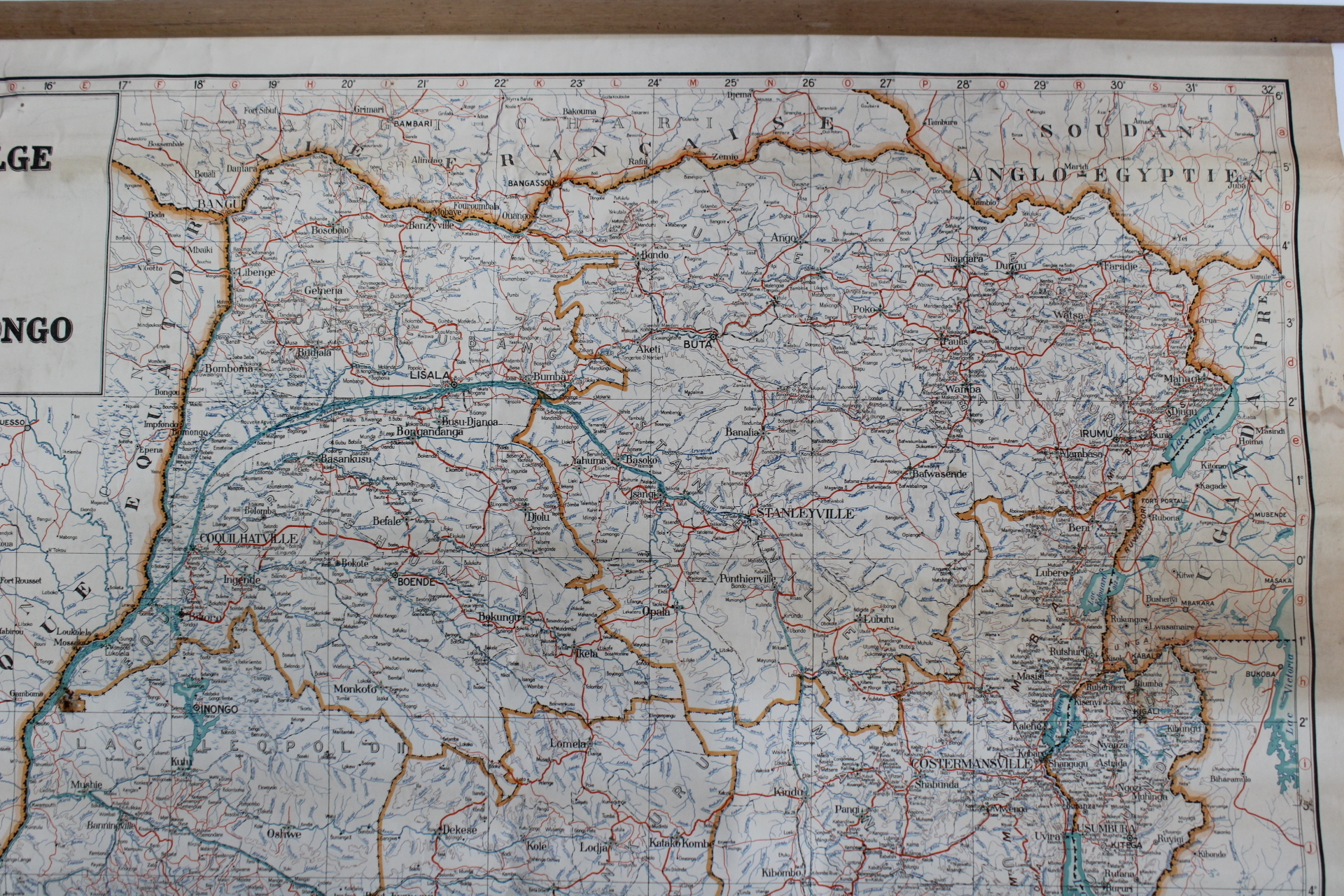
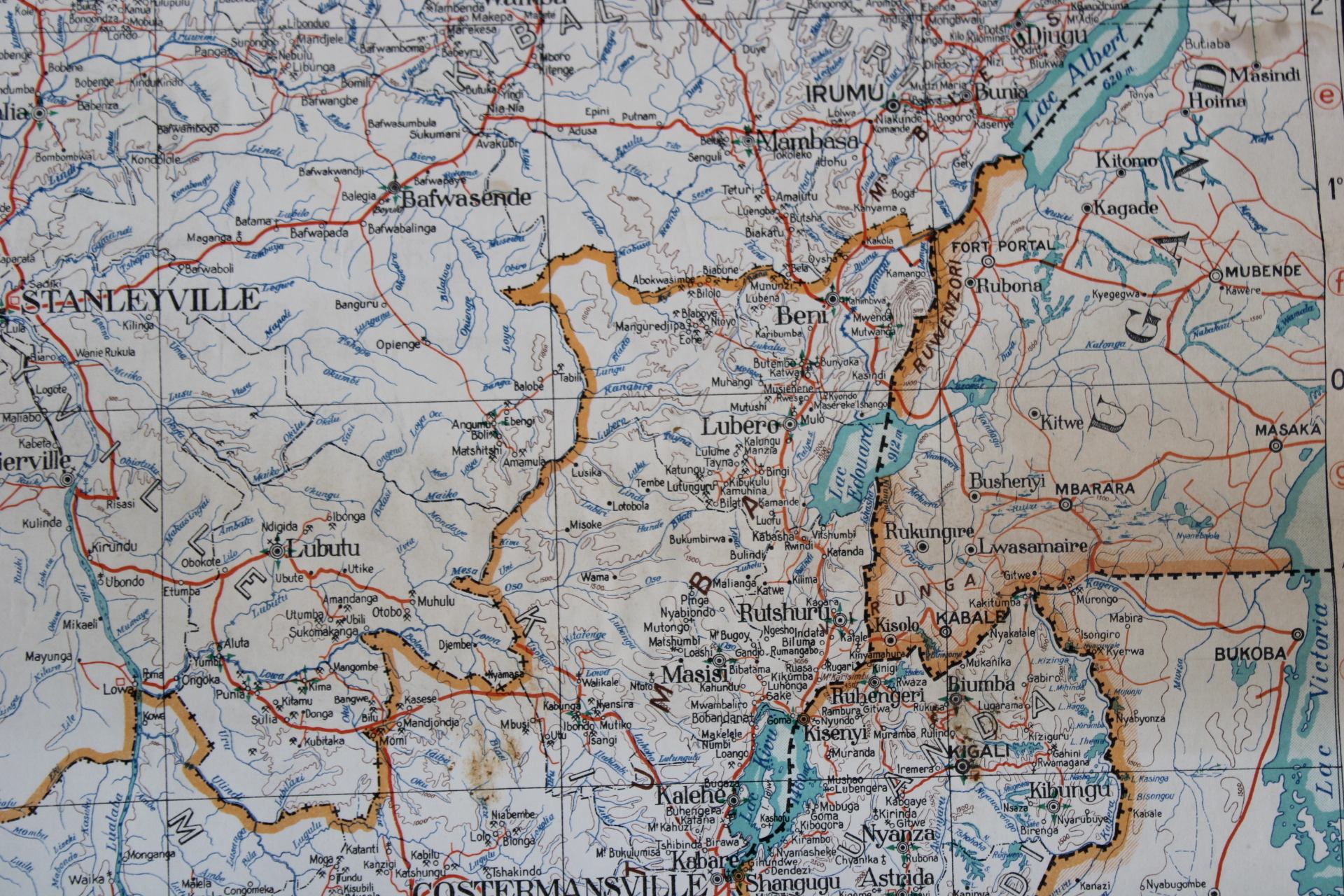
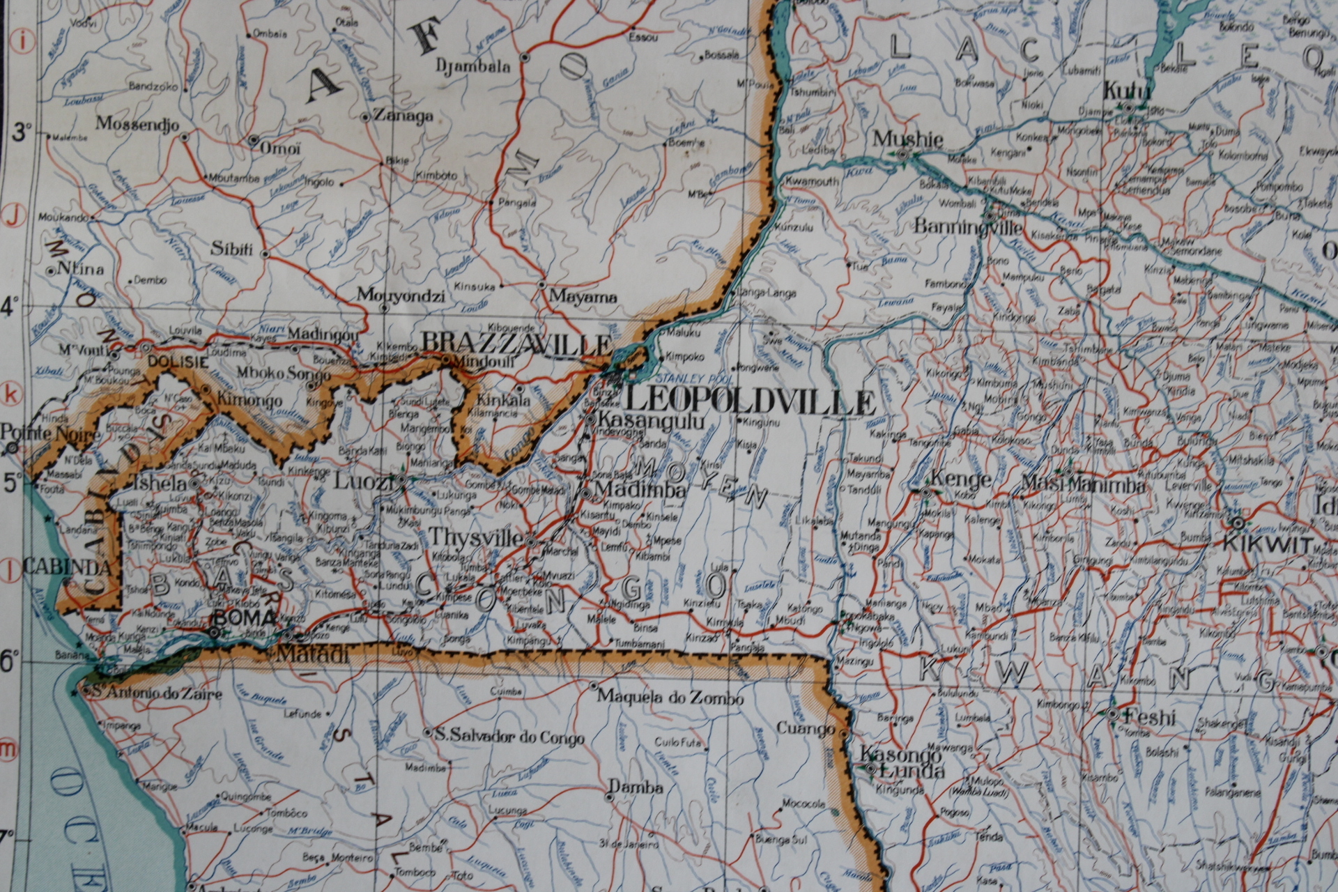
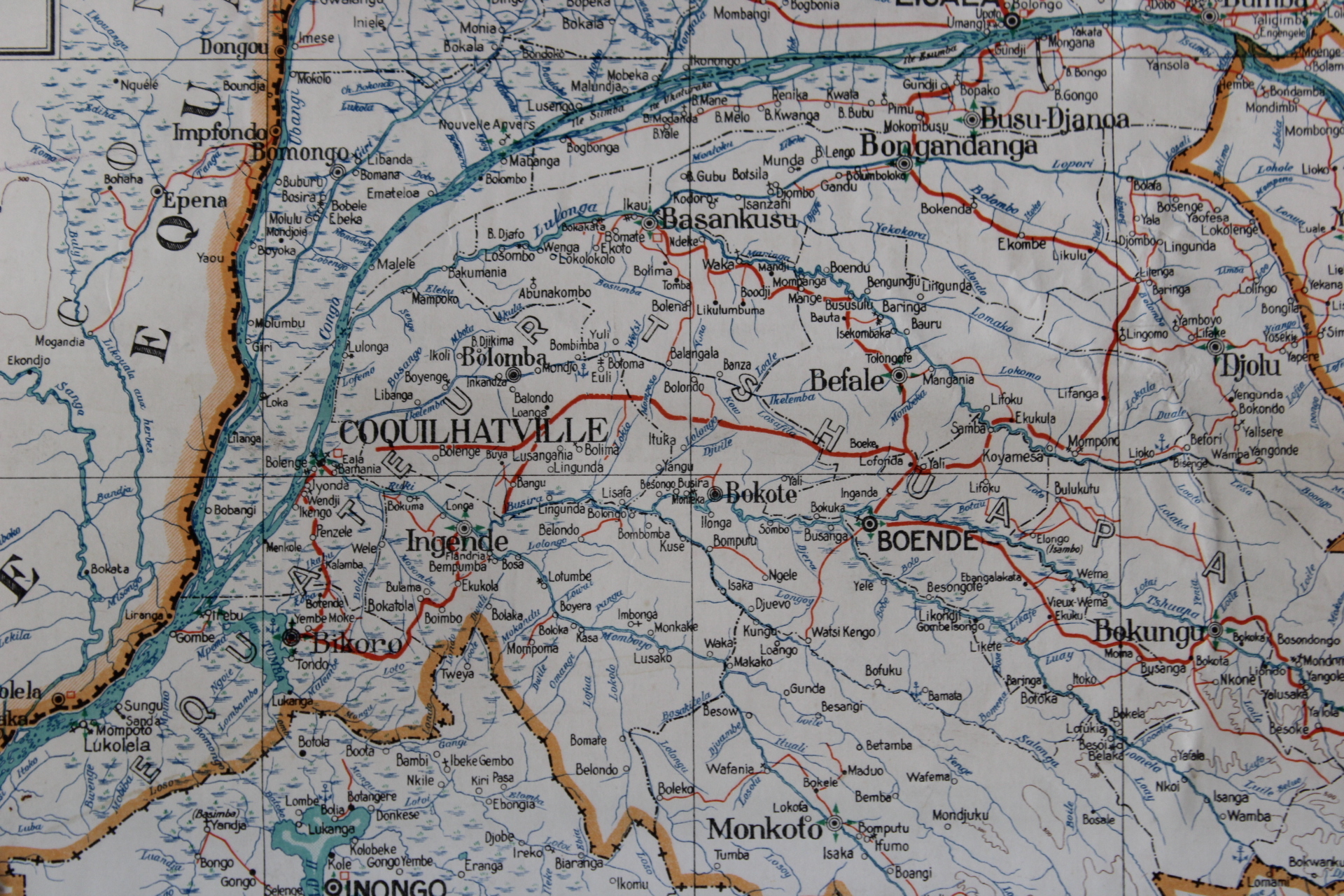
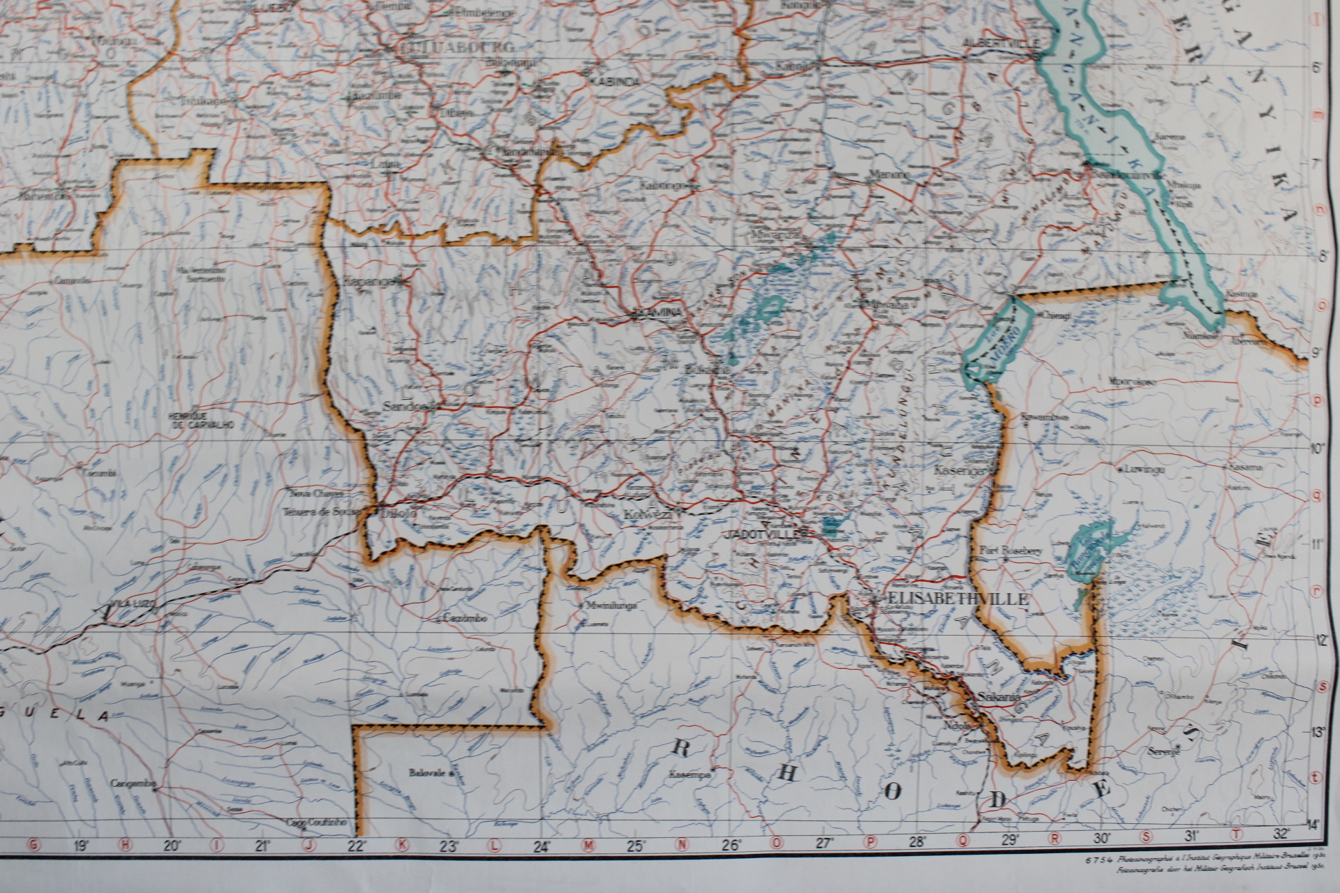
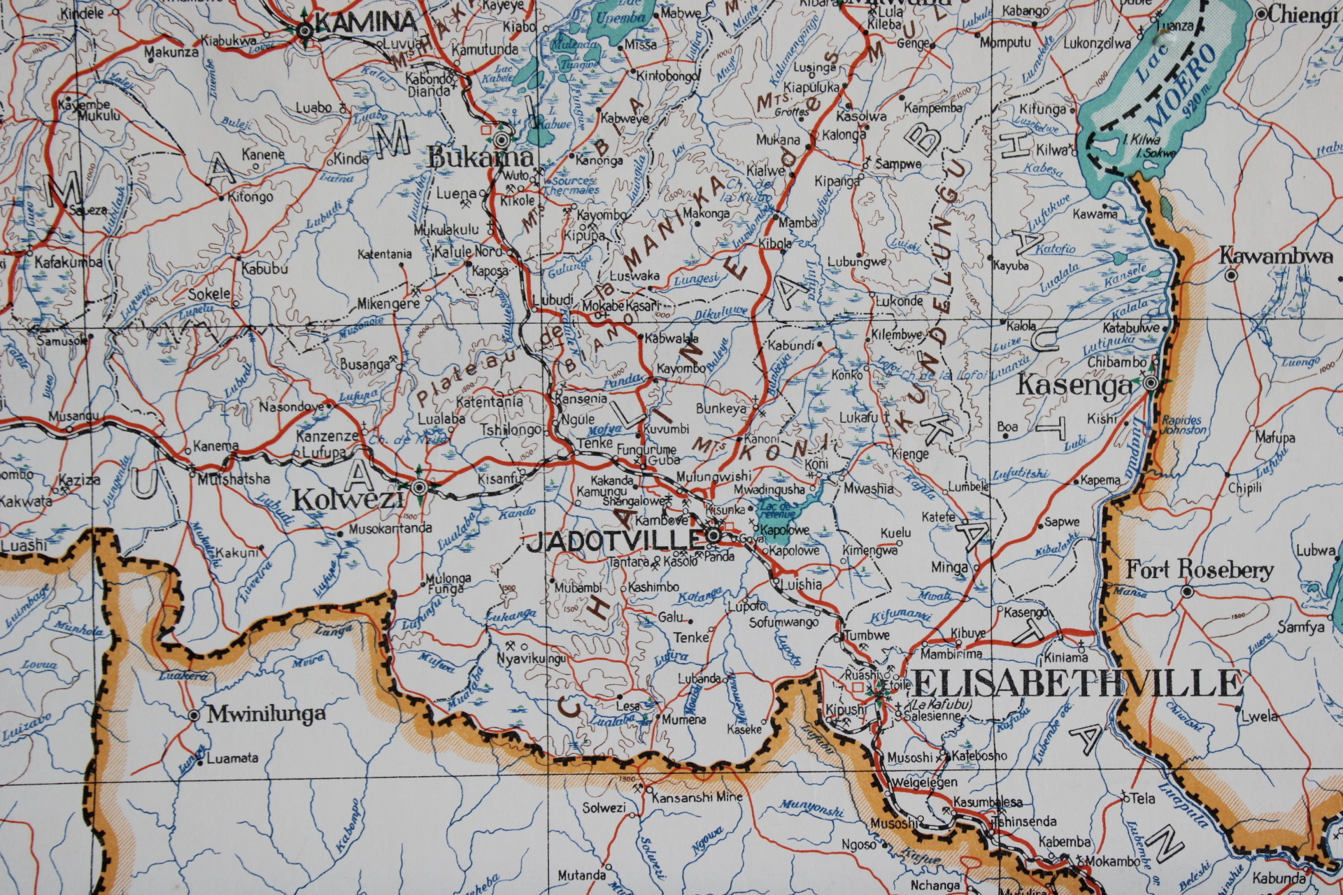
old map of Belgian Congo, 1950
€140,00
- Description
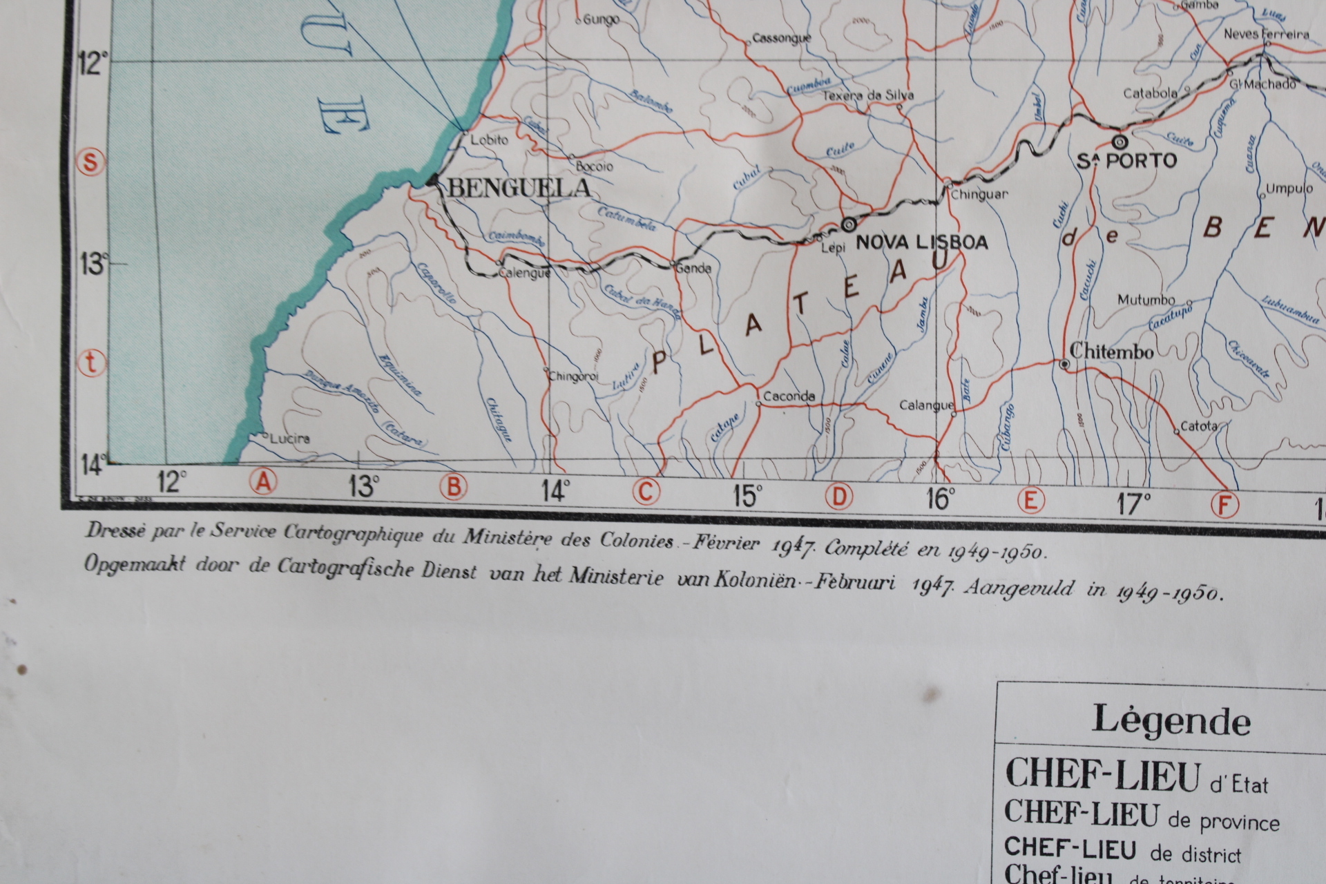
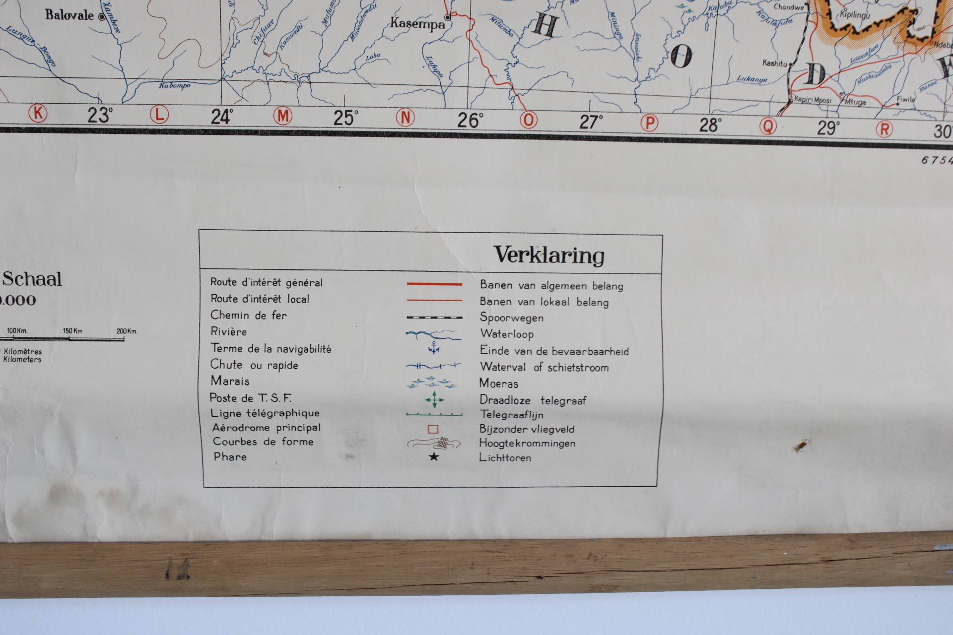
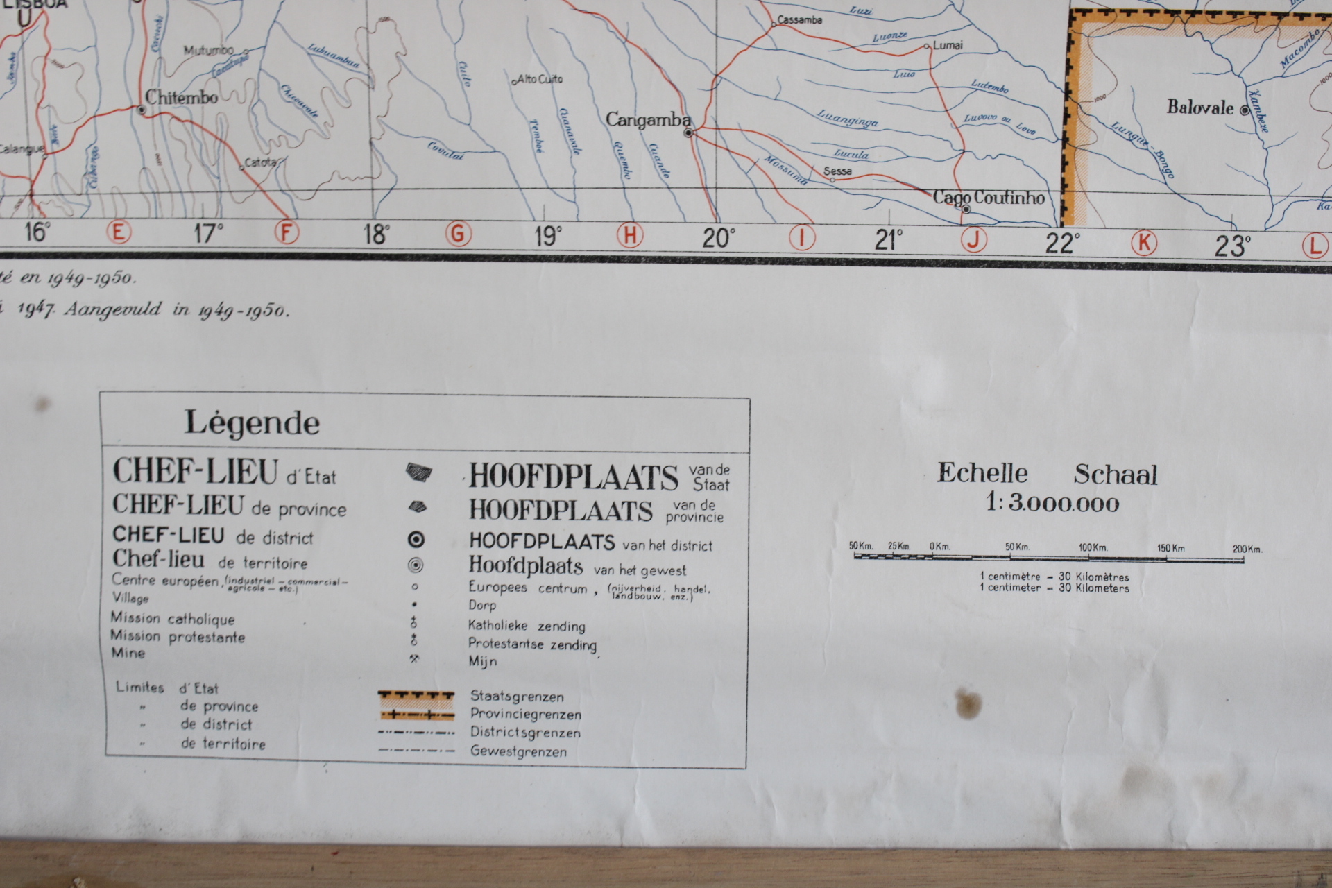
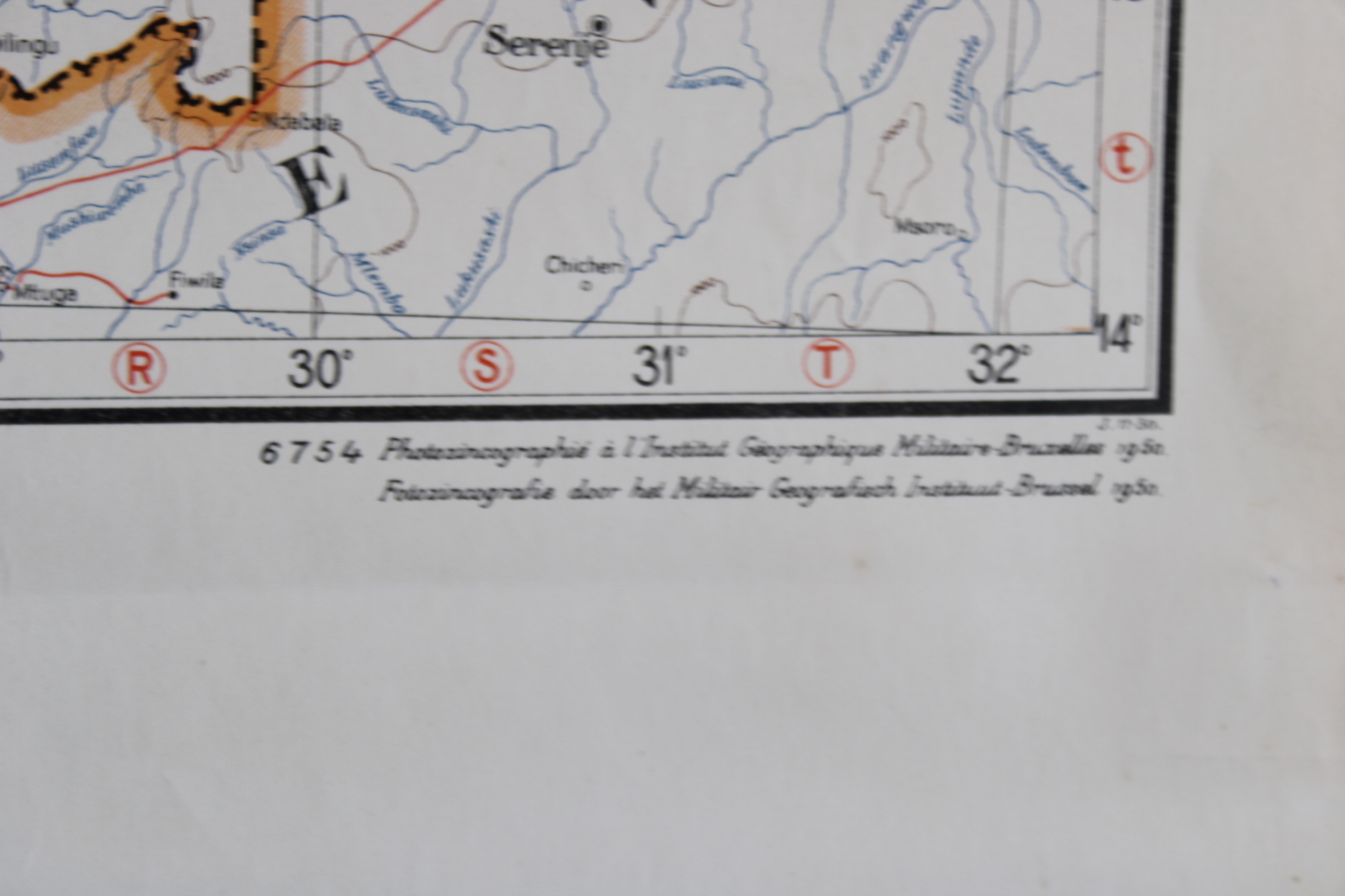
Old detailed topographical map from 1950 of Belgian Congo - Congo Belge. Wall chart. With detailed indication of the cities, traffic lines (roads, railways), rivers, borders. Published by the cartographic service of the Ministry of the Colonies between 1947 and 1950. Scale 1: 3,000,000. In fairly good condition with slight discolouration. Paper on canvas, between 2 wooden sticks.
Dim: 80*93 cm
- Shipping Costs
- Shipment possible or pick-up at the store